
If you read the September and October 2025 photo columns about my very favorite photo spots at Mount Rainier National Park in Washington State, you will know where I like to photograph at Tipsoo Lake and the Sunrise Area, along Stevens Canyon Road, and at the Paradise Area. In this final column for Mount Rainier sites, I provide my favorite photo locations along the Nisqually-to-Longmire Corridor (aka Paradise Valley Road), from Paradise down to the Nisqually Entrance next door to the small community of Ashford, Washington.
This is just a reminder: there are many view areas, pullouts, marked parking lots, and trailsides offering stunning vistas within Mount Rainier National Park. I might not mention a favorite, familiar area of yours because the locations listed in this article are my favorite spots. They may very well be your favorite spots already, or they may be new sites you can add to your own list of favorites. I have numbered these sites sequentially, not preferentially, making it easier for you to follow on the map. Also, the photos here were captured during different years and seasons.
Location 1 – Ricksecker Point
This small, one-way road is about 5 miles (8 kilometers) southwest of Paradise, between Narada Falls and Christine Falls. It’s only open to drive from May – October. The road is 1/3-mile (0.5 kilometers) long and has two large, main pullouts. Stop at the first pullout, walk over to the exhibit panel, and aim your camera toward that bridge you spy far below. That is Glacier Bridge spanning the Nisqually River.
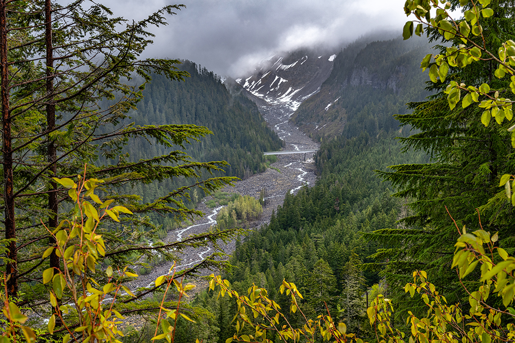
The bridge makes a nice reference point for you to see just how high up in elevation you are. It looks tiny from where you stand, but it’s quite a large bridge up close and personal.

The vegetation has grown thickly at this spot, so I’d advise a telephoto lens or your smartphone’s telephoto setting to push through most of the greenery in order to capture a nice shot of bridge and river.
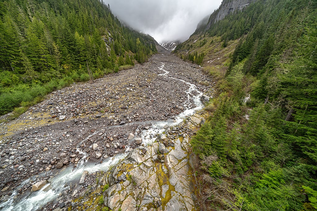
Location 2 – Glacier Bridge
While Glacier Bridge looks far away from Ricksecker Point, it’s only 2.3 miles’ (3.7 kilometers) distance. Approximately 0.3 mile (0.5 kilometers) prior to crossing this bridge is a long, wide dirt and gravel pullout to your left. You may park there and walk to and along the bridge (there’s a narrow, raised walk next to the bridge railings on either side), or you can drive across the bridge, make an immediate left turn into a large parking area, then walk back up to the bridge.
If you park at the long pullout, you might just experience a little serendipity like I did, when a marmot – wary but not too concerned by my presence – clambered up to the parking area and began munching on the yellow flowers.

This location makes for a nice leading line shot of the bridge.

Move from one side of the bridge to the other for photos of the Nisqually River flowing from Nisqually Glacier on the south-southwest flank of Mount Rainier and heading down toward the Nisqually Entrance of the park further west.

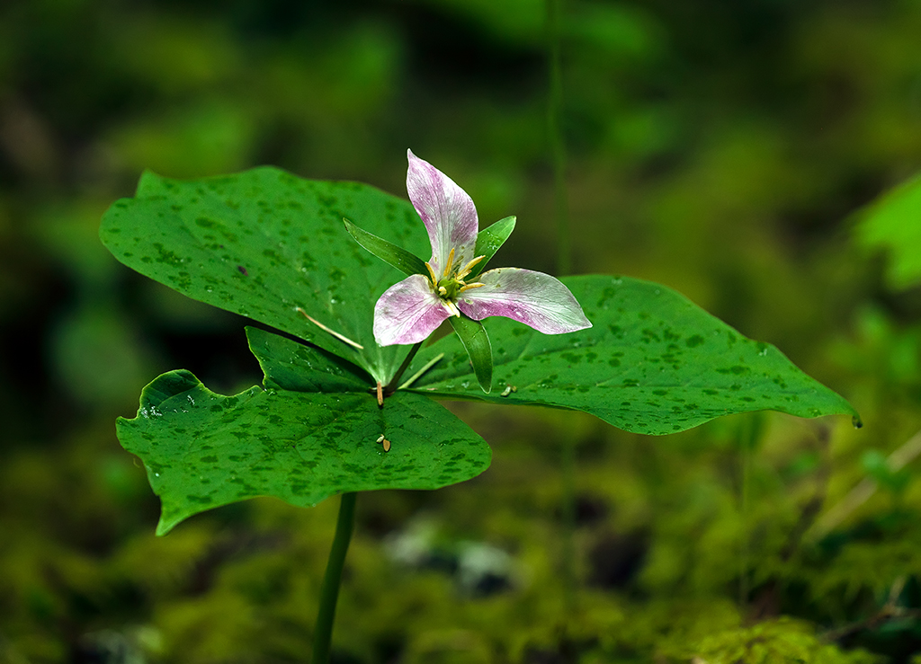
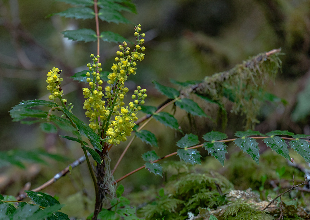
As you drive down from Location 1 to Location 3, keep an eye on the roadside for wildflowers – especially during early July. The flowers begin blooming in the forest zone much sooner than at Paradise. You’ll spot trillium, columbine, devil’s club, and Cascade Oregon grape, to name a few.


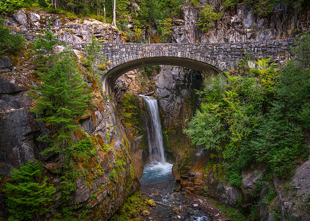
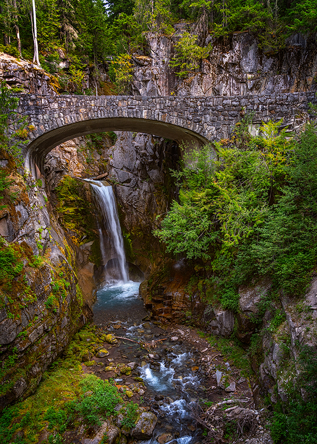
Location 3 – Christine Falls
At least 150 waterfalls – most of them unnamed – cascade down the mountain’s slopes. While Falls Creek Falls near the Stevens Canyon Entrance is my favorite waterfall, Christine Falls is my second favorite. It’s a charming waterfall framed by greenery and a historic arched stone bridge. The two pullouts on either side of the falls, however, are tiny, as is the view area you must hike to. Early morning is the best time for avoiding crowds, and it does get crowded.
According to Park Staff:
Christine Falls bridge is very narrow and busy, use caution and watch for vehicles when crossing or viewing the waterfall from the bridge. The path can be very icy and hazardous during winter.
Both horizontal and vertical images of Christine Falls look lovely. This is a great place to practice your silky water technique using a slow shutter speed, small aperture, and a circular polarizing or neutral density filter.
As with other waterfalls in this park, the amount of water flow depends upon the time of year.
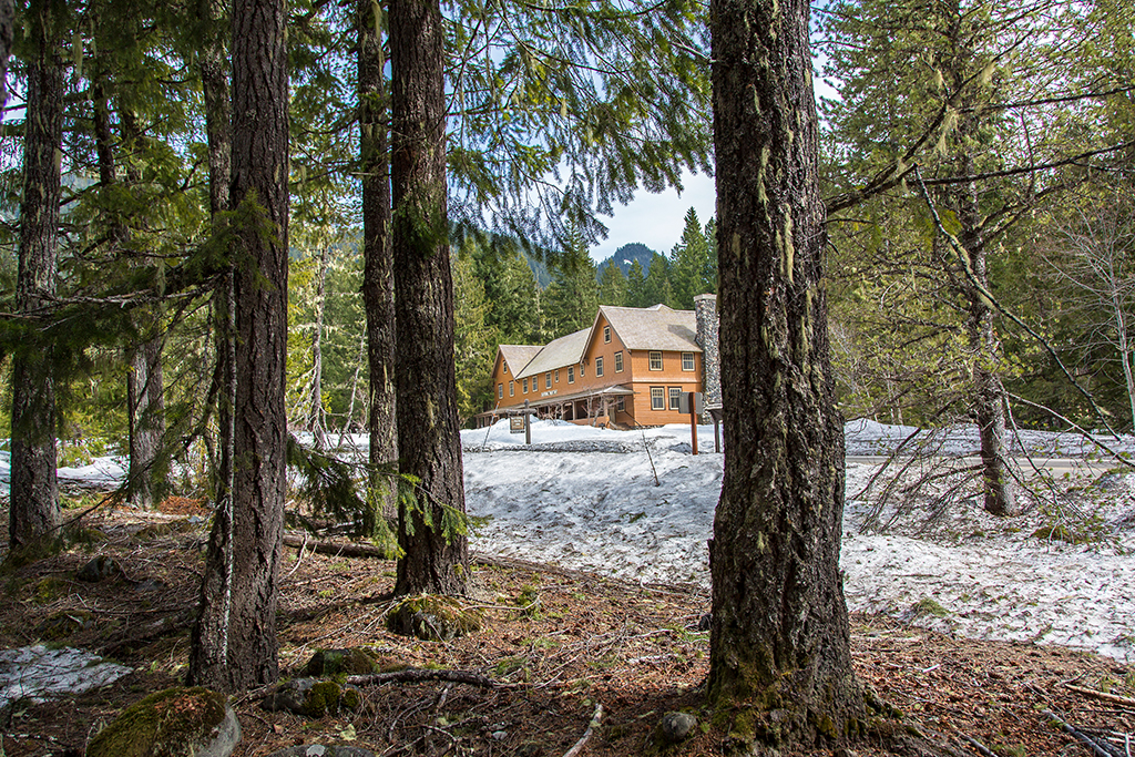
Location 4 – Trail of Shadows and National Park Inn
Trail of Shadows is a loop trail across the road from the buildings of the Longmire Historic District. This short trail rings Longmire Meadow and the bubbling mineral springs dotting the grassy area during wetter times of the year. The trail also introduces you to a part of this area’s history, with a replica of an early homestead cabin and remnants of rocked-in mineral springs available to guests staying at the Longmire Medical Springs Resort in 1890.
I like this short, shadowy trail because of the trees and gnarled roots standing parallel like so many matchsticks atop the low-growing vegetation. Visit during a foggy morning (or wildfire-smoke-hazy day) and the atmosphere adds a certain moody spookiness to the scene.

I mentioned photographing the historic Paradise Inn in my previous column, and the same may be said about photographing the National Park Inn: it’s picturesque and you should capture a few exterior photos.


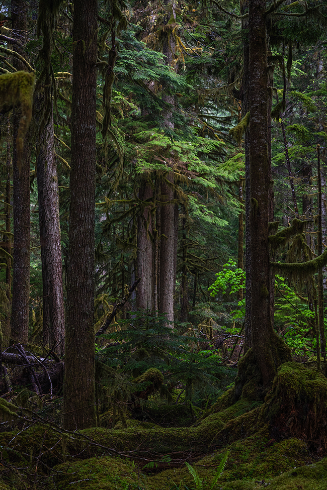
Location 5 - Twin Firs Trail
You are heading down into the lower-elevation forests of this national park. Views of the mountain are few to non-existent because of the trees. This means it’s now time for you to concentrate your compositions on the beautiful scenes which do not include Mount Rainier.
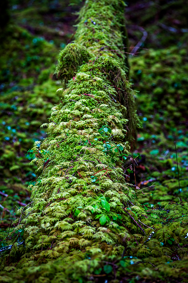
For forest interior imagery, Twin Firs Trail is one of my favorites. All along this 0.4-mile (0.6 kilometers) trail are many shades of green and brown within a shadowy forest canopy sometimes dappled by sunlight. Moss “sleeves” wrap themselves around logs and tree trunks while creating dangling drapes of green hanging from branches.

The further you walk along this trail away from the road, the quieter it becomes until you can only hear the drip-drip-drip of water off leaves and perhaps a solitary soliloquy by a hidden bird.
Location 6
Approximately 0.7 mile (1.1 kilometers) west of Twin Firs Trail, you will see on either side of the road a frothy little creek. It’s next to the Kautz Creek Service Road East and is maybe 0.1 mile (0.16 kilometers) from the Kautz Creek parking area and restrooms. I cannot find a name for this little creek on any map, but I believe it’s far more photogenic than Kautz Creek.


There’s a large drainpipe right beneath the bridge, so you will need to compose your shot to avoid the pipe, or else crop it out during the editing stage.
Location 7
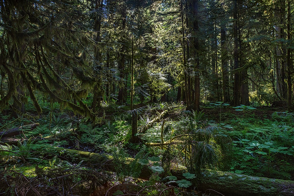
There’s no name for this spot, as far as I can tell. It will be on the right side of the road as you head toward the Nisqually Entrance. I can’t even give an approximate distance for this either (sorry) because I can’t see it on Google Maps. Look for a small pull-through parking area just large enough for two vehicles. From there, you can walk into the forest interior, bathed in shadow and sometimes sunlight. This is another one of my favorite places for forest photography. There’s a sort of “glow” to the scene even when no sun flecks the vegetation.

When photographing forest interiors, you need to adjust your settings for the low-light atmosphere. A tripod – while not mandatory – is better than handholding the camera, because you can still use a small aperture and low ISO to prevent noise (graininess), while slowing the shutter speed to allow more light onto your camera’s sensor.
Forest interiors are great for concentrating on the little details, like feathery vegetation on a nurse log, or a telephoto view of a moss-draped branch.

Location 8 – Nisqually River
As you head toward the Nisqually Entrance, you will notice pullouts to your left with views of the Nisqually River. There is one large-ish pullout with a view toward the tree you see in the shot below. Those shots were captured from the far end of the pullout looking out toward that lone tree.

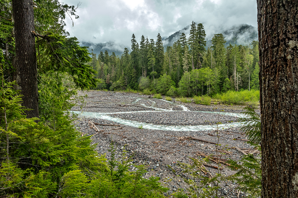

At the other end of the pullout is a short path leading down to the rocky riverbank where you can photograph a different perspective of the river. Just remember to watch your footing on these loose rocks.

Location 9 – Tahoma Creek Bridge
The road toward the Nisqually Entrance is great for photographing not only the Nisqually River, but various creeks. About a mile (1.6 kilometers) prior to reaching the Nisqually Entrance, you will see a very short bridge over Tahoma Creek. On your right will be a small, uneven dirt pullout. Park there and walk to the bridge.

The road here is narrow and there is no elevated walk next to the railing, so be mindful of traffic. Early morning is the best time to photograph here.
Location 10 – Westside Road
Approximately 0.1 mile (0.16 kilometers) beyond the Tahoma Creek Bridge is the right turn onto Westside Road. Immediately upon turning, you will see a pullout on the right. Park there and walk across the road up a short, steep (sometimes slippery) incline to a lovely nameless little cascade. This is a great place for moody shots and silky water imagery.

As always, I use a tripod for my silky water images. I have captured images handholding the camera and using the burst method of holding down on the shutter button for several clicks (insuring at least one sharp, clear image), but that was only because I had forgotten to load my tripod in the car (insert huge eye roll here). Those images froze the water in motion but did not add that satiny touch.
Once you are finished with the water shots, cross the road next to your parked vehicle to photograph the forest interior.
From that vantage point, turn around and look across the road and upward for more forest shots.

This ends my favorite photo spots series for Mount Rainier National Park. FYI, I will not be writing anything about the Carbon River Area (northwest section of this park). It’s not that this is not a place with great photo spots – I know it is. However, I only visited the Carbon River Area once, 30 years ago (pre digital camera). To be honest, it’s currently more distant from my home, and it is a little more difficult to access – well, you can’t access it now with the indefinite closure of the Carbon River/Fairfax Bridge on State Route 165 to vehicles, bicyclists, and pedestrians.
Note: While a timed entry reservation for this area up to Paradise was not necessary for 2025, you may need one for 2026 if you intend to visit and photograph Mount Rainier during the summer between 7 a.m. and 5 p.m. Remember to check the park's website to see what is required for entry.
Stories about:
Story Categories:
A copy of National Parks Traveler's financial statements may be obtained by sending a stamped, self-addressed envelope to: National Parks Traveler, P.O. Box 980452, Park City, Utah 84098. National Parks Traveler was formed in the state of Utah for the purpose of informing and educating about national parks and protected areas.
Residents of the following states may obtain a copy of our financial and additional information as stated below:
- Florida: A COPY OF THE OFFICIAL REGISTRATION AND FINANCIAL INFORMATION FOR NATIONAL PARKS TRAVELER, (REGISTRATION NO. CH 51659), MAY BE OBTAINED FROM THE DIVISION OF CONSUMER SERVICES BY CALLING 800-435-7352 OR VISITING THEIR WEBSITE. REGISTRATION DOES NOT IMPLY ENDORSEMENT, APPROVAL, OR RECOMMENDATION BY THE STATE.
- Georgia: A full and fair description of the programs and financial statement summary of National Parks Traveler is available upon request at the office and phone number indicated above.
- Maryland: Documents and information submitted under the Maryland Solicitations Act are also available, for the cost of postage and copies, from the Secretary of State, State House, Annapolis, MD 21401 (410-974-5534).
- North Carolina: Financial information about this organization and a copy of its license are available from the State Solicitation Licensing Branch at 888-830-4989 or 919-807-2214. The license is not an endorsement by the State.
- Pennsylvania: The official registration and financial information of National Parks Traveler may be obtained from the Pennsylvania Department of State by calling 800-732-0999. Registration does not imply endorsement.
- Virginia: Financial statements are available from the Virginia Department of Agriculture and Consumer Services, 102 Governor Street, Richmond, Virginia 23219.
- Washington: National Parks Traveler is registered with Washington State’s Charities Program as required by law and additional information is available by calling 800-332-4483 or visiting www.sos.wa.gov/charities, or on file at Charities Division, Office of the Secretary of State, State of Washington, Olympia, WA 98504.
INN Member

The easiest way to explore RV-friendly National Park campgrounds.

Here’s the definitive guide to National Park System campgrounds where RVers can park their rigs.
Our app is packed with RVing- specific details on more than 250 campgrounds in more than 70 national parks.
You’ll also find stories about RVing in the parks, tips helpful if you’ve just recently become an RVer, and useful planning suggestions.
