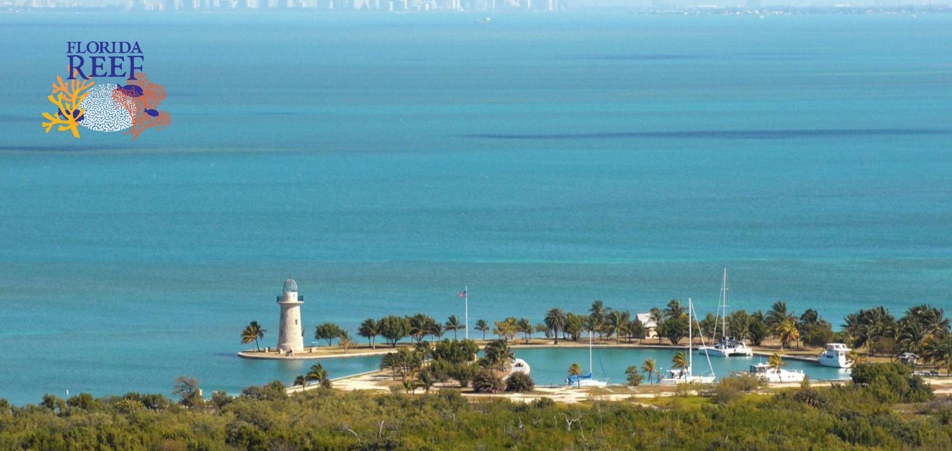
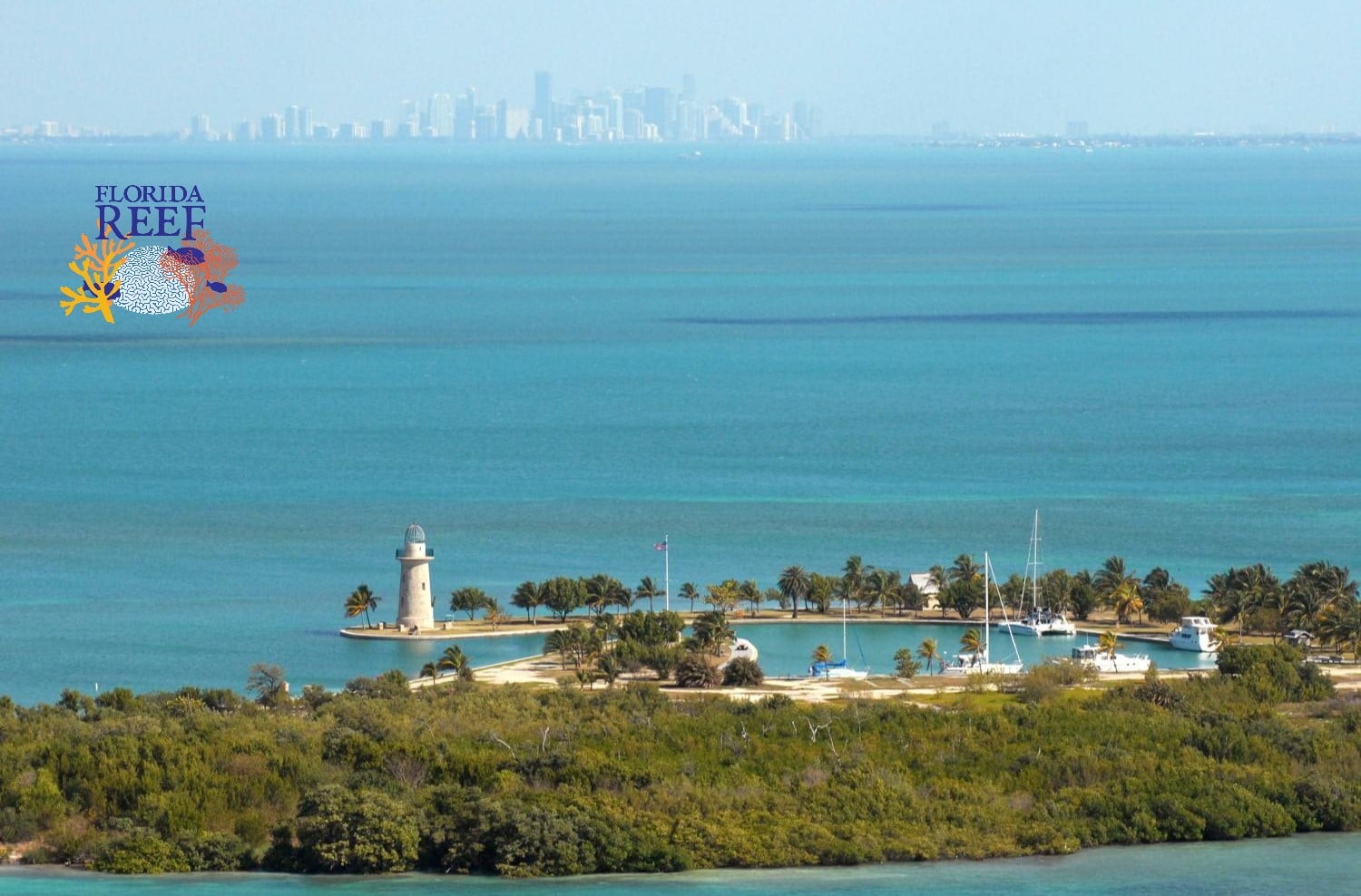
BISCAYNE NATIONAL PARK, Fla. — In one direction, the view from the 65-foot-tall Boca Chita lighthouse in Biscayne National Park is an endless sea of shimmering Atlantic Ocean off the coast of Florida.
In another, across Biscayne Bay, stands the Miami skyline, bedazzled with glassy skyscrapers and surrounded by the most densely populated region of the Sunshine State.
Beneath those views and unseen underwater, decades of pollution, controversial water management and land-use practices, and aging infrastructure have greatly compromised the water body locals refer to as Miami’s “blue heart.”
The bay, which also is being impaired by climate change’s warming ocean waters and more potent storms, in recent years has seen massive fish kills, deadly algal blooms, and the loss of vibrant seagrass beds.
Biscayne Bay hit rock bottom with a fish kill in 2020 that stunned residents who until then had little idea — or will to change — what was simmering beneath their beloved bay.
“That really triggered a huge community outcry and, I think for the very first time, brought the community together to understand how precious the bay was,” said Todd Crowl, director of the Institute of Environment at Florida International University (FIU) in Miami.
And it could turn out to be the bay’s savior.
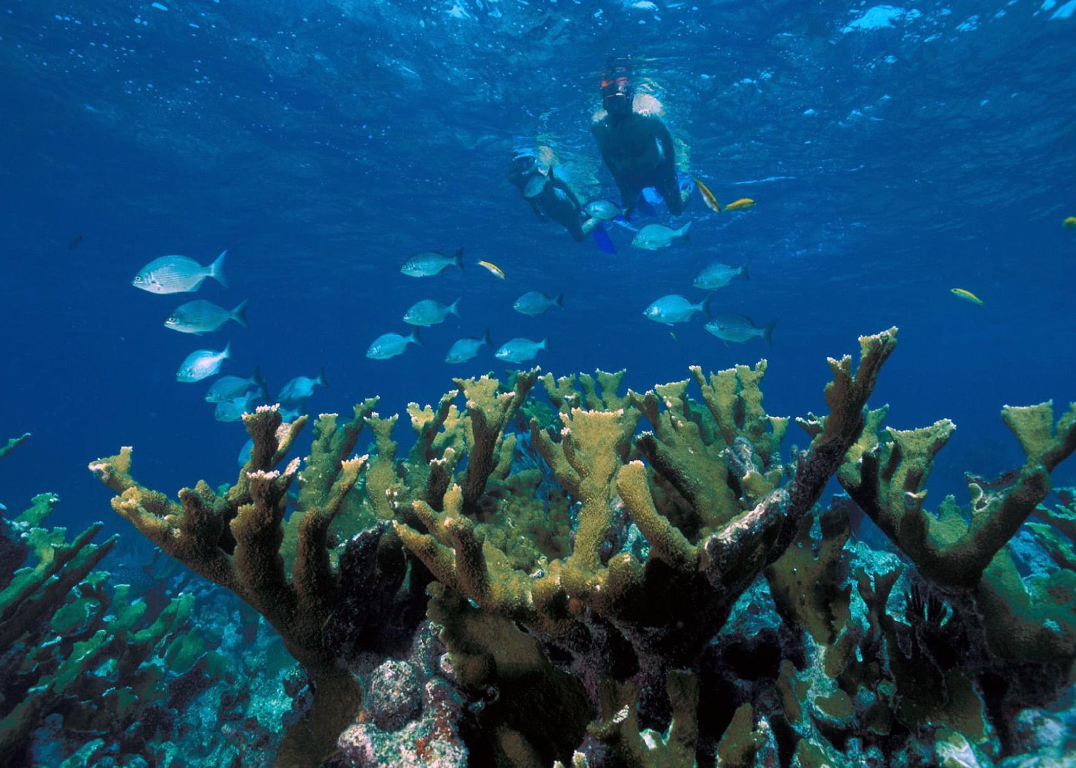
Biscayne National Park is a huge tourism draw, generating hundreds of millions of dollars in economic activity for Florida. But ocean warming tied to climate change has impacted Biscayne Bay and its corals, leading to elkhorn (foreground) and staghorn corals being declared functionally extinct in Florida/NPS file
Problems From The Urban Jungle
“It's really the jewel that we have built our community around,” Rachel Silverstein, CEO of the nonprofit Miami Waterkeeper, said in describing the bay to the National Parks Traveler. “It's iconic, it's cultural, it has extremely important environmental value, and it also supports our major industries here, which are real estate, tourism, and agriculture.”
And Biscayne Bay also provides habitat for more than a dozen threatened and endangered species including manatees, sea turtles, and American crocodiles.
And yet, despite those recognized and cherished values and roles, what ails Biscayne Bay dates back more than a century, rooted in the rapid and relentless development that shaped Florida and continues today.
The bay is a brackish estuary, an area where freshwater from inland rivers, rain, and runoff mixes with the salty ocean waters. Before the Miami-Dade region was developed, the bay was an integral part of a natural drainage and filtration system for the entire southern half of the Florida peninsula.
But the native path of freshwater into the bay was altered over the decades by a vast system of engineered canals, pumps, and gates built as part of efforts to drain the Everglades, manage irrigation, develop land, and prevent flooding.
The engineering effort started in the late 1800s and kicked into high gear in 1949 with the Central and Southern Florida (C&SF) Project, described by the South Florida Water Management District as a “massive flood control plumbing system.”
Today, the system includes 2,175 miles of canals, including 11 major canals that empty into Biscayne Bay; 2,130 miles of levees and berms; 98 pump stations; and more than 936 water control structures. Its primary purpose, according to the water management district, is to protect regional water supplies and control flooding.
Water channeled through the system runs from and through agricultural areas, industrial zones, landfills, cities, and neighborhoods where millions of people live. Along the way, it picks up ocean-defiling nutrients and contamination from septic tanks and sewage leaks, fertilizers, pesticides, trash, and other pollution.
“It's all going into these canals and then those canals are draining into Biscayne Bay,” Silverstein said.
The canal system also limits the amount of freshwater that reaches the bay, throwing off the natural salinity balance that many species depend on and exacerbating problems caused by pollution.
Where is Biscayne Bay?
Biscayne Bay is located along the southeastern coast of Florida. A large part of it is within Biscayne National Park.
What's wrong with the bay's water quality?
Pollution washed into the bay from coastal areas, along with aged infrastructure, greatly impacts the bay's water quality. In 2020 a lack of oxygen in the water caused by pollution led to a massive fish kill.
How can the bay be restored?
The state of Florida is spending tens of millions of dollars on projects to reduce pollution in the bay, in part by replacing septic systems with sewer system connections and improving wastewater storage facilities.
Water quality monitoring going back to at least the 1970s showed increased levels of bacteria and nutrients in the bay.
By 2019, an analysis by the National Oceanic Atmospheric Administration concluded that Biscayne Bay was in eutrophication, a process that suffocates the marine environment when excessive nutrients from sources like fertilizer and septic tanks spill into a marine environment. That can lead to a cascade of problems, including algae blooms, lack of sunlight, and lower oxygen levels in the water.
The NOAA report warned that eutrophication could have major impacts on species that live in the bay, on the ways that humans use the bay, and on the local economy.

At the same time, seagrass that serves as food and a nursery for marine species including manatees, sea turtles, crabs, lobsters, and fish was being choked out by pollution. Seagrass also acts as a natural filter, helping to absorb and disburse those harmful excess nutrients and other pollution.
It all came to a head in 2020, the year after the NOAA warning. A report from Miami-Dade County blamed that year’s fish kill in part on a heavy rainfall event the prior year that pushed large amounts of stormwater into Biscayne Bay via the canal drainage system.
“Twenty-seven thousand fish died, basically overnight, in northern Biscayne Bay,” Silverstein said. “And that was really a tipping point where the bay had so much pollution in it that it just failed to have enough oxygen for the wildlife, and they suffocated and died.”
Curing Biscayne Bay’s Ills
Silverstein said continued Everglades restoration projects could help the bay. One, the Biscayne Bay Coastal Wetlands Project, was finished in December. It included re-distributing freshwater canal flows across areas that were traditionally wetlands, mimicking a more natural, slower flow of water into the bay and the national park.
Another project, the U.S. Army Corps of Engineers’ Biscayne Bay and Southeastern Everglades Ecosystem Restoration, is working its way through the planning process. Known as BB SEER, it seeks to increase natural freshwater flows.
Both initiatives are part of the larger Comprehensive Everglades Restoration Plan, approved by Congress in 2000.
Originally, CERP was projected to include more than 50 projects completed over a 30-year span, with an estimated cost of $8.2 billion. A Congressional update published on January 14, 2025, revealed that’s now increased to more than $23 billion and a 50-year time line. As of Fiscal Year 2024, the federal government had invested $3.2 billion in CERP projects and the State of Florida had spent $2.8 billion.
At the same time, the state has spent $90 million since 2021 on efforts to improve the bay’s health. Last December the DeSantis administration promised $20 million to reduce the use of septic systems and improve wastewater storage in several municipalities around Biscayne Bay, including Homestead, South Miami, Cutler Bay and Miami Shores.
"The very best thing we can do is replace all septics with sewer, but that comes to about $12,500 per household, so providing funding to the bay communities to allow then to target which neighborhoods are the highest priority is a big step forward," said Crowl. "Same argument for new storm drain technology such as better, self-cleaning filters, sensors that alert the cities when particular storm drains are clogged, etc. Bottom line is, our current infrastructure was not build for the current human population size and coastal density."
Meanwhile, sea-level rise associated with climate change is bringing new challenges. Sea levels in the northern half of 221-square-mile Biscayne Bay have risen 8 inches since 1950, according to Florida’s state climatologist. That’s accelerated in the past decade, with about 1 inch of sea-level rise every three years.
Research published this month shows that seawater inundation could continue to push the bay to higher salinity levels in the future, further throwing off the natural balance.
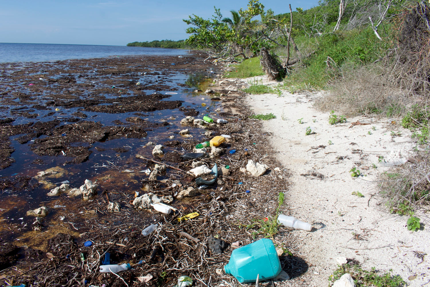
National Park Service staff at Biscayne National Park shared this photo on its social media channels in 2024 in a bid to get visitors to clean up after themselves/NPS file
Biscayne Bay’s Health And The Florida Reef
A portion of the 350-mile Florida Reef runs parallel to Biscayne Bay, within the boundaries of the national park.
“Everything we do inland affects the reef tract as well,” said Crowl back at FIU.
A 2022 report from the Coral Restoration Foundation noted that just 2 percent of live coral remained on the Florida Reef. Previous reports from NOAA showed that coral coverage had declined by 90 percent since the 1970s in the Florida Keys, a chain of islands that starts at Elliott Key in Biscayne Bay.
The degradation was brought on by pollution, disease, heat stress, and damage from boats and storms. Studies also showed negative impacts from dredging for Miami’s cruise ship port, one of the largest in the world, at the northern end of Biscayne Bay.
In 2023, a sweltering marine heatwave pushed water temperatures in the region to record highs. That caused a mass coral bleaching event that the reef is still recovering from. Higher-than-normal ocean water temperatures can stress corals and cause them to lose algae that is their primary food source and also gives them their distinct coloring. Scientists say the upward trend in ocean temperatures is a result of global warming.
Warmer temperatures also drive more rain and more intense storms, which extends the cycle of pollution that affects the bay and the reef.
"And as you have more rain, the groundwater's flooding the septic tanks and the sewage infrastructure underground, and those things are not getting treated as they should," Silverstein said. "Or you're getting (sewage) spills, and that's contaminating the bay, more fertilizers, more runoff, and that is getting into the bay."
Miami Waterkeeper counts 120,000 septic systems in Miami-Dade County, including in areas along canals and the Biscayne bayfront. Many are decades old and prone to leakage and overflows.
In addition, climate-driven sea level rise increases minor flooding that’s already frequent in Miami.
That's one reason Miami Waterkeeper and other environmental groups continue to keep a close eye on the Turkey Point Nuclear Plant, situated along the bay about 2 miles south of the Biscayne National Park visitor center. Florida Power & Light seeks to keep the plant running into the 2050s, but sea level rise projections show the flat, low-lying ground where it sits could be covered in water by 2040.
"The actual nuclear core is elevated," Silverstein said. “But the infrastructure at sea level includes most of the plant and its operations and the roads in and out and backup power and the spent fuel.”
A 2024 report from the Government Accounting Agency highlighted Turkey Point as being especially vulnerable to the impacts of climate change.
The Nuclear Regulatory Commission said it had no qualms about the plant’s safety.
“The NRC is satisfied that the Turkey Point nuclear power plant is meeting the agency’s requirements to operate safely and to safely shut down during severe events such as hurricanes and flooding,” the agency said in a statement last year to local news outlet WPLG-TV.
Coral, Wildlife And Shipwrecks
The Turkey Point power plant can easily be seen through the mangroves that flank Convoy Point Jetty in Biscayne National Park. The southern part of the bay is the biggest attraction at the park, where 95 percent of the park’s 300 square miles are covered by water. It also plays a role in the ecosystem at nearby Everglades National Park.
The jetty is a popular walking path and fishing area along the bay near the park’s visitor center in the Miami suburb of Homestead.
On one recent afternoon, a family on vacation from Minnesota spotted their first-ever manatee at the jetty. The giant creature, also known as a sea cow, floated slowly just a few feet away.
Nearby, a dog wearing sunglasses ran along the path with its human. Several anglers cast fishing lines into the clear shallow water.
And in the visitor center’s boat harbor, a snorkeling tour returned from exploring a shipwreck, floating over coral and swimming along mangrove shorelines. Lillian Freundlich, Keara Farrelly, and Elizabeth Gorman, three friends on a girls’ trip from Philadelphia, excitedly ran down a list of what they saw: Lobsters, a spotted eagle ray, eels, barracuda, rainbow parrotfish, and more.
“It was really amazing,” Freundlich said.
The park logged more than 500,000 visitors last year, and a National Park Service report from 2020 said parkgoers spent $46.2 million on hotels, gas, restaurants, and other services.
In all, activities in and around Biscayne Bay pump $64 billion into the local economy, according to Miami-Dade Department of Environmental Resources Management Director Loren Parra.
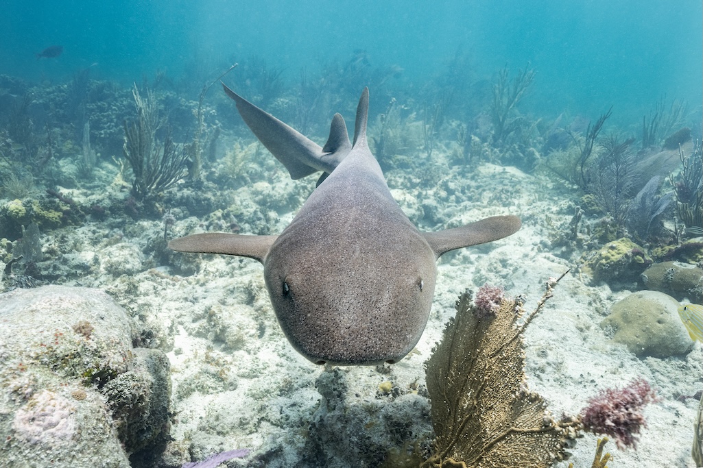
If Biscayne Bay's health continues to decline, marine life like this gray nurse shark will leave the bay/NPS file, Pete Wintersteen
Signs Of Hope For Biscayne Bay
Crowl’s team at Florida International University tracks the bay’s water quality in near real time via a series of buoys that monitor temperature, salinity, chlorophyll, clarity and other environmental indicators.
Those buoys were deployed in response to the 2020 fish kills and others that followed in the next two years.
It was one of many efforts created, or given new life, as the fish kills energized residents, local governments, and environmental groups. The county convened a first-of-its-kind Biscayne Bay Health Advisory Board in 2021. A law banning fertilizer on lawns during the rainy months of the year took effect in 2022, something Miami Waterkeeper and other groups advocated strongly for as it reduces nutrient runoff into the bay.
Parra said the county is also working on a number of other programs, including boater education to discourage littering and encourage support of initiatives to conserve the bay and its surroundings, and new technologies to help mitigate sewer overflows.
There are first-hand observations of positive change.
“Those seagrass beds are starting to come back a little bit, but it's still only about 20 percent of what it historically was,” Crowl said. “So the good news is it seems to be slowly coming back, but the bad news is there was an awful lot of damage.”
Despite the improvements, the county’s annual Biscayne Bay report card shows little change in overall water quality since its first iteration five years ago. Most of the bay remains in what is considered “fair” or “poor” condition.
And those who fight for the bay continue advocating to abolish septic tanks, repair sewer systems, and upgrade stormwater drainage.
“We like to say clean water is what makes Miami, Miami," Silverstein said. "And, by that, we really do mean Biscayne Bay.”
Contributing Editor Jan Wesner Childs writes about climate, weather, travel and everything in between. Her work appears in local and national print and online publications. For the Traveler her stories have included one on whether De Soto National Memorial would be targeted for cuts as a "cost-center" Interior Secretary Doug Burgum thinks should be cast out of the National Park System.
This article was made possible in part thanks to the Curtis & Edith Munson Foundation.
Stories about:
Story Categories:
A copy of National Parks Traveler's financial statements may be obtained by sending a stamped, self-addressed envelope to: National Parks Traveler, P.O. Box 980452, Park City, Utah 84098. National Parks Traveler was formed in the state of Utah for the purpose of informing and educating about national parks and protected areas.
Residents of the following states may obtain a copy of our financial and additional information as stated below:
- Florida: A COPY OF THE OFFICIAL REGISTRATION AND FINANCIAL INFORMATION FOR NATIONAL PARKS TRAVELER, (REGISTRATION NO. CH 51659), MAY BE OBTAINED FROM THE DIVISION OF CONSUMER SERVICES BY CALLING 800-435-7352 OR VISITING THEIR WEBSITE. REGISTRATION DOES NOT IMPLY ENDORSEMENT, APPROVAL, OR RECOMMENDATION BY THE STATE.
- Georgia: A full and fair description of the programs and financial statement summary of National Parks Traveler is available upon request at the office and phone number indicated above.
- Maryland: Documents and information submitted under the Maryland Solicitations Act are also available, for the cost of postage and copies, from the Secretary of State, State House, Annapolis, MD 21401 (410-974-5534).
- North Carolina: Financial information about this organization and a copy of its license are available from the State Solicitation Licensing Branch at 888-830-4989 or 919-807-2214. The license is not an endorsement by the State.
- Pennsylvania: The official registration and financial information of National Parks Traveler may be obtained from the Pennsylvania Department of State by calling 800-732-0999. Registration does not imply endorsement.
- Virginia: Financial statements are available from the Virginia Department of Agriculture and Consumer Services, 102 Governor Street, Richmond, Virginia 23219.
- Washington: National Parks Traveler is registered with Washington State’s Charities Program as required by law and additional information is available by calling 800-332-4483 or visiting www.sos.wa.gov/charities, or on file at Charities Division, Office of the Secretary of State, State of Washington, Olympia, WA 98504.