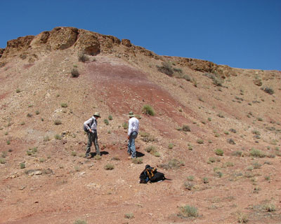
Completion of a geological map requires considerable time in the field. NPS photo.
The process has taken over three decades, but Petrified Forest National Park now has its first published geological map—and in the world of rocks, it's a star.
Although it's best known for colorful deposits of fossil wood, Petrified Forest National Park is also a treasure trove for anyone interested in geology. The area, initially established as a national monument in 1906, was redesignated a national park in 1962. It was "set aside to protect scientific values of a 20-million-year slice of Triassic Period deposits that include some of the earliest dinosaurs in the fossil record."
Map Represents Successful Culmination of a Long Project
According to a park spokesperson, a first draft of a complex project to prepare a geological map of the area was begun 35 years ago, but it was never finalized. In 2008 the park geology staff began work on a related project that required many hours—and miles—in the field.
Bill Parker, the park's physical scientist/ paleontologist, notes that his collegue Jeff Martz "literally wore his boots down to 'sandals'" before the project was completed. The payoff was a big one: a "completely revamped park stratigraphy" that was published in the open access journal PLoS ONE in 2010.
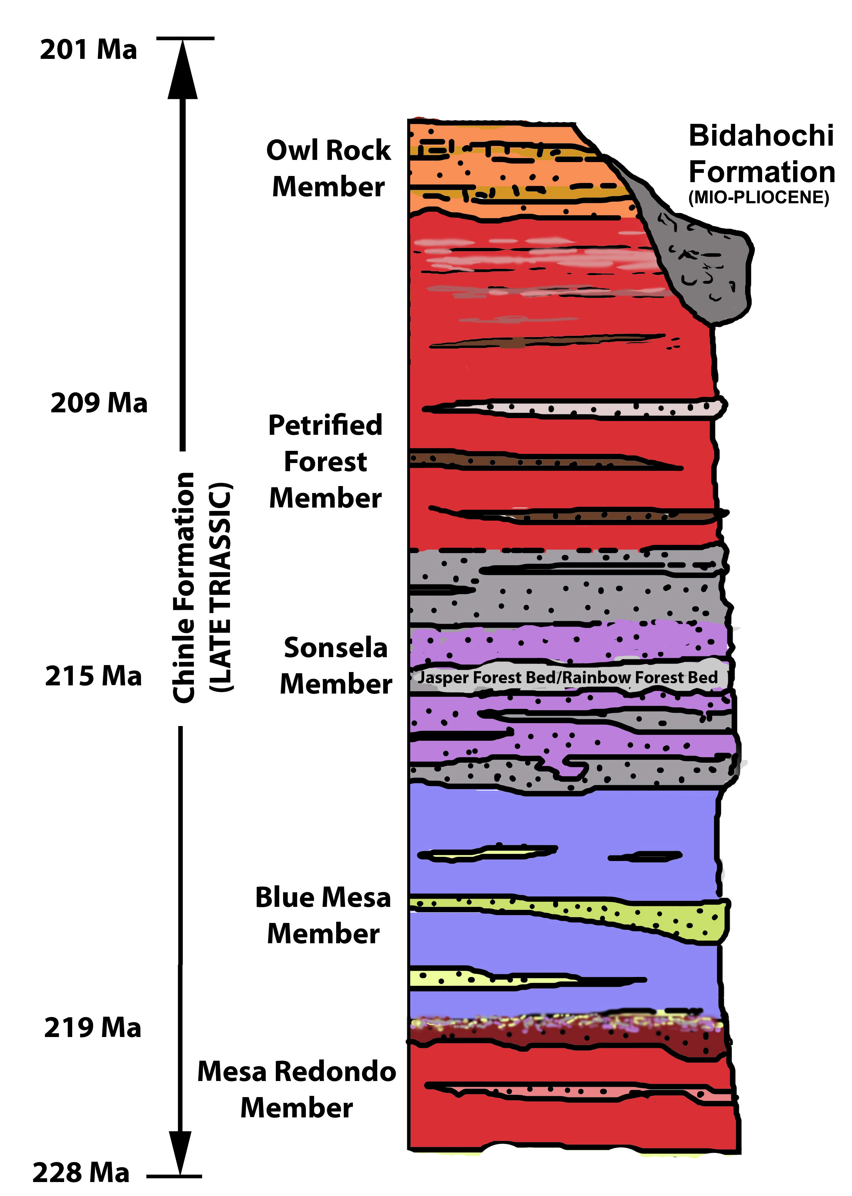
For those not familiar with the term, one basic definition of "stratigraphy" is "geology that deals with the beginnings, composition, distribution, and succession of the layers of rock in the earth's crust." You'll find a basic Geological Stratigraphy Diagram on the park website.
That study published in 2010 formed the foundation for the now-completed geological map, which covers 93,000 acres in the park. The map was digitized in partnership with the staff at Northern Arizona University, using funding from the NPS Geological Resources Division.
Map and Guide Provides New Information About the Park's Geology
The new map includes an 18-page report summarizing the park’s geology, and offers a colorful cross-section of the park geology and photographs of key rock outcrops. This new work provides a detailed breakdown of the park geology and demonstrates for the first time that the Chinle Formation is thicker in Petrified Forest than previously believed.
This study also identified a specific layer where a sudden extinction of plants and animals is recorded, and provides foundation for continuing work studying possible causes of this major event.
Current technology has made sharing the information much easier; the new map and accompanying report are freely available online through the Arizona Geological Survey website. If you're interested in the more detailed study, the 2010 publication is also available at no cost at the PLoS ONE website.
The New Map is a "Rock Star"
Interest in the project has been high in geology circles. The new map is garnering lots of interest on the Arizona Geological Survey website, recording more than 1100 visits in one week—the best performance the site has ever recorded for an online product.
The recently published geological map includes most of the park's original 93,000 acres, but there's still plenty of work to be done. In 2004 President George Bush signed legislation authorizing the expansion of Petrified Forest National Park boundaries to include approximately 125,000 acres of adjacent federal state and private lands. These lands contain significant geological, paleontological, cultural, natural, and scenic resources, and are described as a "researcher's paradise."
Interested in some basic information about the park's geology? A good place to start is this page on the park website.
Story Categories:
A copy of National Parks Traveler's financial statements may be obtained by sending a stamped, self-addressed envelope to: National Parks Traveler, P.O. Box 980452, Park City, Utah 84098. National Parks Traveler was formed in the state of Utah for the purpose of informing and educating about national parks and protected areas.
Residents of the following states may obtain a copy of our financial and additional information as stated below:
- Florida: A COPY OF THE OFFICIAL REGISTRATION AND FINANCIAL INFORMATION FOR NATIONAL PARKS TRAVELER, (REGISTRATION NO. CH 51659), MAY BE OBTAINED FROM THE DIVISION OF CONSUMER SERVICES BY CALLING 800-435-7352 OR VISITING THEIR WEBSITE. REGISTRATION DOES NOT IMPLY ENDORSEMENT, APPROVAL, OR RECOMMENDATION BY THE STATE.
- Georgia: A full and fair description of the programs and financial statement summary of National Parks Traveler is available upon request at the office and phone number indicated above.
- Maryland: Documents and information submitted under the Maryland Solicitations Act are also available, for the cost of postage and copies, from the Secretary of State, State House, Annapolis, MD 21401 (410-974-5534).
- North Carolina: Financial information about this organization and a copy of its license are available from the State Solicitation Licensing Branch at 888-830-4989 or 919-807-2214. The license is not an endorsement by the State.
- Pennsylvania: The official registration and financial information of National Parks Traveler may be obtained from the Pennsylvania Department of State by calling 800-732-0999. Registration does not imply endorsement.
- Virginia: Financial statements are available from the Virginia Department of Agriculture and Consumer Services, 102 Governor Street, Richmond, Virginia 23219.
- Washington: National Parks Traveler is registered with Washington State’s Charities Program as required by law and additional information is available by calling 800-332-4483 or visiting www.sos.wa.gov/charities, or on file at Charities Division, Office of the Secretary of State, State of Washington, Olympia, WA 98504.
INN Member

The easiest way to explore RV-friendly National Park campgrounds.

Here’s the definitive guide to National Park System campgrounds where RVers can park their rigs.
Our app is packed with RVing- specific details on more than 250 campgrounds in more than 70 national parks.
You’ll also find stories about RVing in the parks, tips helpful if you’ve just recently become an RVer, and useful planning suggestions.

Comments
This looks awesome.