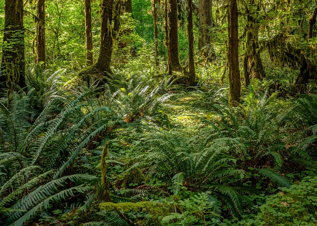
Hoh rain forest scenery, Olympic National Park / Rebecca Latson
I believe you all are enjoying these national parks quiz/trivia pieces, so I’m aiming for one a month. It’s always fun to test your knowledge and find out just how much you really do know. While researching for these quizzes and trivia pieces, I have discovered I really don’t know very much about our national parks, at all. But, I’m learning, and I hope you learn, too.
Remember, test your knowledge first, then go and look at the bottom of this piece for the answers.
1.) The Hoh Rain Forest in Olympic National Park receives how much rain annually (on average)?
a) 300 inches
b) 144 inches
c) 120 inches
d) 255 inches
2.) Which of the following presidents more than doubled the acreage of the National Park System?
a) Calvin Coolidge
b) Jimmy Carter
c) Richard Nixon
d) George H.W. Bush

Day and night divide, Great Smoky Mountains National Park / Jody Claborn
3.) There are more than 100 waterfalls and cascades in Great Smoky Mountains National Park. Which waterfall listed here is the tallest?
a) Grotto Falls
b) Abrams Falls
c) Ramsey Cascades
d) Hen Wallow Falls

A snowy spring vista, Banff National Park, Canada / Rebecca Latson
4.) What animal’s population in Banff National Park , in Canada, was boosted with help from Yellowstone National Park?
a) Elk
b) Coyote
c) Beaver
d) Black Bear
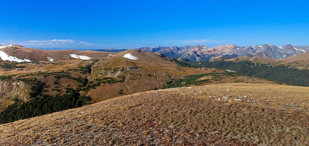
The view from Trail Ridge Road, Rocky Mountain National Park / Rebecca Latson
5.) What makes Trail Ridge Road in Rocky Mountain National Park unique?
a) It is the longest continuous paved road in a North American park
b) It is the highest continuous paved road in a North American park
c) It is the highest continuous paved road in the Northern Hemisphere
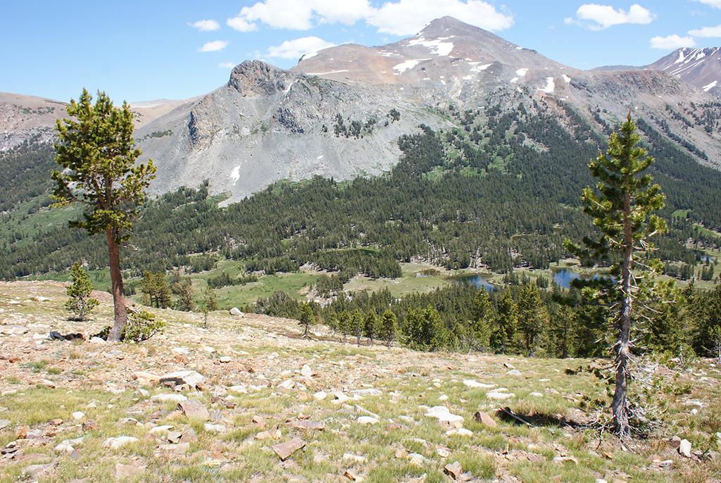
Overlooking Dana Meadows, Yosemite National Park / Everett Carrico
6.) John Muir, a Scottish-American botanist who founded the Sierra Club and became a well-known Yosemite activist, is featured on the 2005 California state quarter. What two other Yosemite National Park icons are featured with him?
a) A California condor and Half Dome
b) Mount Dana and a black bear
c) A mule deer and El Capitan
d) The Merced River and a bighorn sheep

Studying coral reefs, Virgin Islands National Park / NPS
7.) What island in Virgin Islands National Park was once used as a lookout?
a) Whistling Cay
b) Trunk Island
c) Reef Bay
d) Petroglyph Bay

The view framed by Mesa Arch, Canyonlands National Park / Rebecca Latson
8.) Dead Horse Point is located within Canyonlands National Park.
a) True
b) False

Wonder Lake scenery, Denali National Park / Rebecca Latson
9.) How many river valleys are there on the road to Wonder Lake at Denali National Park?
a) three
b) five
c) seven
d) nine

Wheeler Peak, Great Basin National Park / NPS - Tae Kim
10.) Between which mountain ranges is Great Basin National Park located?
a) Sierra Nevada and Grey Cliffs
b) Wheeler Peak and the Great Basin Range
c) Rocky Mountains and the Sierra Nevada
d) Snake Range and Rocky Mountains
And now, here’s some national park trivia for you.
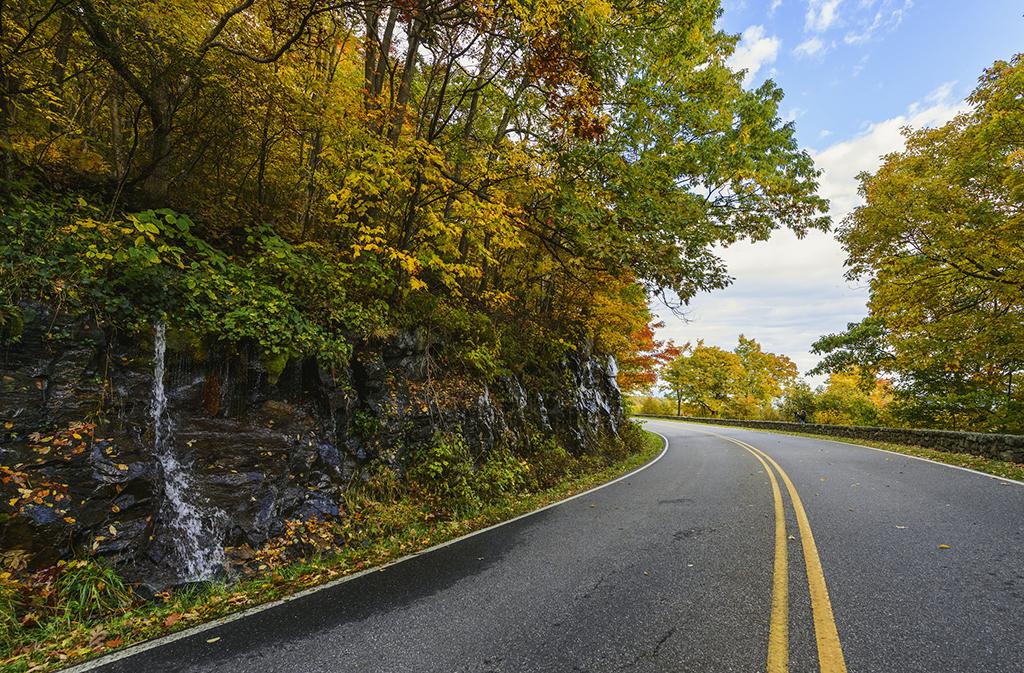
A mini falls along Skyline Drive, Shenandoah National Park / NPS-N. Lewis
Skyline Drive is a 105-mile (168 km) stretch of road along the crest of the mountains in Shenandoah National Park. Aside from inclement weather, which may close the road, Skyline Drive is generally open 24/7 and takes about three hours to drive the entire length on a clear day. For more information about Skyline Drive, check out this NPS link https://www.nps.gov/shen/planyourvisit/driving-skyline-drive.htm

An evening view of Pyramid Peak, Ross Lake National Recreation Area, North Cascades Complex / Rebecca Latson
In 1956, Canadian author Jack Kerouac found solace (and inspiration for two novels) in a cabin on Desolation Peak, within North Cascades National Park, where he worked for the Park Service as a fire spotter for 63 days. In The Dharma Bums, he writes, "I went out in my alpine yard and there it was ... hundreds of miles of pure snow-covered rocks and virgin lakes and high timber ... Below, instead of the world, I saw a sea of marshmallow clouds."

Clements Mountain and Hidden Lake Trail, Glacier National Park / Rebecca Latson
According to the NPS website for Glacier National Park, "the Continental Divide separates the Atlantic and Pacific watersheds of North America." The divide creates a north-south line right through the park. Water draining on the western side of the Continental Divide may eventually drain out into the Pacific Ocean, while water draining along the eastern side will end up in the Hudson Bay or the Gulf of Mexico. Many years ago, while on a ranger-led hike up a still-snowy Hidden Lake trail, the ranger stopped at a small meltwater stream flowing from a higher elevation to talk about the Continental Divide and how part of the trail we hiked crosses the divide. I watched that stream of meltwater flow into a smaller, intersecting stream that was more or less parallel to the trail where I stood. I swear to you, as I watched the water drain, I could see part of that stream flowing west, and part flowing east. Looking back, I’m sure it was just an optical illusion, but that illusion brought home to me how waterflow acts on each side of the Continental Divide.

Cave archeology, Mammoth Cave National Park / NPS-Gary Berdeaux
“…Nowhere else can you get a better lesson in the totality of darkness and the miracle of light …” than on a guided tour through the labyrinthine passages of Mammoth Cave National Park, in Kentucky. When I was in college, some 39 years ago, I remember visiting this national park for the first time, sans any sort of camera (what *was* I thinking?) and taking a tour through a portion of this more than 400-mile-long cave. At one point during the walk, we all stopped and the ranger, who had prepped us for this, turned out the lights. Talk about dark! Everybody fell silent and It felt like my eyes were then trying to create their own sparks of light to combat this thick curtain of matte-black deep within the bowels of limestone. Then, suddenly, the lights came back on, and I could hear the rest of the group breathe a huge, palpable, sigh of relief.
Quiz Answers
1.) B – according to the U.S. Department of the Interior, the Hoh Rain Forest reaches over 12 feet of rain annually. There’s 12 inches to 1 foot, so 12 x 12 = 144 inches.
2.) B – “With the stoke of a pen, President Jimmy Carter signed the Alaska National Interest Lands Conservation Act of 1980, securing some 40 million acres of federal lands in the 49th state.”
3.) C – Ramsey Cascades is said to have a height of over 100 feet.
4.) A – “Despite efforts to reproduce naturally, the elk population was diminishing in Banff National Park in the early 1900s. Yellowstone National Park came to the rescue, donating about 200 elk, which aided in the proliferation of the species in Banff.” Thank you, Yellowstone!
5.) B – Trail Ridge Road is the highest continuous paved road in a North American park. According to the National Park Service, “The road was designed with a ruling grade generally less than 5% and never exceeding 7%, less than half as steep as the Fall River Road.” Now, if we are going to get nit picky about this, the Mount Evans Scenic Byway also claims to be the highest paved road by about a couple of thousand feet more, give or take. The key thing to the answer of B is that Trail Ridge Road is "continuous", and it's located in a national park, while the Mount Evans Scenic Byway is not.
6.) A – John Muir appears on the 2005 California quarter with Half Dome and the California condor. You can actually hike Half Dome if you have a permit and the cables are up. Before you decide to test your stamina and skills on this hike, check out the information on this NPS page: https://www.nps.gov/yose/planyourvisit/halfdome.htm
7.) A – Whistling Cay, a small island, was used by customs officers during the 19th century to look out for smugglers.
8.) B – False. Dead Horse Point is a Utah state park reached by a left-hand turnoff from the road that heads into the Island in the Sky District of Canyonlands National Park.
9.) B – On the way to Wonder Lake, the road that bisects the northern range of the park crosses five river valleys and climbs four mountain passes
10.) C – Great Basin National Park is located between the Rocky Mountains and the Sierra Nevada. The Snake Range runs through the park. If we are getting nit picky again, a number of sites I looked at said this park is located between the Sierra Nevada and the Wasatch Range. Most sites consider the Wasatch Range to be a part of the Rockies, so I stuck with the answer of the Sierra Nevada and the Rockies.
References
The Bathroom Readers’ Institute, Uncle John’s Bathroom Reader Plunges Into National Parks, Advanced Marketing Services, Inc., 2007
Ann G. Harris, Esther Tuttle, Sherwood D. Tuttle, Geology of National Parks, Sixth Edition, Kendall/Hunt Publishing Company, 2004
https://www.nationalgeographic.com/travel/national-parks/north-cascades-national-park/
https://www.nationalgeographic.com/travel/national-parks/mammoth-cave-national-park/
https://www.doi.gov/blog/11-things-you-didnt-know-about-olympic-national-park
https://www.funtrivia.com/playquiz/quiz254372ec8a0.html
https://www.mentalfloss.com/article/70113/12-deep-facts-about-crater-lake-national-park
https://play.howstuffworks.com/quiz/rocky-mountain-national-park-quiz
https://play.howstuffworks.com/quiz/virgin-islands-national-park-quiz
https://play.howstuffworks.com/quiz/denali-national-park-quiz
https://play.howstuffworks.com/quiz/great-basin-national-park-quiz
https://play.howstuffworks.com/quiz/shenandoah-national-park-quiz
https://www.mysmokymountainpark.com/things-to-do/waterfalls
https://www.nationalgeographic.com/travel/quizzes/canada-parks-quiz-part-1/
https://www.nationalgeographic.com/travel/quizzes/national-parks-quiz-part-2/
https://www.nationalgeographic.com/travel/quizzes/yosemite-national-park-quiz-part-1/
https://www.pc.gc.ca/en/pn-np/ab/banff/decouvrir-discover/faune-wildlife/wapiti
https://en.wikipedia.org/wiki/Whistling_Cay,_United_States_Virgin_Islands
https://www.atlasobscura.com/places/mount-evans-scenic-byway



 Support Essential Coverage of Essential Places


