Editor's Note: Yellowstone Caldera Chronicles is a weekly column written by scientists and collaborators of the Yellowstone Volcano Observatory. This week's contribution is from Jamie Farrell, associate research professor with the University of Utah Seismograph Stations and Chief Seismologist of the Yellowstone Volcano Observatory.
It is well-known that the Yellowstone region, with an average of 1,500-2,500 earthquakes per year and active ground deformation, is an active volcanic area. We often talk about whether the Yellowstone Caldera or Norris Geyser Basin area is uplifting or subsiding. We also tend to focus on large earthquake swarms when they occur in the Yellowstone region. However, sometimes these two things occur at the same time and in the same area, and they are clearly related to one another. When this happens, scientists who are charged with monitoring Yellowstone must try to figure out why this is happening and what it means in terms of geologic hazards and risks to those living in and visiting the area.
So let’s look at recent episodes where seismicity and ground deformation were happening at the same place and the same time. In late December 2008, a large earthquake swarm occurred beneath northern Yellowstone Lake. The swarm started under Stevenson Island and over a ten-day period migrated north to near the outlet of Yellowstone Lake at Fishing Bridge. As the swarm passed by the Lake Lodge and housing area, where GPS station LKWY is located, the ground there moved about 7 mm (around 1/3 of an inch) to the west. This indicates that the earthquake swarm was probably due to pressurized fluids migrating to the north. There’s no clear consensus on what these fluids were, but they were most likely aqueous or gaseous fluids that came from the upper-crustal magma reservoir. The earthquakes were caused by breaking rock, and as the crack opened, it pushed the ground out of the way, resulting in the ground deformation.

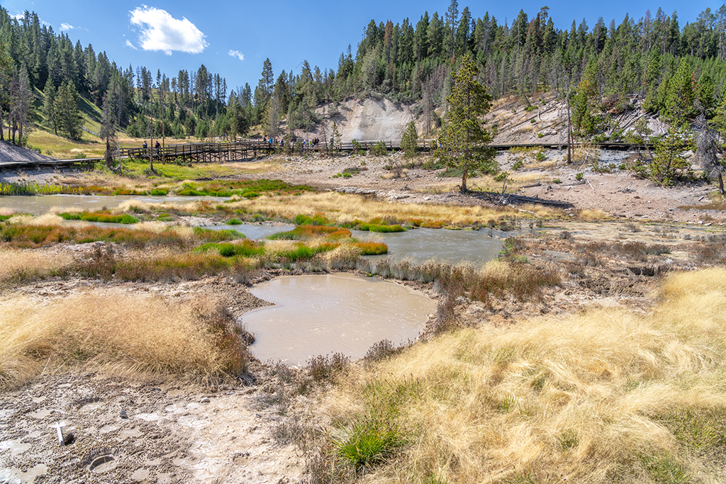
Another example is from November 2013, when the area around Norris Geyser Basin started to uplift, as recorded at nearby GPS station NRWY. Rates of uplift exceeded 15 cm/yr (~6 inches/yr), which is one of the fastest deformation rates ever recorded in Yellowstone. At around the same time and in the same area, the rate of seismicity increased. This continued into 2014 and culminated on March 30, when a M4.8 earthquake occurred near Norris Geyser Basin. This was the largest magnitude earthquake to occur in Yellowstone since 1975. Coincidentally with the M4.8 earthquake, the deformation pattern changed from uplift to rapid subsidence. This activity was interpreted as due to the accumulation and subsequent release of hydrothermal fluids beneath the geyser basin—fluids that might have come from a deeper magmatic intrusion just south of the area in 1996–2004.
The same link between ground deformation and earthquakes is also on display right now. In July 2025, the area to the south of Norris Geyser Basin began to uplift once more. This area is located on the north rim of Yellowstone Caldera in the same place as the earlier area of deformation from 1996–2004. And there are indications of increased seismicity in the uplift area, including a swarm that occurred directly on top of the center of uplift in November 2025. At this point, there is no way of knowing what will come of this current deformation episode. Will it lead to more seismicity, larger magnitude earthquakes, or ultimately shallow accumulations of hydrothermal fluids, as apparently happened as a result of the 1996–2004 deformation episode? Although there are no clear answers at this point, YVO scientists will keep monitoring this deformation and the associated seismicity. You can follow along—the most recent deformation and seismic data are posted at https://www.usgs.gov/
Stories about:
Story Categories:
A copy of National Parks Traveler's financial statements may be obtained by sending a stamped, self-addressed envelope to: National Parks Traveler, P.O. Box 980452, Park City, Utah 84098. National Parks Traveler was formed in the state of Utah for the purpose of informing and educating about national parks and protected areas.
Residents of the following states may obtain a copy of our financial and additional information as stated below:
- Florida: A COPY OF THE OFFICIAL REGISTRATION AND FINANCIAL INFORMATION FOR NATIONAL PARKS TRAVELER, (REGISTRATION NO. CH 51659), MAY BE OBTAINED FROM THE DIVISION OF CONSUMER SERVICES BY CALLING 800-435-7352 OR VISITING THEIR WEBSITE. REGISTRATION DOES NOT IMPLY ENDORSEMENT, APPROVAL, OR RECOMMENDATION BY THE STATE.
- Georgia: A full and fair description of the programs and financial statement summary of National Parks Traveler is available upon request at the office and phone number indicated above.
- Maryland: Documents and information submitted under the Maryland Solicitations Act are also available, for the cost of postage and copies, from the Secretary of State, State House, Annapolis, MD 21401 (410-974-5534).
- North Carolina: Financial information about this organization and a copy of its license are available from the State Solicitation Licensing Branch at 888-830-4989 or 919-807-2214. The license is not an endorsement by the State.
- Pennsylvania: The official registration and financial information of National Parks Traveler may be obtained from the Pennsylvania Department of State by calling 800-732-0999. Registration does not imply endorsement.
- Virginia: Financial statements are available from the Virginia Department of Agriculture and Consumer Services, 102 Governor Street, Richmond, Virginia 23219.
- Washington: National Parks Traveler is registered with Washington State’s Charities Program as required by law and additional information is available by calling 800-332-4483 or visiting www.sos.wa.gov/charities, or on file at Charities Division, Office of the Secretary of State, State of Washington, Olympia, WA 98504.

National parks and their natural resources belong to you. The National Parks Traveler works to ensure you know how these essential places are being cared for.
Sign Up For Our Weekly Newsletter
Unsubscribe at any time.
INN Member

The easiest way to explore RV-friendly National Park campgrounds.

Here’s the definitive guide to National Park System campgrounds where RVers can park their rigs.
Our app is packed with RVing- specific details on more than 250 campgrounds in more than 70 national parks.
You’ll also find stories about RVing in the parks, tips helpful if you’ve just recently become an RVer, and useful planning suggestions.
