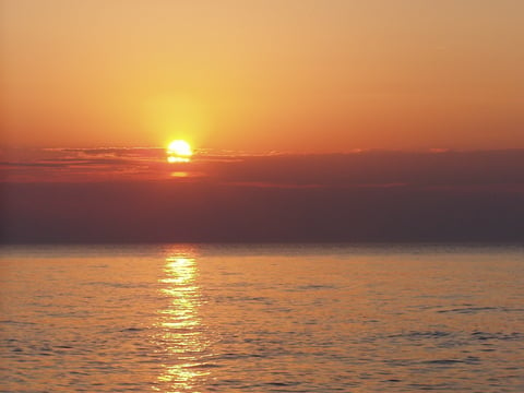
Sunset over Lake View Beach at Indiana Dunes National Park. NPS Photo by Christopher Light.
There are parks across the national park system that have decidedly watery settings: Voyagers National Park, Isle Royale National Park, Channel Islands National Park, Acadia National Park, Biscayne National Park and Dry Tortugas National Park, just to name some of the most obvious.
Then, too, there are the national seashores, places like Cape Cod National Seashore, Cape Hatteras National Seashore, Cape Lookout National Seashore, and Point Reyes National Seashore to name some.
And then there are the national lakeshores, of which there are only four in the entire park system: Apostle Islands National Lakeshore, Indiana Dunes National Lakeshore, Sleeping Bear Dunes National Lakeshore, and Pictured Rocks National Lakeshore. All are tied to the Great Lakes, with Apostle Islands and Pictured Rocks on the south shore of Lake Superior and the other two on Lake Michigan.
The lakeshores were created from private and state-owned land during the brief interval 1966-1970. It had become obvious that the federal government would have to move quickly to preserve important natural and historical/cultural resources threatened by shoreline-focused development and related economic activities, notes Dr. Robert Janiskee, who teaches an online course on national parks through the University of South Carolina’s Independent Learning Division.
Pictured Rocks and Indiana Dunes were established in 1966, while Apostle Islands and Sleeping Bear Dunes were created in 1970. In the years since, there have been various proposals to create additional national lakeshores, but none has made it through Congress.
[url=http://www.nps.gov/piro]
Pictured Rocks National Lakeshore[/url]
Pictured Rocks, the first national lakeshore to be created, lies along a 42-mile stretch of Lake Superior’s south shoreline in Michigan’s Upper Peninsula. As with the other lakeshores, it does not extend very far inland, just five miles at its maximum width. Pictured Rocks boasts multicolored sandstone cliffs, beaches, sand dunes, woods, waterfalls, inland lakes, and wildlife. While the Lake Superior waters are far too cold and treacherous for comfortable swimming, visitors enjoy a wide range of recreational activities, including sightseeing, hiking, camping, picnicking, hunting, and boating and kayaking along the park’s strikingly scenic cliffs. This is a four-season park, with winter activities including cross-country skiing, snowshoeing, snowmobiling, ice climbing, and ice fishing. The Miners Castle scenic overlook, which is accessible via a spur road, is a popular choice with motorists. Many park visitors elect to take the 2.5-hour commercial boat tours from the western gateway town of Munising. Despite its remote location, Pictured Rocks drew more than 419,000 visitors in 2006.
[url=http://www.nps.gov/indu]Indiana Dunes National Lakeshore
[/url]
Attracting 1.9 million visitors in 2006, Indiana Dunes is the most popular of the four lakeshores. The park’s high visitation is attributable to its location on the south shore of Lake Michigan near major highways and urban centers. (The park is just 90 minutes from Chicago and 30 minutes from Gary, Indiana.) Visitors to this nearly 25-mile long shoreline-hugging park enjoys beaches, sand dunes, bogs, woodlands, prairie remnants, and historical/cultural attractions including an 1830s French Canadian homestead and a working 1900-era farm (both partially restored). A wide array of recreational activities is available, including auto touring, nature walks and hiking, horseback riding, biking, swimming, fishing, camping, picnicking, cross-country skiing, snowshoeing, and wildlife viewing. Although big sand dunes may be the most visually striking feature of the park, Indiana Dunes is also renowned for its rich variety of plant and animal species. This park has more than 1,400 vascular plant species and ranks seventh among national parks in native plant diversity. Management of this park is made difficult by many factors, including heavy visitation, encroaching industry and related development, air and water pollution, and the fragmented nature of the park landholdings.
Apostle Islands National Lakeshore
Located in northern Wisconsin near the western end of Lake Superior, Apostle Islands National Lakeshore consists of 22 picturesque islands and an 11-mile strip of adjacent Bayfield Peninsula. Apostle Islands is remote and less visited than the other lakeshores, with only 189,000 visits recorded in 2006. The park’s isolation is a saving grace for those who dislike crowds and appreciate “getaway” recreational opportunities. The park even has 33,000 acres of protected wilderness. Apostle Islands appeals to people who particularly enjoy boating, sailing, kayaking, fishing, hiking, camping, scuba diving (permit required), hunting, and nature appreciation. Few parks are better suited to sea kayaking and island hiking. The brownstone cliffs, sea caves, wooded shores, lighthouses, wildlife, and other scenic delights are remarkably picturesque. Many visitors are surprised to learn that this park has the country’s finest collection of historic lighthouses. Stockton Island is a favorite of many outdoor enthusiasts, offering 14 miles of hiking trails, wonderful beaches, and campsites along the lakeshore.
Sleeping Bear Dunes National Lakeshore
Sleeping Bear Dunes National Lakeshore consists of fragmented holdings, including North and South Manitou Islands, spread along a 35-mile stretch of Lake Michigan's eastern coastline near Traverse City, Michigan. The park was established to protect outstanding natural and cultural features, including enormous sand dunes that tower as much as 460 feet high, some of the finest beaches on the Great Lakes, forests, inland lakes and wetlands, trout streams, and ancient glacial landforms. The Lakeshore also has outstanding cultural features, including an 1871 lighthouse, three former Life-Saving Service/Coast Guard Stations, a Maritime Museum, the Cannery (historic boat museum), and an extensive rural historic farm district. Sleeping Bear is very heavily visited (1.2 million in 2006), being situated within the booming Grand Traverse Bay urban-tourism region and popular with weekenders and vacationers from major urban centers to the south (such as Chicago, Detroit, and Grand Rapids). An excellent road system, including the renowned Pierce Stocking Loop Drive, makes visiting this park very auto-convenient. As might be expected of a place that is world famous for its big dunes, the dune-top lookouts and Dune Climb are very popular. In addition to auto tours, nature walks, and beach activities, the park offers a wide range of outdoor sports such as boating, sailing, kayaking, scuba diving, hunting, fishing, cross-country skiing, and snowshoeing.
Story Categories:
A copy of National Parks Traveler's financial statements may be obtained by sending a stamped, self-addressed envelope to: National Parks Traveler, P.O. Box 980452, Park City, Utah 84098. National Parks Traveler was formed in the state of Utah for the purpose of informing and educating about national parks and protected areas.
Residents of the following states may obtain a copy of our financial and additional information as stated below:
- Florida: A COPY OF THE OFFICIAL REGISTRATION AND FINANCIAL INFORMATION FOR NATIONAL PARKS TRAVELER, (REGISTRATION NO. CH 51659), MAY BE OBTAINED FROM THE DIVISION OF CONSUMER SERVICES BY CALLING 800-435-7352 OR VISITING THEIR WEBSITE. REGISTRATION DOES NOT IMPLY ENDORSEMENT, APPROVAL, OR RECOMMENDATION BY THE STATE.
- Georgia: A full and fair description of the programs and financial statement summary of National Parks Traveler is available upon request at the office and phone number indicated above.
- Maryland: Documents and information submitted under the Maryland Solicitations Act are also available, for the cost of postage and copies, from the Secretary of State, State House, Annapolis, MD 21401 (410-974-5534).
- North Carolina: Financial information about this organization and a copy of its license are available from the State Solicitation Licensing Branch at 888-830-4989 or 919-807-2214. The license is not an endorsement by the State.
- Pennsylvania: The official registration and financial information of National Parks Traveler may be obtained from the Pennsylvania Department of State by calling 800-732-0999. Registration does not imply endorsement.
- Virginia: Financial statements are available from the Virginia Department of Agriculture and Consumer Services, 102 Governor Street, Richmond, Virginia 23219.
- Washington: National Parks Traveler is registered with Washington State’s Charities Program as required by law and additional information is available by calling 800-332-4483 or visiting www.sos.wa.gov/charities, or on file at Charities Division, Office of the Secretary of State, State of Washington, Olympia, WA 98504.
INN Member

The easiest way to explore RV-friendly National Park campgrounds.

Here’s the definitive guide to National Park System campgrounds where RVers can park their rigs.
Our app is packed with RVing- specific details on more than 250 campgrounds in more than 70 national parks.
You’ll also find stories about RVing in the parks, tips helpful if you’ve just recently become an RVer, and useful planning suggestions.

Comments
Pictured Rocks National Lakeshore is gorgeous. We've visitied the Upper Penninsula a few times in past years, staying in Shelter Bay (a small area outside Au Train). The beaches are clean with sand dunes and sand soft under your toes. Chapel Falls area has a 7.5 mile round-trip trail through the forest that ends at Chapel Beach. It's the only walk-in way to get to a secluded bay unless you come in by boat. This area of Pictured Rocks is so secluded that we were the only people there. However, no amenities are available with the exception of a small outhouse. A nice place for a romantic picnic. There are other scenic trails leading to the lakeshore just as fantastic as the Chapel Falls trail. And, there's always the boat ride out of Munising, unless it's foggy. Miners Castle Overlook gives you a great view of Grand Island National Recreation Area, part of Hiawatha National Forest. We can't wait to go back again this Summer. We haven't seen all of Pictured Rocks National Lakeshore yet or traveled all the forested trails in the Upper Penninsula.