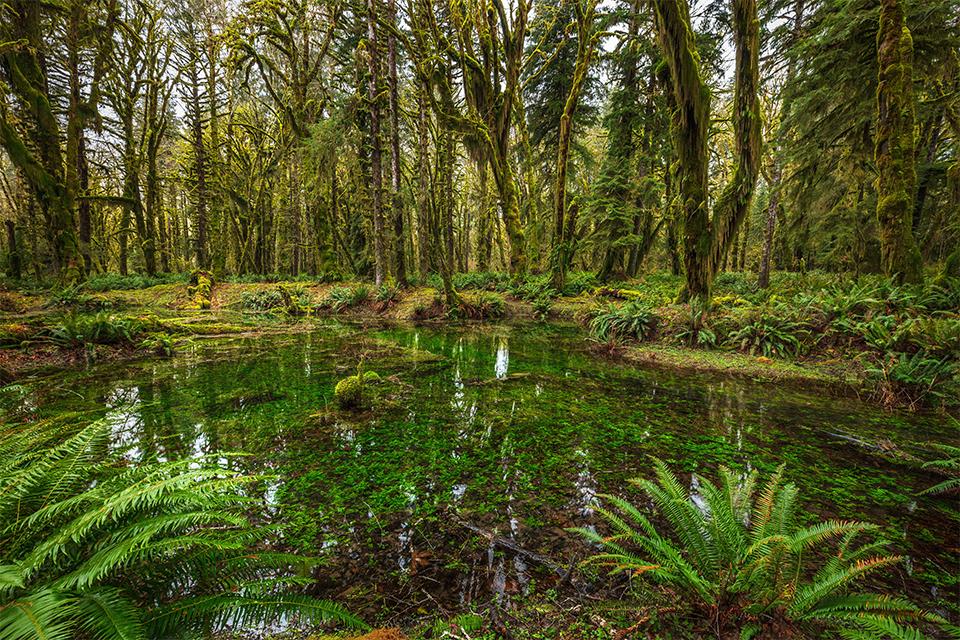
A green scene along the Maple Glade trail, Quinault Rain Forest, Olympic National Park / Rebecca Latson
Olympic National Park, on Washington state’s Olympic Peninsula, offers a little bit of everything for the visitor: Coastal Pacific beaches, lush rain forests, and rugged, snowcapped mountains. It’s a large park with plenty to do, and the Traveler’s Checklist can help you plan your trip to make the most of your time exploring this park.
You’ll have to do a bit of driving to reach Olympic National Park.

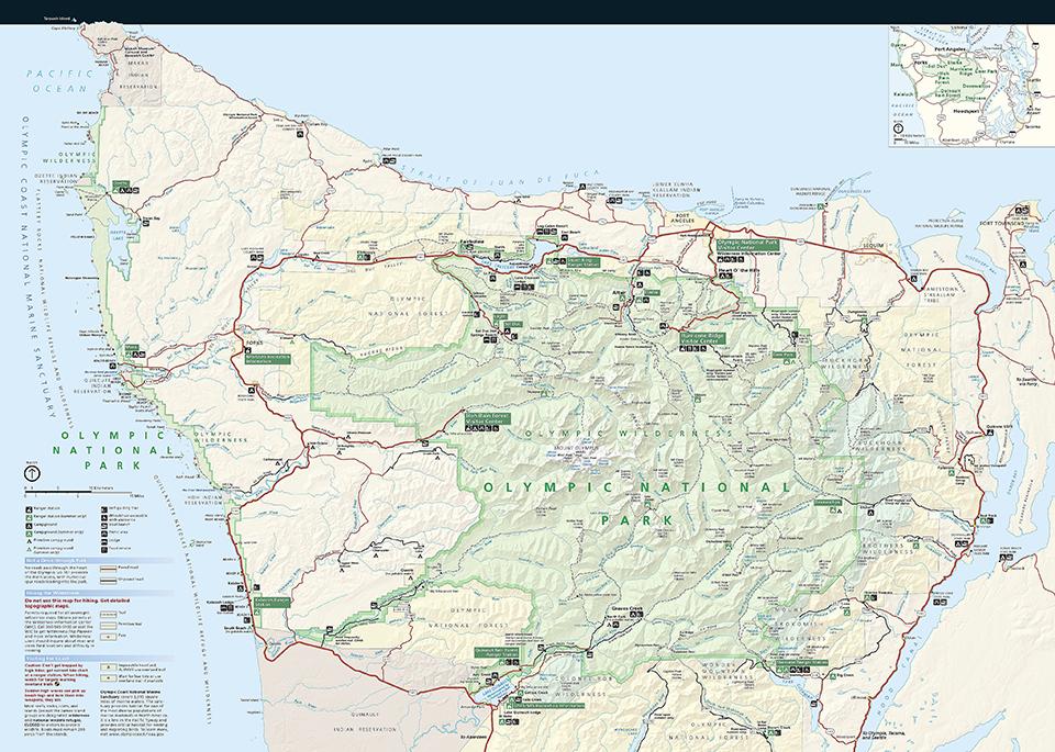
Map of Olympic National Park / National Park Service
If you are contemplating seeing everything in a single day, you might want to re-think your plans. Reaching Kalaloch Beach at the southwestern edge of the park from the Seattle-Tacoma International Airport will take you about three hours of driving. Seattle to Port Angeles, the gateway city to Hurricane Ridge and conveniently located about 21 miles east of Lake Crescent, is an almost-three-hour drive along the peninsula’s eastern side. If you really want a feel for the Olympic Peninsula and this park, then spend several days soaking it all in, or a single day visiting just one area of the park, saving the other areas for a future return visit.
- There are several brick-and-mortar lodges inside the park (Kalaloch Lodge, Lake Crescent Lodge, Log Cabin Resort, and Sol Duc Hot Springs Resort) but you’ll need to make your reservations far ahead of your trip to snag a room or cabin. Nearby lodging can be found at Lake Quinault Lodge, next door to the park’s Quinault Rain Forest, as well as in various communities around the peninsula (Forks, Port Angeles, Sequim, Port Townsend, Neah Bay, Sekiu). I spent time in one of Kalaloch Lodge’s cabins and absolutely loved it. I also stayed in a cabin at Sol Duc Hot Springs Resort and in a small room (no bathroom) within the historic Lake Crescent Lodge. Next time I stay at this particular lodge, I think I’ll reserve either a cabin or one of their separate, motel-style rooms.
- Instead of brick-and-mortar, how about camping? A large park like Olympic National Park offers quite a few campground options, some requiring reservations during certain times of the year, but most first-come, first-served, and most offering sites for RVs with some size restrictions. Click here to see maps for different areas within the park, including campground locations. Click here if you want to really get away from it all with some backcountry camping.
- Pack raingear and a jacket. The summer months of July and August are the most popular times to visit the park, and while there are more sunny days than at any other time of the year, rain is always a possibility, in addition to fog on the beach and in the forest. Spring, autumn, and especially winter mean unpredictable, sometimes dramatic weather (great for photography), with great beach sunsets (when the sun is out) and fewer people. It also means rain and possible flooding that might close down some areas in addition to the regular seasonal closures within the park. Winter travel into the high elevations of Hurricane Ridge means you might want to pack your vehicle’s tire chains as well as ice traction devices for your boots.
- There are so many places to go and things to do in this national park. Why not start with a day hike. There are many coastal, mountain, lowland and rain forest trails in the park from which to choose. Here are a few suggestions for short, must-do hikes that I did and which will introduce you to a particular area and environment of the park.
Walk along the beaches. I recommend Kalaloch Beach, Beach 4, Ruby Beach, and Rialto Beach. Not only will you experience different surface conditions (e.g. sand versus pebbles), but you’ll see different coastal features, like the “Tree of Life (aka Tree Root Cave)” on Kalaloch Beach, Kalaloch Creek streaming across the beach into the Pacific Ocean, multi-story-tall sea stacks at Ruby and Rialto beaches, and - if you love all things geological - tilted rocks at Beach 4.
It goes without saying, you should walk along the 0.8-mile Hall of Mosses trail in the Hoh Rain Forest. This trail starts at the Hoh Visitor Center and takes you along a trail through lush, moss-blanketed old-growth forest and huge maples upon a fern-carpeted landscape. You’ll see nurse logs, every shade of green you can imagine, birds like gray jays and perhaps even a barred owl, trees with roots extending above-ground and beyond the confines of their trunks, and maybe you’ll even spot the iconic banana slug. Pack rain gear with you because this is, after all, a rain forest “teeming with life around every root.”
There are two trails in the Quinault Rain Forest providing another great introduction to temperate rain forests: The very short July Creek loop trail not only has restrooms and picnic tables where you can enjoy a snack or lunch, but a very short trail that crosses a small bridge overlooking the trail’s namesake creek. Further up the road, the 0.5-mile Maple Glade loop begins near the Quinault River Ranger Station on the north end of Lake Quinault, taking you over a bridge spanning Kestner Creek and into a dripping, shadowy green and brown world of mirror-smooth swamps reflecting green moss-draped trees, ferns, nurse logs, and other plants adapted to this lush environment.
If you love waterfalls, there are two easy, lowland forest trails you should not miss: the Sol Duc Falls Trail and the Marymere Falls Trail. The Sol Duc Falls 0.8-mile trail (one way) is located at the end of the Sol Duc Road, which parallels the Sol Duc Valley. This extremely-popular trail leads you through a different, drier-but-still-lush forest environment to the iconic waterfall you’ve seen in so many photographs. If you want to photograph this waterfall yourself, minus all the people lining the bridge and view area, start your hike early in the morning to get to the bridge around 6 a.m. It’s an awesome location to practice your silky water photo technique. Word of warning: stick to the trail once you are there. I’ve seen people climb down from the viewing area and gingerly make their way along the Sol Duc River’s rocky banks to peer over the waterfall edge. A couple of area news stories in 2016 and 2019 are evidence of just how slick and easy it is to fall in and have to await a rescue by the park.
The Marymere Falls trail is a very popular 0.9-mile (one way) trail beginning at the Storm King Ranger Station. The first half mile is wheelchair accessible, but after that, the trail gets a little uneven and the steps up to the two different viewing areas in front of the waterfall are tall and steep, so maybe bring along a walking stick or ski pole to help you navigate up and down those steps.
If you find yourself up in the mountains at Hurricane Ridge, the 1.6-mile one-way “roughly-paved” Hurricane Hill trail beginning at the end of Hurricane Ridge Road offers panoramic mountain vistas all along the way to the Hurricane Hill summit. - Feel like stretching your legs on a much longer, multi-day backcountry hike? Click here for information on planning that trip.

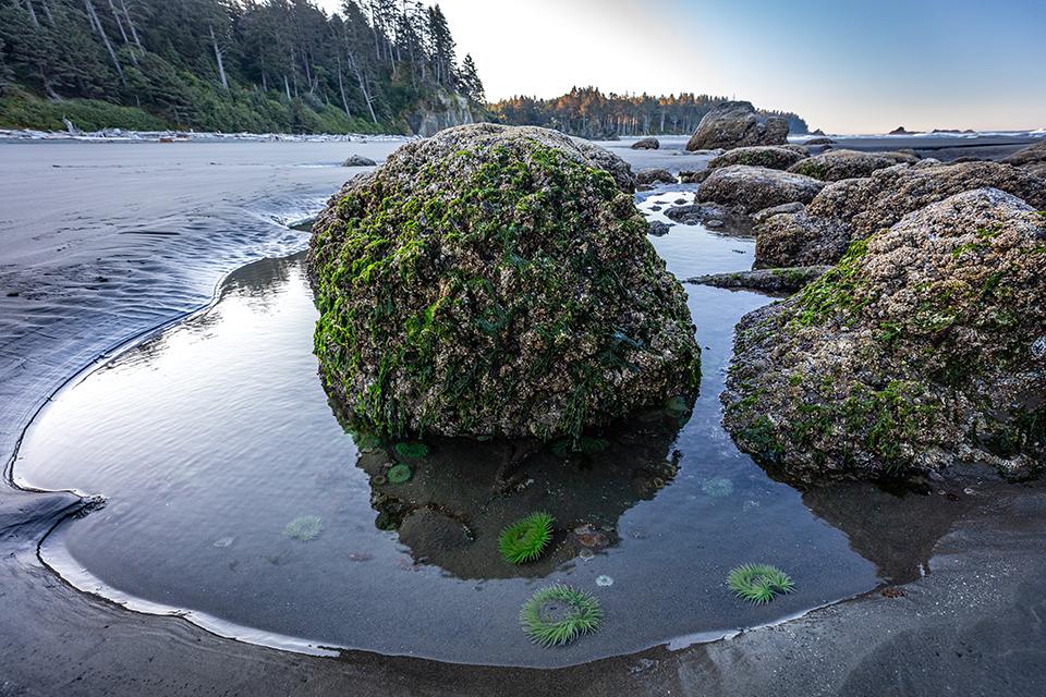
Anemones in a tidepool, Ruby Beach, Olympic National Park / Rebecca Latson
- Go beachcombing and tidepooling. During low tide, you’ll see pools of water at exposed rocky areas along the beach where you can spot sea stars, anemones, barnacles, sea urchins and maybe even a brightly-colored nudibranch (sea slug). Click here for proper tidepool etiquette, wear shoes you won’t mind getting wet (NOT flip flops, which are easy to lose to the water and add to ocean trash), and consult a tide chart so you won’t get caught by a rising tide. From personal experience, it’s a scary feeling when you think you are walking in an area of shallow water only to find yourself battling the tidal pull.
- Watch (and photograph) the sunset from the beach. Pacific sunsets are a sight to behold at any of the beaches you visit in this national park. Stay after the sun has set and capture that last little bit of afterglow before it turns dark.
- Once the sun sinks, go stargazing from the beach or in the mountains. On a clear night, you’ve got a wide-open, star-studded canvas above the beach and ocean, with sea stacks creating interesting foreground silhouettes. In the mountains, you’ll be that much closer to those twinkling dots of light, and you can even “join a Master Observer at Hurricane Ridge for an evening of astronomy and stargazing.”
- Learn about the park by taking part in a ranger-led program. During the winter, you can join a ranger-guided snowshoe walk at Hurricane Ridge.

Oystercatchers on the rocks at Kalaloch Beach, Olympic National Park / Rebecca Latson
- Pack your binoculars and/or camera and telephoto lens for some “watchable wildlife” viewing, from elk to bears, to marmots (aka “whistle pigs”) to one or more of almost 300 species of birds. You might see a blue heron readying itself for takeoff from a pond in the Hoh Rain Forest, or a flock of black oystercatchers on the exposed rocks of Kalaloch Beach during low tide, or a bald eagle perched high in a tree above Rialto Beach, observing your every move.
- Pack your rod and tacklebox and go fishing. Know before you go what the fishing regulations are within the park and where you can cast your line.
- Take your boat, kayak, canoe, or raft with you for some boating in the park’s rivers and lakes, as well as out in the ocean.
- Go climbing. Per the NPS website for this park, the rocks are shale, sandstone, and basalt. While the rock can be soft, unstable, and loose, there are good opportunities for remote alpine climbing and this link will take you to information you should know prior to setting out on a climbing route.

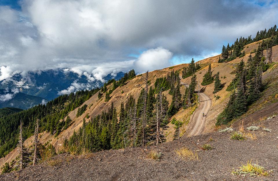
Hiking up Obstruction Point Road, Hurricane Ridge Area, Olympic National Park / Rebecca Latson
- If you’ve got a vehicle (preferably 4-wheel drive) with sturdy tires, then drive the narrow, gravel Obstruction Point Road (not recommended for trailers and motor homes). “Obstruction Point Road is Olympic National Park's highest elevation road, leading from Hurricane Ridge (5,242 feet above sea level) approximately eight miles east to Obstruction Point at 6,150 feet.” There are a few trails at the end of this road and the panoramic vistas are incredible. This road is typically open mid-July through mid-October, depending on snow and weather conditions. Check the park’s website for current conditions.
- As mentioned earlier, a winter visit to Hurricane Ridge opens up opportunities for snowshoeing and cross-country skiing. There’s also an area for downhill skiing, snowboarding, and tubing. Check Hurricane Ridge’s Twitter page for road and other winter updates.
- Before you go on your trip, remember to check the park’s website to find out if and where pets are allowed and whether or not there are any closures or restrictions due to the season, construction, weather, or Covid-19.
- As you make your trip plans, remember, the coronavirus pandemic is not over, yet. Per the National Park Service, whose parent organization is the Department of the Interior: “To protect the health of those who live, work, and visit America’s national parks, face masks are required in all NPS buildings and facilities. Masks are also required on NPS-managed lands when physical distancing cannot be maintained, including narrow or busy trails, overlooks, and historic homes.” So, travel safely, take some masks, practice social distancing and wash your hands often.

Sunset's afterglow over Ruby Beach, Olympic National Park / Rebecca Latson


Comments
Thank you for another checklist. They're great!
I have an addition to the "watchable wildlife." If I recall correctly, it was a bit north of Kalaloch Lodge where I saw sea otters surfing. As you said, bring binoculars!