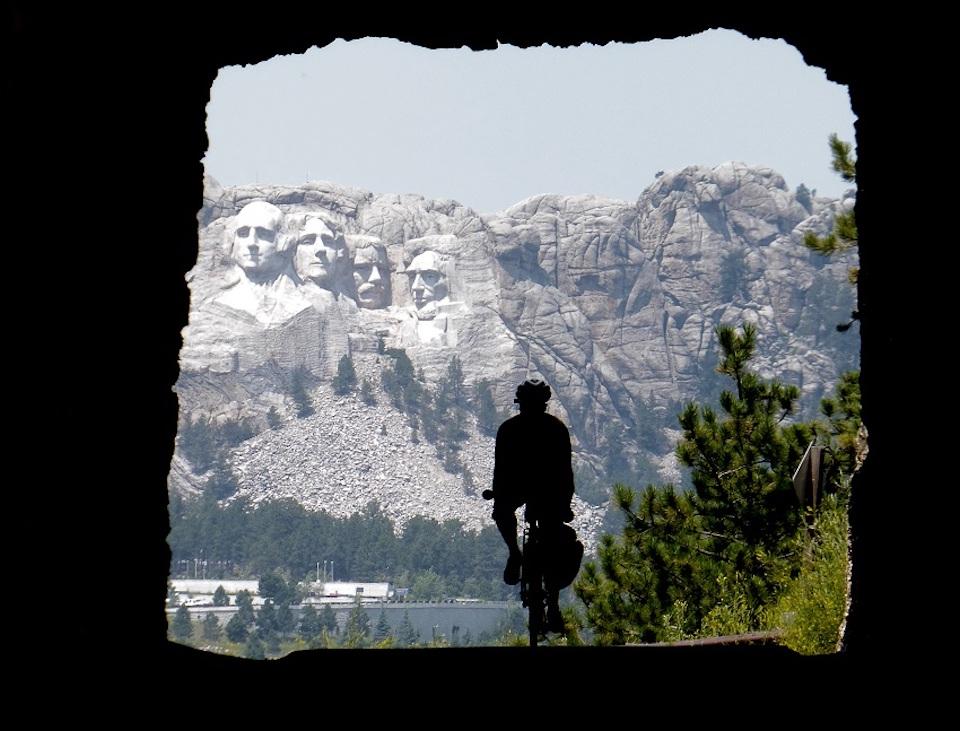
The Adventure Cycling Association has come up with a new road cycling route from Yellowstone to Minnesota that takes you through or by a nice handful of national park properties/ACA
Looking for a new road cycling adventure? There's now an Adventure Cycling Association route from Yellowstone National Park east to Minnesota (or from Minnesota to Yellowstone) that takes you pedaling past Devils Tower National Monument, Mount Rushmore National Memorial and into Badlands National Park.
The entire route runs 1,372 miles, though no doubt you could add to it with a sidetrip to Wind Cave National Park along the way.
Dubbed the Peaks and Prairies Bicycle Route, this mapped route brings Adventure Cycling's total cycling route network to 50,000 miles.
Guiding cyclists from Yellowstone National Park, through Wyoming’s plains and past Devils Tower National Monument, into the Black Hills and to Mount Rushmore, and then into Badlands National Park, the route continues on to the continent’s biggest rivers and some of the 10,000 lakes of Minnesota before finishing in bike-friendly Minneapolis.
“Our newest route takes in some of our country’s most beautiful natural wonders and national landmarks between the Rocky Mountains and the Midwest, and it brings our route network to a total of 50,000 miles,” said Director of Routes & Mapping Carla Majernik, who rode across the country in 1976 with Bikecentennial and has helmed Adventure Cycling’s Routes & Mapping department for decades. “However, we never imagined the challenges of traveling this summer as we designed it. So while 2020 might not be the ideal time to ride the full Parks, Peaks, and Prairies route, it’s a great time to tackle smaller sections if you live nearby or to plan for riding in 2021 and beyond.”
The PPP also offers a connecting option between the TransAmerica Trail and the Northern Tier bicycle routes, as well as crossing over the Lewis & Clark Trail near the new route’s midpoint.
Like all Adventure Cycling routes, the Parks, Peaks, and Prairies Route was extensively researched by volunteers and the organization’s cartography staff before being distilled into cyclist-specific maps in print and digital form. PPP is available in print and GPX data format at adventurecycling.org/store, and via the Bicycle Route Navigator app on Apple and Android stores.
50,000 Miles
Beginning with the TransAmerica Trail in 1976, Adventure Cycling Association has steadily grown its route network to crisscross the country in every direction, plus a number of loop routes in some of the continent’s most compelling landscapes.
The Adventure Cycling Route Network includes the world’s premier bikepacking route, the Great Divide Mountain Bike Route, four east-west corridors (Southern Tier, Northern Tier, TransAm, and Bicycle Route 66/Chicago to New York City), four more north-south routes (Atlantic and Pacific Coast routes, Sierra Cascades, and Underground Railroad) and loops in Arkansas, Idaho, Texas, New York, and others.
Visit Adventure Cycling’s Interactive Route Map for an overview of the network, and see adventurecycling.org/routes-and-maps for more about the organization’s history guiding cyclists on two-wheeled adventure.


Comments
The route actually ends in another National Park Site that you didn't mention! The Mississippi National River and Recreation Area is a 72-mile stretch of the Mississippi River that runs through the heart of Minneapolis and Saint Paul in Minnesota. nps.gov/miss