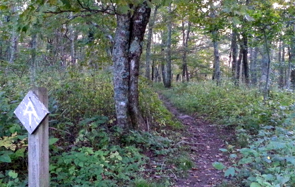
Once upon a time, deciding to thru-hike the Appalachian National Scenic Trail might have meant getting away from it all, but apparently no more.
"It seems like half the time I sat down for a break I’d have someone come over like, 'got room for one more?'” one thru-hiker wrote on Reddit after asking whether "anyone else learned that thru hiking is different from normal wilderness backpacking?"
"Specifically, all the socializing, camping in crowded spots, and just generally being in a 'club' with other thru hikers?" they added.
The number of hikers who complete the entire trail, which today measures about 2,198 miles, has grown from just five during the 1940s (no doubt, World War II likely played a role in holding down the number), to 996 last year, which actually is down from recent years, according to the Appalachian Trail Conservancy (ATC). In 2020, for example, 1,440 hikers claimed to have completed the entire walk.
Those are small numbers for those who step onto the trail and actually make it end to end, as each year more than 3 million folks walk some part of the trail, although even that number might be low, said Morgan Sommerville, the Conservancy's director of visitor use management.
"We currently estimate 3 to 4 million people a year. I think that's a low number, and we're working on figuring that out," said Sommerville while recording this week's podcast from the National Parks Traveler.
Thru, Section, Or Flip-Flop?
Most of those who take to the A.T., as it's known, are out for day hikes or short backpacking trips.
"There're several thousand a year who attempt a thru-hike," Sommerville said. "I don't know what percentage that is of 3 or 4 million. A few percent?"
In deciding where to locate new campsites, ATC has been working with recreation ecologists to identify areas that will be least impacted.
"The new sites we're selecting are built into the side of the hill, in cut-and-fill spots, or on tent platforms," he said. "So when a camper shows up at the campsite, the only good place to pitch their tent is on one of the sites that's been picked, and those are designed to accommodate a reasonable load, camper capacity, and so there's almost no user-created expansion of those sites.
"That's what we're shooting for. We're in the process of doing a comprehensive campsite inventory of the whole A.T., and I think we'll finish this year. And then we will have a benchmark at the end of the first century [of the A.T] of the total camping impact area along the A.T. and we'll be able to gauge as we go forward how much progress we're making with our sustainable overnight site program."
Back on the Reddit discussion, talk turned to avoiding crowds by deciding to go southbound on the A.T.
"Having done all 3 (A.T., Pacific Crest, and Continental Divide) trails SOBO, it's quite wonderful once you get around the bubbles of unwashed, noro-spreading nobos," wrote one. "No competition for hostel space or tent sites, though hardly any 'trail magic' either."
But there can be other issues for south-bounders.
"I went SOBO, and after passing through the NOBO [north-bound] bubble I got pretty lonely. Especially after the clocks fell back in November and it was dark by 5 p.m.," they wrote.
"I hit [Great Smoky Mountains National Park] at a terrible time, beard was frozen solid for days and it was absolutely beautiful with nobody there," added another. "Night time genuinely sucked, after I stopped moving for the day I had about 10 minutes to set up in the shelters and cook before my hands lost all feeling, but the hike itself was incredible."
And not all succeed.
Since 1936, more than 20,000 end-to-end hikes have been recorded by ATC. This includes thru-hikes, section hikes that can occur over a number of years, and "flip-flop" hikes, those in which the backpacker might start at Harpers Ferry, where ATC is based, and head north to Mount Katahdin, the northern terminus of the trail in Baxter State Park in Maine, and then travel back to Harpers Ferry to set off hiking south to Springer Mountain in Georgia, the southern terminus.
Most thru-hikers — about 70 percent, according to the Sommerville — head north from Springer Mountain in the spring with a goal of reaching Mount Kathadin by early fall. The remaining 30 percent are split between south bounders (SOBO) or flip-floppers.
"There's lots of ways of doing it," he said. "Some people set out on a thru-hike and decide very quickly that it's not what they were looking for and get off the trail. Often just within the first 30 miles. And then there are those who might go a very, very long distance, like myself. I did most of a thru-hike in 1977, did about all but 300 miles of the trail for a variety of reasons, and then it took me until 2000 to finish it off. "

It's quite a disparity of numbers, those who complete the entire trail in an extended hike and those just out for their daily exercise. And some of the thru-hikers have noticed that, according to the Reddit posts.
"It’s everyone’s public land to use how they like," the initial poster said, "but damn, every other time I’ve gone backpacking there’s an unspoken rule of 'everyone gets as much space and solitude as possible.' On the A.T. it’s as if people see the hang tag and think, 'Oh, hey, a buddy.'"
Another hiker agreed with that observation.
"I've been planning (well, fine, dreaming about) my own solo thru, and while I knew there was a social aspect to it, I don't think I understood that it was a constant kind of thing," that hiker said. "I'm not an introvert, and I'm perfectly good at being friendly when I want to be, but I really, REALLY, need my alone time/personal space and would probably get pretty grumpy if I had to face every day like it was a big scene that demanded my attention and participation just because of proximity."
Sommerville said the Conservancy is aware of the crowding that can arise along certain sections of the trail.
"The long-term policy of the ATC and our agency partners is to, at a minimum, provide as natural-appearing environment as possible," he said. "There's no good definition for this, but a primitive experience, if you will. It is what you make of it. ... The crowding is important in changing the experience. There's no question about that. And so we have been working for as long as I've worked at ATC, since 1983, we have worked to try and figure out how best to preserve the primitive experience of the A.T. What we can do to try and make people more aware of spreading out."
Cogs In The Machine
It is a challenging task, not just because the ATC can't specifically tell day hikers and thru-hikers how to hike, but also because the Conservancy is just one cog in the machinery that oversees the A.T. There is, of course, the National Park Service, which gained the trail as a National Scenic Trail in 1968 under the National Trails System Act, and ATC, but also 30 separate trail clubs that work to maintain sections of the foot path and state governments that might control some forests that the trail passes through, such as Worthington State Forest in New Jersey, which holds only about 7 miles of the famous trail.
"We can't tell them what to do, and by God, if we did, they'd resign," Sommerville said. "And so it's a complicated political system we have. It's a wonderful system, the partnership between the local A.T. clubs, our agency partners, which are very diverse."
That diversity, he pointed out, brings complexity to the task of maintaining 2,200 miles of foot path that climbs and falls with the Appalachians.
"It's pretty amazing stuff, but hardly anybody knows about it," he said. "I just wish that people would at least try to get a grip on how it works and understand how complicated it is, and that it's a very democratic system. We work pretty much by consensus on doing stuff along the trail. The other thing people don't realize, I guess, is that the A.T. comprehensive plan, each national forest plan, each national park general management plan, every state forest, every state park has a plan, some part of which deals with A.T. management. We have things we have to do to manage the A.T. and a lot of people don't realize that. If we did everything that A.T. campers and hikers wanted us to do, we would not be doing what we're mandated to do, and we're mandated to keep the trail as simple, as natural, as primitive as possible."
Part of that mandate involves addressing areas around trail shelters and other generally accepted camping spots that have suffered from overuse. That work, while reducing hiker impacts, can also reduce hiker congestion.
The ATC, working with its partners, has been focusing on "places where there are too many people in one place at one time, and that number of people is causing either natural or cultural resource damages or experiential social damages that defeat the purpose of what we're trying to do with the A.T., said Sommerville.
One effort to disperse trail crowds, he said, has been the "ATCamp.org" site the Conservancy created to help trail users predict where they might encounter crowds of hikers so they can avoid them. The site is a voluntary registration system — not a campsite reservation system — by which hikers can study "charts and calendars [that] show numbers of other campers registered for a thru-hiker start date and for designated overnight sites. If a start date or overnight site is full, you can use ATCamp to select a less crowded start date or location."
"Prior to [ATCamp], there was no way for people to know how many other people might be starting on a given day at Springer," explained Sommerville. "There were days when there were over 100 people trying to start. And the facilities north of there, the campsites and the A.T. shelters, didn't have that capacity. They had a capacity that's more like 50 people per day for the first 30 miles or so. And so everything was getting overrun."
The Conservancy also works with its partners to reduce campsite crowds by creating additional camping areas where possible. Eight miles north of Springer Mountain at Hawk Mountain, said Sommerville, that approach shrank an area that had expanded to nearly 4 acres to less than an acre. Similar success has been measured at Annapolis Rock in Maryland, he said.

In deciding where to locate new campsites, ATC has been working with recreation ecologists to identify areas that will be least impacted.
"The new sites we're selecting are built into the side of the hill, in cut-and-fill spots, or on tent platforms," he said. "So when a camper shows up at the campsite, the only good place to pitch their tent is on one of the sites that's been picked, and those are designed to accommodate a reasonable load, camper capacity, and so there's almost no user-created expansion of those sites.
"That's what we're shooting for. We're in the process of doing a comprehensive campsite inventory of the whole A.T., and I think we'll finish this year. And then we will have a benchmark at the end of the first century [of the A.T] of the total camping impact area along the A.T. and we'll be able to gauge as we go forward how much progress we're making with our sustainable overnight site program."
Back on the Reddit discussion, talk turned to avoiding crowds by deciding to go southbound on the A.T.
"Having done all 3 (A.T., Pacific Crest, and Continental Divide) trails SOBO, it's quite wonderful once you get around the bubbles of unwashed, noro-spreading nobos," wrote one. "No competition for hostel space or tent sites, though hardly any 'trail magic' either."
But there can be other issues for south-bounders.
"I went SOBO, and after passing through the NOBO [north-bound] bubble I got pretty lonely. Especially after the clocks fell back in November and it was dark by 5 p.m.," they wrote.
"I hit [Great Smoky Mountains National Park] at a terrible time, beard was frozen solid for days and it was absolutely beautiful with nobody there," added another. "Night time genuinely sucked, after I stopped moving for the day I had about 10 minutes to set up in the shelters and cook before my hands lost all feeling, but the hike itself was incredible."
Listen to the entire conversation with Morgan Sommerville of the Appalachian Trail Conservancy on National Parks Traveler Episode 332.
Stories about:
Story Categories:
A copy of National Parks Traveler's financial statements may be obtained by sending a stamped, self-addressed envelope to: National Parks Traveler, P.O. Box 980452, Park City, Utah 84098. National Parks Traveler was formed in the state of Utah for the purpose of informing and educating about national parks and protected areas.
Residents of the following states may obtain a copy of our financial and additional information as stated below:
- Florida: A COPY OF THE OFFICIAL REGISTRATION AND FINANCIAL INFORMATION FOR NATIONAL PARKS TRAVELER, (REGISTRATION NO. CH 51659), MAY BE OBTAINED FROM THE DIVISION OF CONSUMER SERVICES BY CALLING 800-435-7352 OR VISITING THEIR WEBSITE. REGISTRATION DOES NOT IMPLY ENDORSEMENT, APPROVAL, OR RECOMMENDATION BY THE STATE.
- Georgia: A full and fair description of the programs and financial statement summary of National Parks Traveler is available upon request at the office and phone number indicated above.
- Maryland: Documents and information submitted under the Maryland Solicitations Act are also available, for the cost of postage and copies, from the Secretary of State, State House, Annapolis, MD 21401 (410-974-5534).
- North Carolina: Financial information about this organization and a copy of its license are available from the State Solicitation Licensing Branch at 888-830-4989 or 919-807-2214. The license is not an endorsement by the State.
- Pennsylvania: The official registration and financial information of National Parks Traveler may be obtained from the Pennsylvania Department of State by calling 800-732-0999. Registration does not imply endorsement.
- Virginia: Financial statements are available from the Virginia Department of Agriculture and Consumer Services, 102 Governor Street, Richmond, Virginia 23219.
- Washington: National Parks Traveler is registered with Washington State’s Charities Program as required by law and additional information is available by calling 800-332-4483 or visiting www.sos.wa.gov/charities, or on file at Charities Division, Office of the Secretary of State, State of Washington, Olympia, WA 98504.
INN Member

The easiest way to explore RV-friendly National Park campgrounds.

Here’s the definitive guide to National Park System campgrounds where RVers can park their rigs.
Our app is packed with RVing- specific details on more than 250 campgrounds in more than 70 national parks.
You’ll also find stories about RVing in the parks, tips helpful if you’ve just recently become an RVer, and useful planning suggestions.
