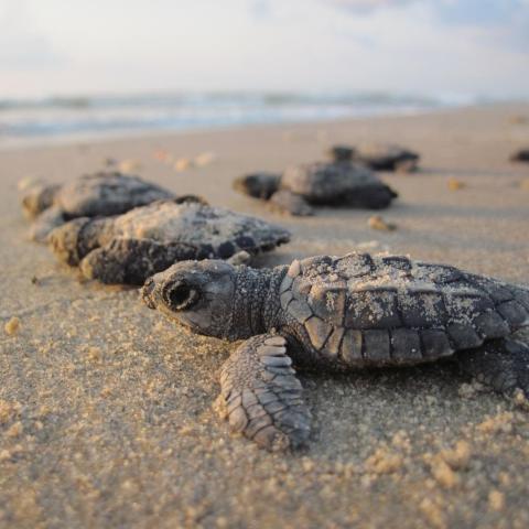
Though Hurricane Beryl isn't expected to reach the Gulf Coast of Texas until Sunday, crews were working at Padre Island National Seashore to prepare for the storm/National Hurricane Center
Editor's note: This updates with Padre Island National Seashore warning visitors this week to be prepared to leave.
Though Hurricane Beryl was roughly 1,200 nautical miles from Padre Island National Seashore on the Gulf Coast of Texas on Tuesday, crews already were out on the barrier island's beaches searching for Kemp's ridley sea turtle nests.
"Actively looking at Hurricane Beryl, it's looking like it may have some significant impacts on Padre Island National Seashore," James Purcell, the National Park Service's acting-National Search and Rescue and Emergency Management Services director, said Tuesday. "Padre Island is one of the largest nesting sites for the Kemp's ridley turtle. And so as of today, teams are actively out, going up and down the beach and GPS-marking every single sea turtle site, so that we can come in after the storm and make sure that they are still there and see what we can do to make sure if we need to recover any of the egg nesting sites that we can do that."
At the same time, however, Purcell was monitoring a wildfire that closed the north entrance to Denali National Park, and staying apprised of any other developing situations that might turn into a disaster and ensuring the Park Service was prepared to respond. Key to the job, he explained during a phone call, was being prepared in advance to protect infrastructure — including historic structures — and dispatch teams when necessary to help local park staff where needed.
Across the country the Park Service has three "all-hazard incident management teams" that can be summoned on 48 hours' notice to respond to a park to help with cleanup. The agency also has specially trained "AIR" tree crews that prune damaged trees. Skilled in rope work, these crews can rappel down from the treetops to prune branches.
Managing this system-wide preparation and response system would seem to be a daunting job as climate change is spawning more potent hurricanes — some that can send stormy weather far inland, as was the case with Hurricane Hilary whose remnants decimated Death Valley National Park's road system last year — more explosive wildfires, and hurricane-force winds that can raze forests.

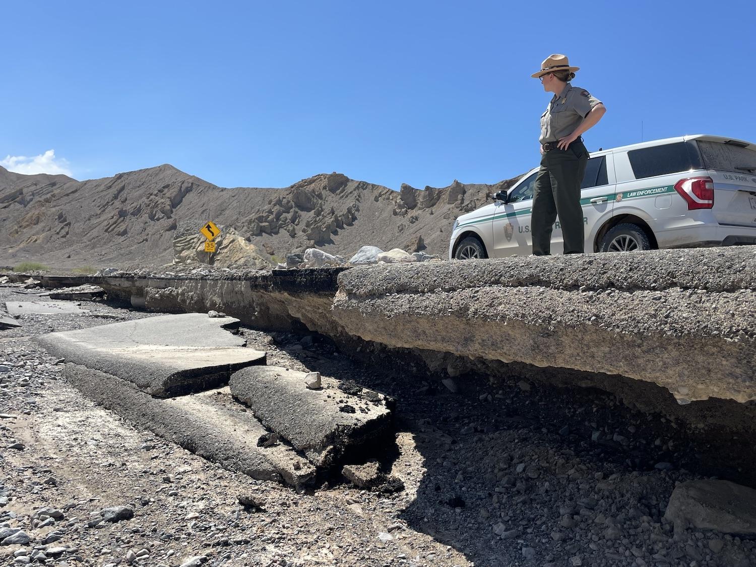
Remnants from Hurricane Hilary damaged some 400 miles of roads in Death Valley last August/NPS
The task this summer appears particularly challenging due to the national hurricane forecast, which calls for an above-normal number of hurricanes, with possibly 25 “named” storms, seven of which could blossom into major storms carrying winds above 111 mph.
"We are very aware of climate change and sea level rise, and very specifically, hurricanes," said Purcell, who has been with the Park Service for about 20 years, much spent dealing with visitor resource protection. "During that visitor resource protection time, I really got to focus on how to manage incidents. And what I was able to discover was that being prepared was really key. Making sure that our employees were prepared, that we had the right equipment, and the right training to prepare for whatever that whatever the emergency was."
Being prepared might involve reinforcing walls at Fort Jefferson at Dry Tortugas National Park south of the Florida Keys so they can withstand hurricane-force winds, and even monitoring corals there.
"Something as simple as just taking photos of coral and looking at those coral reefs, and then to come in afterward and be able to say this is what was specifically impacted by the storm," he said. " And then here are the resources that we need to go in and bring it back to its original state."
Elsewhere, the Park Service has installed pumping systems at Fort Pulaski National Monument, which sits basically at sea level in Georgia and often floods when hurricanes or tropical storms pass by, to cope with structural flooding, and has staged trucks at Great Smoky Mountains National Park in North Carolina to be ready to respond to events at Cape Hatteras National Seashore on the Outer Banks to help, for example, with cleanup of houses that are pulled down into the Atlantic Ocean.
"We have dump truck crews and bulldozer crews actively staged [at Great Smoky] now. That way, if a storm does hit, then it doesn't hit our equipment. Then as soon as the storm passes, we can then deploy all of that equipment from the Smokies directly over into Cape Hatteras," said Purcell.
The storms produced through climate change have led to a new response paradigm for the Park Service, he said, pointing to Hurricane Hilary's impact on Death Valley last August. That storm dropped more rain on the park on August 20 — 2.20 inches — than Death Valley typically receives in an entire year.
"Major flooding damaged or destroyed about 400 miles of roads in Death Valley National Park, resulting in an eight-week closure that was the longest in the park’s history," the National Hurricane Center reported in reviewing the hurricane. "Residual floodwaters formed temporary lakes in Death Valley that persisted for months after the storm."
The extensive damage was the result of engineers not anticipating hurricane-like storms reaching Death Valley, which is roughly 360 miles inland from where Hilary came ashore at Baja California.
"Now we're having to adapt our strategies and our procedures to make sure that even an inland park such as Death Valley is ready for those new environmental changes," said Purcell.
Part of that preparation involves providing the best information to park visitors. Beyond handing out park maps and telling visitors where the nearest restroom is, rangers are urging them to stay on top of weather forecasts and to follow any safety information rangers relay, said Park Service spokesperson Cynthia Hernandez.

Storm damage to the road leading to the Fort Pickens Campground at Gulf Islands National Seashore can strand campers/NPS file
"We're trying to arm our visitors with more more tools and more knowledge so that they can make these good decisions on on their own," she said.
That practice comes into play more times than one might think at Gulf Islands National Seashore along the coast of Florida.
"Fort Pickens campsite is extremely popular. Sometimes it's booked out two years in advance," said Purcell.
From time to time, though, high tides will washout the access road.
"And then all those campers, a couple hundred people, will then literally be stranded," he said. "We've implemented a new policy of arming the campers with the knowledge that they potentially will be stranded. [Park staff tell campers to] ensure that you have the right things. And then we have boats that will come and get them if need be. But they know exactly that this is not actually an emergency, that we're working on everything we can and that they can get help if necessary. So just one good success story. And it's been very effective at that specific spot."
One key to overseeing potential threats to the park system is an agency meteorologist whom Purcell stays in contact with to understand the possible scenarios involving hurricanes and wildfires. In the case of Hurricane Beryl, it is expected to deliver a glancing blow to Padre Island beginning Sunday that will lead to some flooding, said Purcell. Whether visitors need to evacuate the seashore is something that will be decided a couple days before the storm's arrival, he said.
"Usually it's 48 hours before they make that decision," he said. "But as of today, they're actively filling sandbags, they pulled out all of their hurricane shutters. They're working on making sure that everything is secure as possible."
At Padre Island, staff posted a message on the park website alerting holiday weekend visitors to "come prepared! Have a way to listen to updated weather forecasts, carry extra food, water, and fuel, and be prepared to pack up and leave the park at a moment’s notice."
It's a practice likely to be repeated many times in many parks across the park system, from Cape Hatteras National Seashore in North Carolina to Point Reyes National Seashore in California and from Denali National Park in Alaska to Everglades National Park in Florida.
"These new challenges are definitely here," Purcell said. "The Park Service has really observed this and put time and effort and personnel into trying to make sure that we are prepared for whatever comes next."


 Support Essential Coverage of Essential Places


