
The trail through the Wheeler Peak bristlecone grove, Great Basin National Park / Rebecca Latson
There are living things on this planet that defy the passage of time, surviving harsh winters, drought-dry summers, an altering climate, and less-than-pristine air. These hardy, long-suffering lifeforms twist and turn, becoming gnarly and even stunted as they reach for the sky at upper elevations. Great Basin National Park in Nevada is a sanctuary to these ancient lifeforms thousands of years old. They are the bristlecone pine trees and there’s a trail that you can hike up and pay your respects to the elders.
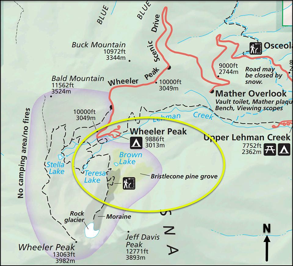
Park map close-up of the Bristlecone Grove Trail, Great Basin National Park / National Park Service
A must-do hike on my trails bucket list, Bristlecone Grove Trail, was the main reason I wanted to visit this national park located within rugged, isolated basin-and-range landscape along the border between Nevada and Utah. Less than three miles roundtrip, this trail is the shortest and most easily-accessible to the bristlecones. While not lengthy, it is uneven and rocky. In addition to the rocks, the first mile of the trail (more or less) is crisscrossed with above-ground tree root systems just waiting to trip or twist an unwary hiker’s ankle. Navigating this trail means you should wear sturdy shoes and watch your step. Nothing ruins a great day in the park faster than an injured foot, ankle, or leg.

Starting the hike to the bristlecone grove, Great Basin National Park / Rebecca Latson
The trailhead commences near the parking lot at the very end of Wheeler Peak Scenic Drive. It’s a popular spot since most of Great Basin’s trailheads begin here or nearby. Arrive early (by 6 a.m.) or much later (4 p.m. – 6 p.m.) to snag a parking space. This national park is not as crowded as Yosemite or Mount Rainier during the summer, but what crowds there are will rapidly fill available parking, leading to jam-packed vehicle lines parked along the narrow-to-non-existent road shoulders on either side of the road.
Bristlecones in Great Basin thrive at high elevations, growing under harsh conditions where other vegetation cannot survive. The high elevations mean the trail to the Wheeler Peak bristlecone grove is all uphill, but it's not too steep. Along the way, there’s an opportunity for a .2-mile side trip to Teresa Lake (which was more like Teresa “Pond” during my late summer visit).
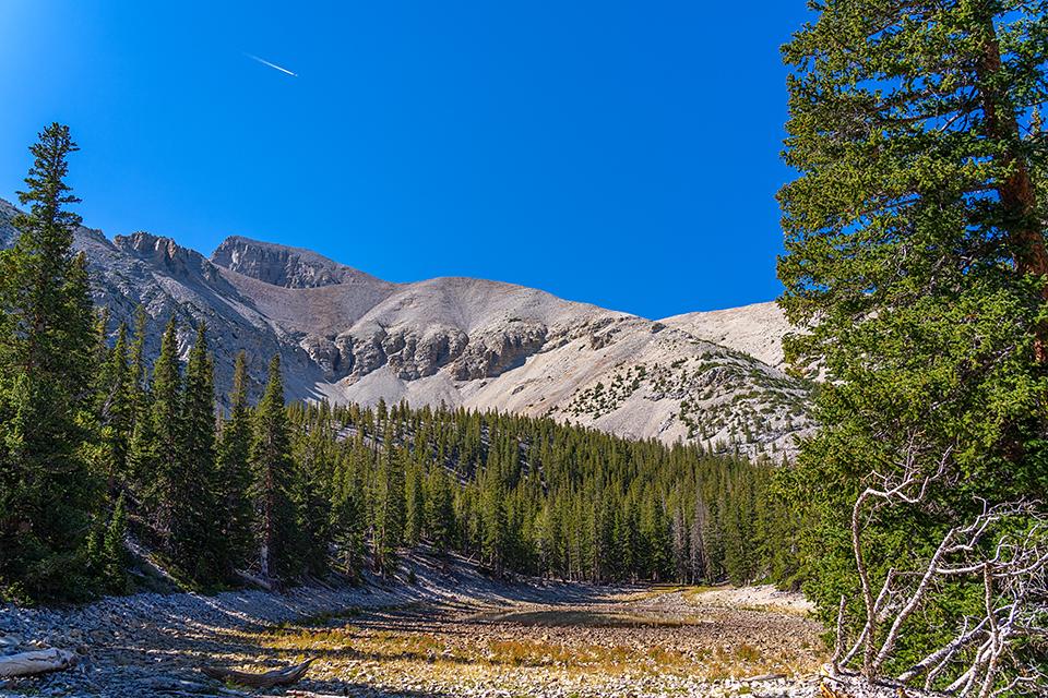
A short side hike to Teresa Lake, mostly dried up during late summertime, Great Basin National Park / Rebecca Latson
As you hike up that last quarter-mile to the grove, turn around and gaze at the amazing vista behind you, then look up the trail and see how well you can identify the bristlecone trees starting to pop up in places.
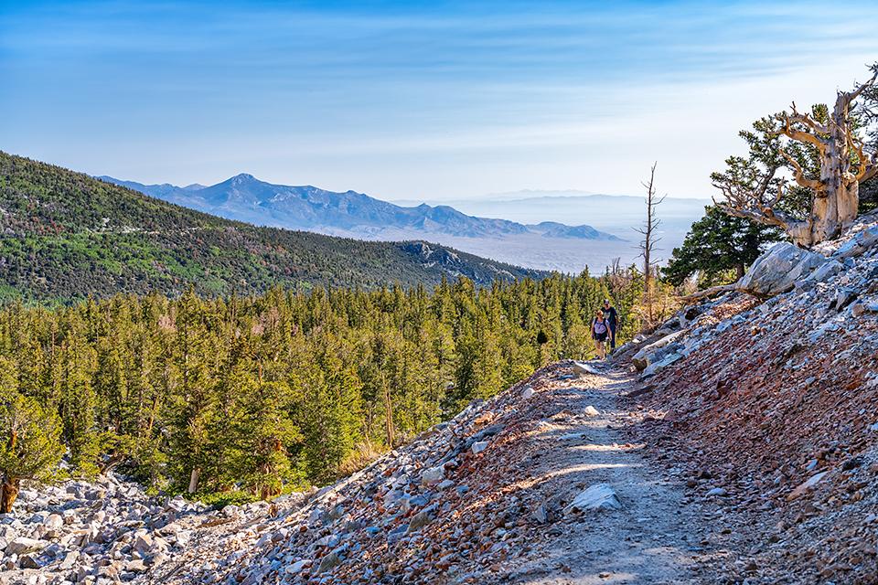
The amazing view from the Bristlecone Grove Trail, Great Basin National Park / Rebecca Latson
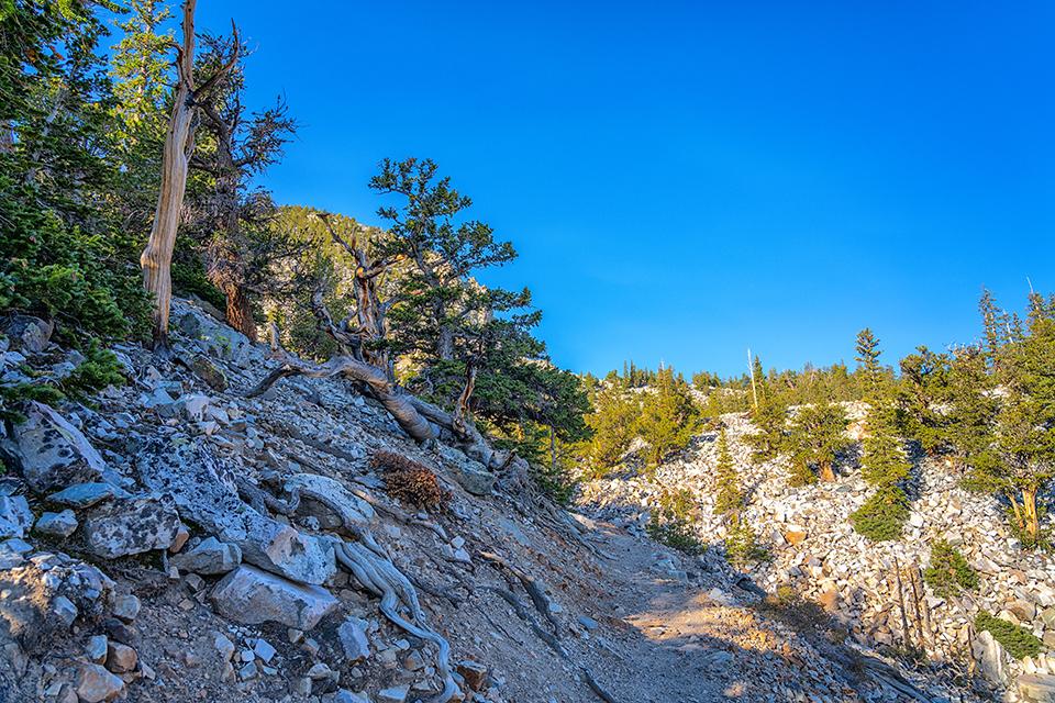
Can you pick out the bristlecone pines? Great Basin National Park / Rebecca Latson
That should be easy, right? Just look for a really twisted, gnarly-looking tree. Whoa there. Did you know limber pines grow closely to bristlecone pines up there? As such, they experience and withstand the same harsh conditions as bristlecones, becoming just as twisted and contorted. So, how do you tell them apart? Look at the needles. Bristlecone needles really do look like bristles or bottle brushes and they extend a foot or more along the branch. Limber pine needles clump together at the end of the branch and look like little green tufts.

The needle arrangement of a limber pine vs. a bristlecone pine, Great Basin National Park / Rebecca Latson
Once you arrive at the bristlecone grove, take the short nature loop trail around and between the trees. Informational plaques tell you such things as ages of specific trees, how to tell bristlecones from limber pines, and a whole host of other information you can take back with you to impress friends, family, and co-workers.
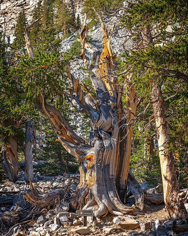
3,200 years old and still around, Great Basin National Park / Rebecca Latson
Once you’ve wandered the loop, why not have a snack and decide if you wish to continue along the trail (now called Glacier Trail at this point) a mile further up to the foot of Wheeler Cirque Rock Glacier, “a lobe of angular boulders and cobbles that resembles an alpine glacier in outline and in its slow downslope movement. They are found in mountain ranges throughout the world. Inside a rock glacier, ice fills the spaces between the blocks. By freezing, thawing, and sagging, the ice works with gravity to provide the force that moves the rock glacier,” according to the National Park Service.
If you opt out of that final 2-mile roundtrip hike to the rock glacier, you can also view it from the Wheeler Peak Overlook on the way back down the Wheeler Peak Scenic Drive while thinking about your next hiking adventure at Great Basin. Hmmm. Perhaps a hike along Stella Lake Trail?
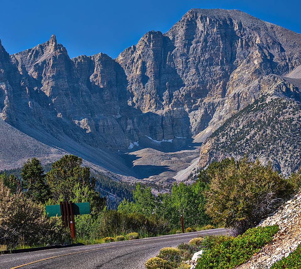
A view of the Wheeler Cirque Rock Glacier from Wheeler Peak Overlook, Great Basin National Park / Rebecca Latson


 Support Essential Coverage of Essential Places


