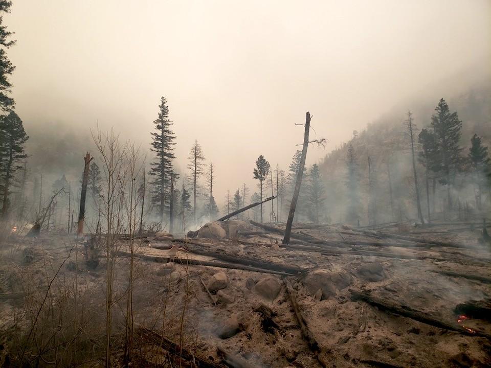
The national park landscape at the confluence of the Spruce and Forest canyons was ignited by embers that were blown roughly 1.5 miles from the East Troublesome Fire/NPS
Flames and far-flying embers from the East Troublesome Fire have spread across Rocky Mountain National Park in Colorado, forcing the evacuation of Grand Lake on the west side of the park and prompting officials to ask visitors to leave Estes Park on the eastern side. The entire park remained closed, as well.
While a cold front, possibly bringing snow by the end of the weekend, was to pass through the region Friday, the winds the front was packing could create problems for firefighters, with gusts to 40 mph or greater.
"Very windy conditions and low relative humidities are expected to continue throughout the day today and a red flag warning will be in effect until 6 p.m.," the fire briefing stated. "A cold front is expected to pass mid-afternoon, which will bring a shift in the wind direction to the west, northwest. Extreme fire behavior is expected on the East Troublesome Fire again today."
"Due to rapidly evolving fire conditions, the Town of Estes Park is requesting visitors leave the community as we monitor rapidly evolving circumstances from the #EastTroublesomeFire to the west. Highways 34, 36 to 66, and 7 to 72 are open. Please watch official fire information sources for updates. Ensure you are signed up for real-time emergency alerts at nocoalerts.org. For #cameronpeakfire updates text LCEVAC to 888-777. For #easttroublesomefire updates, text TFIRE to 888-777."

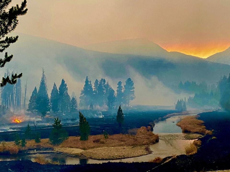
Flames and smoke had crossed through the Kawuneechee Valley on the western side of Rocky Mountain near the Coyote trailhead in the park/NPS
On Wednesday, the fire ran approximately 18 miles before it moved into the west side of Rocky Mountain National Park, where rapid evacuations began for the Grand Lake community and park staff. "There appears to be some structure loss on the west side of the park, but initial assessment indicates that it is minimal. At this time, we are unable to fully assess those impacts," park spokeswoman Kyle Patterson said Friday in an email.
On Thursday, embers from the East Troublesome Fire spotted approximately 1.5 miles from the head of Tonahutu Creek to the head of Spruce Creek in the national park. Park fire lookouts from near the Ute Trail along Trail Ridge Road "were able to confirm a smoke column out of Spruce Creek," said Patterson. "Due to the location of the fire in the lower Spruce Creek drainage and confluence of Forest Canyon, evacuations began for areas of Estes Park. Humidity levels yesterday greatly assisted in stopping the fire growth and it appears it has remained in that general location. It is in the same general area as the Fern Lake Fire of 2012."
"On the west side of the park, resources were focused on continual life and safety priorities and ongoing evacuations from the night before. Numerous trees were down on the west side of Trail Ridge Road, north of the Green Mountain Trailhead, blocking that area as a means to evacuate on Wednesday night," she continued. "Weather conditions on the west of the Continental Divide were very different than the east side yesterday, with low humidity and winds continuing to add to the fire growth. As of (Thursday) night, the East Troublesome Fire had moved north of the Coyote Valley Trailhead.

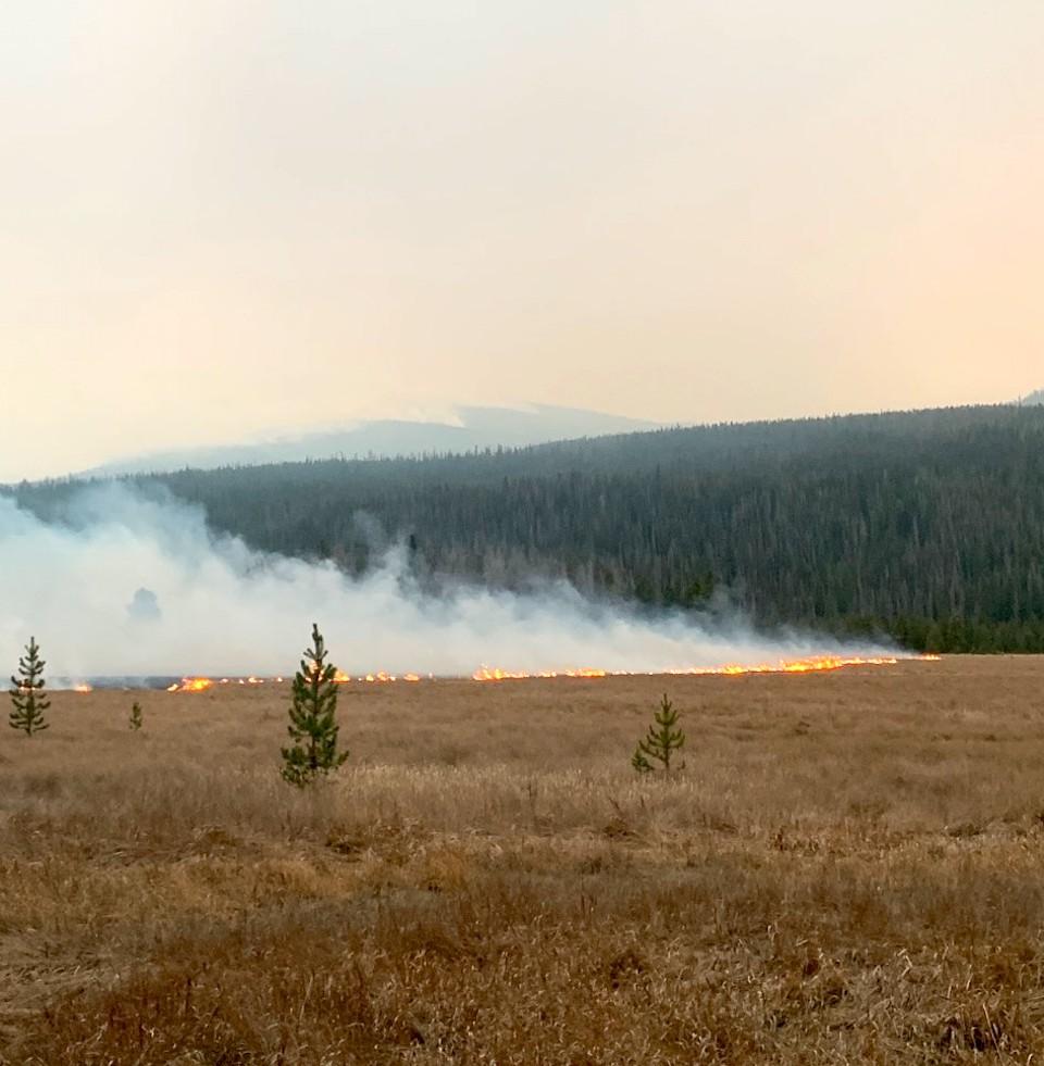
Flames crawled across the meadows of the Kawuneechee Valley near the Coyote trailhead/NPS
By Friday morning the fire was estimated to cover 170,163 acres, with containment along just 5 percent of the footprint. More than 400 firefighters were trying to slow the flames that were burning through grass, sage, and lodgepole pine. The windy forecast generated concerns as to whether the fire could be fought from the skies.
"Today will be another very active fire day with windy conditions making the use of aviation a challenge," said Incident Commander Noel Livingston.


Add comment