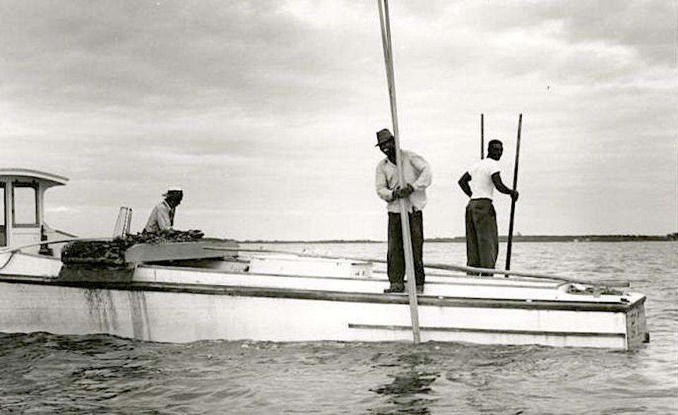
A collaboration is underway to track the history of Blacks in the Chesapeake Bay watershed.
History resides in the Chesapeake Bay watershed that hasn't fully been documented. Black history, specifically. But now a partnership of organizations, including the National Park Service, will work to map and identify sites and landscapes in the watershed region significant to African American history and culture.
The project will map African American cultural sites in an effort to support their conservation and to enable the states of Maryland, Virginia, and Pennsylvania and their localities to fully consider these sites in their land-use and development plans. Joining those states and the National Park Service in this endeavor are the National Trust for Historic Preservation, and the Chesapeake Conservation Partnership.
“The Chesapeake Bay watershed has long been the focus of one of the most significant and effective conservation efforts in the nation. While 18 million people live here, there are important sites and stories that have not received equal attention and need to be elevated and remembered," said Wendy O’Sullivan, superintendent of National Park Service Chesapeake Bay. "This partnership to document African American sites and landscapes is crucial to ensuring these places are honored and reflected in the Chesapeake and American stories.”
The National Park Service’s Chesapeake Bay Gateways Network has provided the initial funding for the project, a $200,000 award to the National Trust for Historic Preservation. Additional support, bringing the total project value to $400,000, will be provided by Maryland state funds from the Maryland Heritage Areas Authority, by the Virginia Department of Historic Resources, by the Pennsylvania Department of Conservation and Natural Resources’ Community Conservation Partnerships Program and the Pennsylvania Historical and Museum Commission, and by the National Trust’s African American Cultural Heritage Action Fund.
The goal is for this project to lay the groundwork for future mapping efforts for African American historic resources by assessing the effectiveness of different project methodologies. This multi-state partnership will undertake unique pilot projects in each of the three states to identify sites and landscapes of relevance to African American history and culture, gathering baseline GIS data on these historic places.
Once collected, this data will be publicly available through state-level and Chesapeake Conservation Partnership Cultural Resource Information Systems to inform land use and planning decisions. The project will also be guided by an advisory committee of professionals dedicated to preserving African American history.
“Mapping African American historic places within the Chesapeake watershed is a critical first step in making sure that these places are protected and that their stories are told," said Katherine Malone-France, the chief preservation officer of the National Trust. "We look forward to identifying the places that are deeply meaningful to both their communities and our shared national heritage.”
As home to some of America’s first colonies, the Chesapeake Bay watershed region is already known to have a significant meaning to African American culture. Many major tobacco plantations were located there, as were many stops on the Underground Railroad. It was the place where Harriet Tubman and both Frederick Douglass and his first wife were enslaved. It includes many battlegrounds of the Civil War, as well as places of notable activism in the 1960s Civil Rights Movement. Generations of Black Americans have made their living from the waters of the Bay and have also used special places along the Bay and throughout the region for recreation.
“The role of the African American watermen in the development of the fisheries of the Chesapeake Bay, from oystering and crabbing to processing and boatbuilding, cannot be overstated," said Julie V. Langan, director of the Virginia Department of Historic resources. "As many of the places associated with this legacy vanish from the landscape, the Virginia Department of Historic Resources welcomes the opportunity to document this important aspect of our region’s past.”
Historic sites and landscapes important to people of color are widely underrepresented in documentation and conservation priorities. This work will take one small step towards addressing that deficit.


Add comment