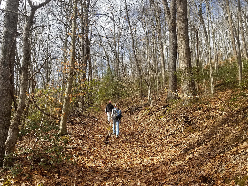
New River Gorge National Park and Preserve offers over 40 different hiking trails ranging from a half mile to 17 miles (0.8 – 27.4 kilometers) roundtrip. Difficulty levels run the gamut from easy to strenuous. Some trails lead to outstanding overlooks of New River and the New River Gorge Bridge; others will take you to various waterfalls. For those interested in history, some trails will guide you to historic sites and ruins. Other trails take you through shaded and sun-dappled old-growth forests. Some trails are shared use, allowing bicycling as well as horseback riding.

Below are quick rundowns of some suggested hikes and their locations within the park. For more detailed information, click on each trail name.
Hikes To Overlooks and Views
Endless Wall Trail
Distance One-way: 2.4 miles/3.86 kilometers
Difficulty Level: Easy to Moderate
This trail takes you through a forest, over a creek, and along the cliff edge with different views of New River and the landscape below and beyond.
Grandview Rim Trail
Distance One-way: 1.6 miles/2.57 kilometers
Difficulty Level: Moderate
This is the longest trail at Grandview, connecting Main Overlook with Turkey Spur. This hike offers many views of the gorge and New River.
Long Point Trail
Distance One-way: 1.6 miles/1.29 kilometers
Difficulty Level: Moderate
Hike across a field, through a forest, and up to an outcrop offering panoramic views of the gorge and New River Gorge Bridge.
Hikes With Waterfalls
Big Branch Trail
Distance Roundtrip: 2.0 miles/2.74 kilometers
Difficulty Level: Strenuous
This trail follows a cascading stream with many waterfalls.
Butcher Branch Trail
Distance One-way: 0.8 miles/1.29 kilometers
Difficulty Level: Moderate
This is a wooded trail with a small stream.
Glade Creek Trail
Distance One-way: 5.6 miles/9.01 kilometers
Difficulty Level: Moderate
This trail follows an abandoned narrow-gauge railroad along Glade Creek. There are several cascades and small waterfalls. Bring your fly rod if you enjoy fishing because the lower part of Glade Creek is also a WV Catch & Release trout stream.
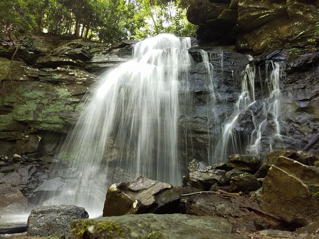
Kates Falls Trail (0.4 miles, accessed via Glade Creek Trail)
Distance One-way: 0.2 miles/0.32 kilometers
Difficulty Level: Strenuous
This spur trail leads from the Glade Creek Trail to Kates Falls.
Hikes To Historic Sites and Ruins
Brooklyn Mine Trail
Distance One-way: 2.7 miles/4.35 kilometers
Difficulty Level: Moderate
This shared hiking and equestrian trail follows an old road through the forest to the Brooklyn coal mine site.
Headhouse Trail
Distance One-way: 0.7 miles/1.13 kilometers
Difficulty Level: Moderate
This gravel trail (and administrative road) leads to the entrance of the Nuttall coal mine and top of the coal conveyor which was used to transport coal from the mine to the processing area at river level.
Kaymoor Trail (0.2 miles to waterfall from Wolf Creek Trailhead)
Distance One-way: 8.6 miles/13.84 kilometers
Difficulty Level: Moderate
This trail runs parallel to the middle of the gorge, passing the historic coal mine site at Kaymoor. The northern two miles (3.2 kilometers) of the trail, from Wolf Creek trailhead to the old mine site, follows an old road. Wayside exhibits interpret the Kaymoor mine operation and community along the way.
Kaymoor Miner's Trail
Distance One-way: 1.0 miles/1.6 kilometers
Difficulty Level: Strenuous
This steep forest trail descends 900 feet (274.3 meters) in elevation from the top of the gorge with rocky stairs and switchbacks to the Kaymoor coal mine site.
Rend Trail - access to Church Loop Trail (0.1 miles)
Distance One-way: 3.4 miles/5.47 kilometers
Difficulty Level: Easy
A great hike for all ages as well as an easy route for beginning mountain bikers, the Rend Trail is one of the most popular in the park. Along the way, there are good views of Dunloup Creek, the New River, and the historic community of Thurmond.
Southside Trail
Distance One-way: 7.0 miles/11.27 kilometers
Difficulty Level: Easy
This riverside trail provides great views of the New River and passes through several abandoned New River Gorge mining towns.
Old-Growth Forest Hikes
Burnwood Trail
Distance One-way: 1.2 miles/1.93 kilometers
Difficulty Level: Easy
This 1.2-mile (2-kilometer) loop trail leads through a 12-acre section of old-growth forest that escaped logging at the turn of the 20th century.
Stone Cliff Trail
Distance One-way: 2.7 miles/4.35 kilometers
Difficulty Level: Easy to Moderate
This trail follows an old road along the banks of the New River. Great views and easy access to the river are available along this trail. The endpoint of the trail leads to old-growth forest.
Backcountry Hiking
Most of the trails in this national park are suited for strolls and day hikes. Historic site considerations, very steep terrain, and private property within park boundaries can make planning a backpacking trip challenging. That doesn’t mean, however, there are no trails offering great overnight backpacking trips.
A backcountry permit is not required but there are regulations which should be followed. To read more about backpacking at New River Gorge National Park and Preserve, click on the Backcountry Hiking link above.
- By Rebecca Latson - May 2nd, 2026 7:06am


