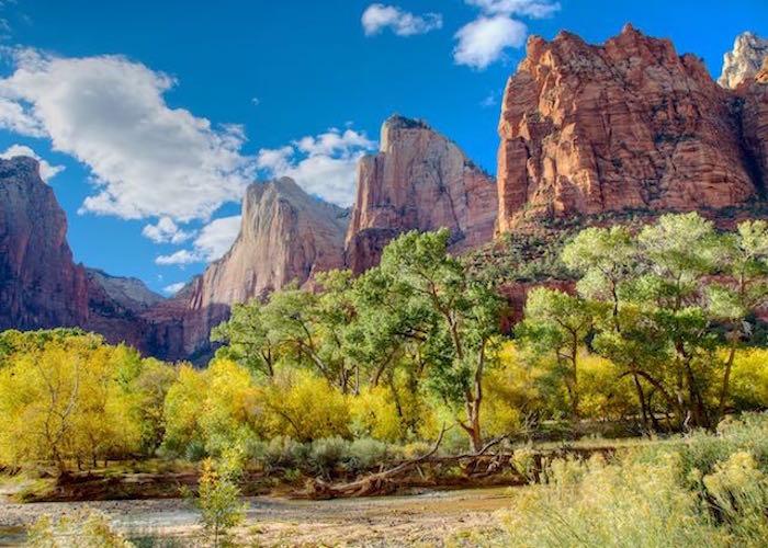
The Court of the Patriarchs in Zion Canyon is always an incredible photo, no matter the season/Jean Bjerke
Zion National Park in Utah is a hiker’s heaven, a rock climber’s mecca. Hikers are drawn to the iconic Angel’s Landing hike with its terrifying thousand-foot drop-offs as you hang for dear life onto a chain secured to a narrow ledge of rock. Another amazing hike explores the mysterious Narrows on a trail following the Virgin River into its deep, narrow canyon, and the famous Subway formation carved by eons of periodically raging flash floods.
Hikers clamber up any of a number of strenuous trails out of spectacular Zion Canyon for awesome views from above, and explore numerous smaller canyons throughout the park. Rock climbers scale 2,000-foot walls of red rock. Canyoneers explore fascinating slot canyons, some of them narrow enough that you can touch both walls at once. In remote areas of the park, a few who know where to look explore caves containing ancient pictographs and discover rock walls decorated with petroglyphs. You could spend years exploring the back country of Zion.
On a succession of visits to see the famous fall colors of Zion, I realized that some of the most magnificent scenery in this national park is also fully accessible. It was good to see a disabled girl in her wheelchair enjoying the spectacular canyon with her family along the Riverside Walk, and an older woman on oxygen, also in a wheelchair, using the park shuttle and taking in the scenery on a four-generation family outing.

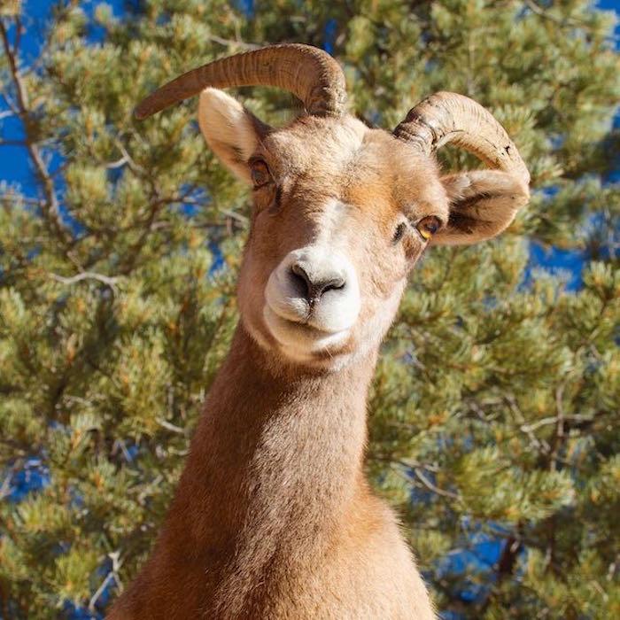
Even the locals are within reach of your camera lens/Jean Bjerke
All of the images published with this article were taken from within a few feet of roads or accessible paved trails.
Zion is beautiful and accessible throughout the year. Spring brings bright green new growth to the cottonwoods along the Virgin River and its smaller side canyons. With summer come the hot temperatures of the desert Southwest, but there are cooler temperatures along the river, and wildflowers bloom in seeps and springs along the walls of Zion Canyon. Zion often appears on lists of the top ten or 12 national parks for fall color, which usually peaks in the first or second week of November - well after winter has set in farther north. Winter brings colder temperatures and snow, but the snow is never deep and the roads are normally open all year.
Zion’s 229 square miles are penetrated by only about 25 miles of road, and all of the views from the road are spectacular. The 6-mile scenic drive through the most-visited part of the park, iconic Zion Canyon, is reached by a free, wheelchair-accessible shuttle bus during the prime season from about May to November. The rest of the year you can drive your own vehicle. The shuttle runs about every ten minutes and stops at several major trailheads. From the shuttle, or its stops, you can easily view the dramatic formations of Zion Canyon soaring directly above. Some of the stops also have accessible restrooms.

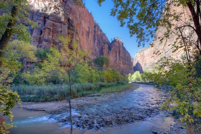
Riverside Walk in Zion National Park is easily accessed/Jean Bjerke
Zion Lodge in the heart of Zion Canyon, the shuttle bus, visitor centers, museum, and restrooms are all fully accessible, with reserved parking and ramps. Several picnic areas and selected sites in the two campgrounds are also accessible.
The 1.7-mlle, paved and accessible Pa’rus trail runs from the Visitor Center to Canyon Junction, where the scenic drive begins. The trail follows the lovely Virgin River, through meadows and among the cottonwoods and box elders lining the river banks. The trail crosses the river a few times on photogenic bridges, with many views of the famous Watchman and the soaring walls of the canyon, which glow red and orange with the early morning and late afternoon light. This is primarily a bike path and is accessible to wheelchairs at each end of the trail.
At the end of the scenic drive, the two-mile round trip Riverside Walk is a pleasant, serene, shaded stroll along the river to the gateway to the Narrows. This trail is also paved and accessible to wheelchairs, with some assistance in a few rough patches. Hikers may continue hiking upstream as far as they wish, wading in the river. Another area of the park, accessible by car for spectacular scenery, is the 14-mile drive from the main entrance to the east entrance to the park. Past Canyon Junction this road is called the Zion-Mount Carmel Highway. As it climbs into the east canyon area, the road enters an impressive mile-long tunnel through the mountain, then winds through fascinating slick rock formations in the upper east canyon. The scenery viewed from the road is some of the most spectacular, twisted, folded, and textured red rock country you will ever see, and there are plenty of opportunities for hikers to explore side canyons. Desert bighorn sheep are regularly spotted from the roadside.

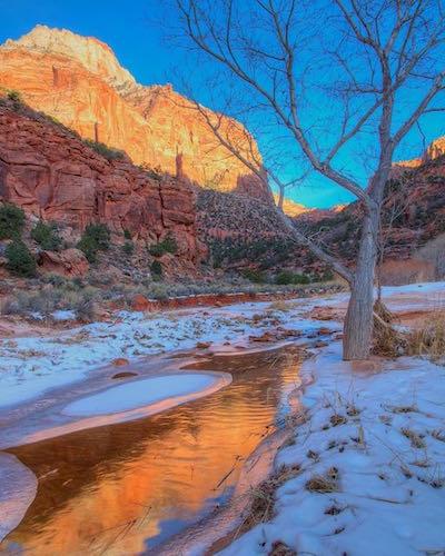
Even in winter there are places in Zion where you can get terrific photos without venturing off the beaten path, such as Lower Pine Creek/Jean Bjerke
Farther north, nearly 50 miles by road from the main part of the park, is the smaller Kolob Canyons section of Zion Park, which offers several more trails to various arches and through more red rock canyons. The paved five-mile road from the freeway affords stunning views of the canyon formations right from the road and its several turn-outs. The striking red pavement dramatically matches the color of the red sandstone. Here there is another accessible visitor center as well as restrooms.
So if you or someone in your family or group are unable to hike or climb, there are still many ways to enjoy the unforgettable red rock country of Zion National Park. Don’t miss this beautiful park!


Add comment