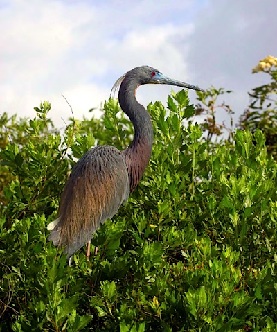
Great blue herons hang out at Cumberland Island National Seashore/NPS
Cast across more than 36,000 acres, Cumberland Island National Seashore is, as its name implies, on an island, the largest of Georgia's Golden Isles. Make the ferry boat crossing from St. Marys and you'll discover history of those long ago enslaved here, blueblood manses, about 18 miles of wave-swept beaches, and nearly 9,000 acres of official Wilderness. It's an appealing setting for natural and cultural history, but one that requires a determined, strategic, approach as only 300 visitors a day can visit, and 120 of those slots are reserved for campers.
That's right, just 300 a day, so crowds are not the same as those you might encounter on a summer day at Coast Guard Beach at Cape Cod National Seashore. Peak visitation, as it is, falls from March into June, and then September into October. Come in August and you just might have that ferry to yourself.
Looking for history? Tour the north end of the seashore, at the Wharf and the Settlement, to see how the islanders here, mostly blacks, lived a century ago. On the southern end of the island stop at Dungeness. This mansion, now in ruins, was built by Thomas Carnegie, brother of Andrew. It burned mysteriously in 1959. While you can't go into the ruins, you can snap some nice photos.
If you're looking to add to your birding life list, or just want to see some feathered residents, head down the Willow Pond Trail that crosses the island. But keep your eyes open for the alligators. The Marsh Boardwalk on the south end of the island also can be good for both birding (black skimmers, oystercatchers and pelicans are regulars, while fresh-water ponds serve as rookeries for wood storks, white ibis, herons and egrets) and tidal creatures.
Want to spend the night, but not on the ground? Try to book at room at the Greyfield Inn, a high-end bed-and-breakfast.
If you go:
You can make a ferry reservation six months' out (877-860-6787, Mon-Fri 10 a.m.-4 p.m.). The first ferry departs at 9 a.m. (check in 30 minutes in advance at the seashore visitor center or chance losing your spot) for the 45-minute crossing. Plan to arrive by 8 a.m., so you can tour the seashore's visitor center in St. Marys before boarding. While there, ask for a bird list for Cumberland Island.
There are a number of camping options, from the Sea Camp front-country area with 16 sites, cold water showers, running water, and fire rings, and the Stafford backcountry campground with toilets, non-potable water and fire rings, to the Brick Hill, Yankee Paradise, and Hickory Hill Wilderness campgrounds. You can reserve a site six months ahead of your visit. Spring and late fall are the high seasons (and less buggy seasons). All camping permits are assigned at the Sea Camp Ranger Station, which also assigns all backcountry, Wilderness, and Sea Camp campsites once you reach the island.
Story Categories:
A copy of National Parks Traveler's financial statements may be obtained by sending a stamped, self-addressed envelope to: National Parks Traveler, P.O. Box 980452, Park City, Utah 84098. National Parks Traveler was formed in the state of Utah for the purpose of informing and educating about national parks and protected areas.
Residents of the following states may obtain a copy of our financial and additional information as stated below:
- Florida: A COPY OF THE OFFICIAL REGISTRATION AND FINANCIAL INFORMATION FOR NATIONAL PARKS TRAVELER, (REGISTRATION NO. CH 51659), MAY BE OBTAINED FROM THE DIVISION OF CONSUMER SERVICES BY CALLING 800-435-7352 OR VISITING THEIR WEBSITE. REGISTRATION DOES NOT IMPLY ENDORSEMENT, APPROVAL, OR RECOMMENDATION BY THE STATE.
- Georgia: A full and fair description of the programs and financial statement summary of National Parks Traveler is available upon request at the office and phone number indicated above.
- Maryland: Documents and information submitted under the Maryland Solicitations Act are also available, for the cost of postage and copies, from the Secretary of State, State House, Annapolis, MD 21401 (410-974-5534).
- North Carolina: Financial information about this organization and a copy of its license are available from the State Solicitation Licensing Branch at 888-830-4989 or 919-807-2214. The license is not an endorsement by the State.
- Pennsylvania: The official registration and financial information of National Parks Traveler may be obtained from the Pennsylvania Department of State by calling 800-732-0999. Registration does not imply endorsement.
- Virginia: Financial statements are available from the Virginia Department of Agriculture and Consumer Services, 102 Governor Street, Richmond, Virginia 23219.
- Washington: National Parks Traveler is registered with Washington State’s Charities Program as required by law and additional information is available by calling 800-332-4483 or visiting www.sos.wa.gov/charities, or on file at Charities Division, Office of the Secretary of State, State of Washington, Olympia, WA 98504.

Comments
Nice article. Have always been intigued by this NS.
Just like Cape Hatteras National Seashore Recreational Area, these south eastern Atlantic ocean beaches have had record number of sea turtle nests the past several years. Sounds like a great place to visit.
Yes, I've never seen sea turtles and would love to have the opportunity. It sounds like efforts to protect them are being successful. Good news.
Experts believe these record numbers will not continue due to this being a cyclical event, because these Loggerhead turtles can take up to 35 years to reach sexual maturity. Its interesting that every NPS unit handles turtle protection efforts differently. Some units relocate nests and some don't. Many nests along Hurricane Arthur's path won't survive without relocation.