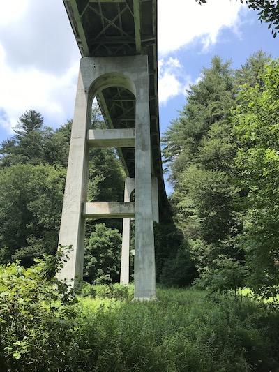
The Laurel Fork Bridge along the Blue Ridge Parkway has reached the end of its useful life and will be replaced/NPS file
An 83-year-old bridge will be replaced at the Blue Ridge Parkway and 75 miles of the parkway's pavement will be rehabilitated thanks to $127 million from the Great American Outdoors Act funding.
“Generations of park visitors and local residents have enjoyed scenic drives along the Blue Ridge Parkway and into our neighboring communities, just last year the park had 15.9 million visitors," said Blue Ridge Parkway Superintendent Tracy Swartout. “The Parkway was created to be a driver of tourism and to support and sustain local economies. Ongoing investments in critical park infrastructure and operations will allow the Parkway to continue to serve the nation in this important role."
Roughly $29 million of the funding will be used to replace the Laurel Fork Bridge at milepost 248.8 in Ashe County, North Carolina. The bridge built in 1939 is approaching the end of its lifecycle. It is 546-feet long and 28-feet wide. It is a five-span bridge with a steel girder and concrete floor beam structure supported by concrete and stone masonry abutments that are set in the steep slope of a ravine, and concrete piers that are cast onto a wide concrete footing. The bridge replacement project will take two years and require a full closure with detour.
The other project is for approximately $98 million for a three-year repaving and rehabilitation project that will span 75 miles of the Parkway in North Carolina, from milepost 229.6, just north of Doughton Park, to milepost 305.1, near Grandfather Mountain. The paving project will include repair or replacement of drainage structures, curbs, walks, shoulders, guardrails, overlooks and signage. The paving project will be phased with a staggered series of closures allowing for continuous access to recreation areas and visitor amenities within the construction zone.
Both projects will be jointly managed by the NPS and the Federal Highway Administration. Contracts for both projects have recently been awarded and construction timelines and detour locations are being finalized. Road closure dates and detour information will be announced and updated on the park’s website at https://www.nps.gov/blri/planyourvisit/roadclosures.htm.


Comments
Go Tracy Go!!! :)
It is great to see these projects rolling out as part of the Great American Outdoors Act!
a great time to add bike lanes for safety !!
Why not re-purpose the old briudge as a bike/hike bridge?