
From the Traveler Archives
It's hard to beat autumn for prime hiking in parks from coast to coast. This season brings fine weather to most of the country and in many locations fall foliage is an added bonus. There are more hikes in national parks than we can take in a lifetime, so here are a few suggestions for some great ones all across the nation—including some alternatives to the most heavily-visited sites.
East
Mention fall hikes in this part of the country and many park fans immediately think of three parks: Acadia National Park in Maine, Shenandoah National Park in Virginia, or Great Smoky Mountains National Park in North Carolina and Tennessee. All three areas are justly famous for fall color, have hundreds of miles of hiking trails…and lots of traffic on the roads, especially on autumn weekends. If you're looking for some options for a fall hike in a park that might not be quite so crowded, you might consider the following areas:
For many travelers, "fall foliage" is synonymous with New England, and a relatively new NPS addition offers some great short hikes right on the edge of the picturesque village of Woodstock, Vermont. Marsh-Billings-Rockefeller National Historical Park offers a chance to, "Walk through one of Vermont's most beautiful landscapes, under the shade of sugar maples and 400-year-old hemlocks, along winding woodland carriage roads and trails. On the gentle slopes of Mount Tom you will find mountain pastures, a mysteriously-named pond, and spectacular views of nearby hills and valleys."
Not too far from the Smokies, Big South Fork National River and Recreation Area straddles the Kentucky-Tennessee border. The park's 125,000 acres includes miles of scenic gorges and sandstone bluffs and is rich with natural and historic features. For fall hikers, the park staff recommends two hikes in particular: the Angel Falls Rapids hike from Leatherwood Ford (four miles round trip, described as easy) and the Twin Arches/ Twin Arches Loop Trail (total distance 1.4 miles round trip to Arches only or 6 miles total for the complete loop). This one is rated by the park as "moderate" in difficulty.

At the point where Virginia, Kentucky and Tennessee meet, Cumberland Gap National Historical Park combines history and scenery in 20,500 acres of rugged mountain beauty. The park offers 85 miles of hiking trails, and Carol Borneman at the park suggests the following fall hike that covers just under three miles and offers a bonus for history buffs: you can walk in the footsteps of Daniel Boone and the almost 300,000 pioneers who traveled through the Cumberland Gap, the nation's first doorway to the west.
"Begin the hike at the Thomas Walker parking area, located near the intersection of the Pinnacle and Sugar Run Roads, and follow the Object Lesson Road to its intersection with the Wilderness Road Trail," said Ms. Borneman. "Along the way, you'll be immersed in a sweet grove of hemlocks. Once on the Wilderness Road Trail, it's another 0.2 miles to the historic Gap itself. The view into Kentucky from the Gap is spectacular in the fall as the mustards of the hickories, the maroons of the sourgum and the orange of the maples paint the mountainsides."
"A short side trip of 0.6 miles one-way along the Tri-State Trail leads to the Tri-State Peak where you can stand in Kentucky, Tennessee and Virginia. Retrace your steps back to the Gap and the Wilderness Road Trail," she added. "At the Object Lesson Road Trail/Wilderness Road Trail intersection, continue on the Wilderness Road Trail back to the Thomas Walker parking area. The Wilderness Road Trail winds around the side of the mountain through immense tulip poplars and oaks. Watch for wild turkeys that frequent this area."
Mammoth Cave National Park (Kentucky) has plenty to see above ground, and two trails are suggested by Vickie Carson at the park for fall color in late September and October.
"The Green River Bluffs Trail begins near the visitor center and winds through a ridge-top forest. Approaching the Green River, the trail follows along the top of limestone bluffs, about 150 above the river. You can return to the visitor center, passing the Historic Entrance of Mammoth Cave, for a one and a half mile hike, or take an extra loop to River Styx Spring, making the trip about two miles," said Ms. Carson. "The Cedar Sink trail is a two-mile trek, through woods to a mammoth sinkhole that has a river running through the bottom—it emerges from the bottom of 100 feet of limestone bluff, and disappears into another on the far side of the sink."
Midwest
If you've not had the opportunity to travel in the middle of the country in autumn, you may have a pleasant surprise in store. The terrain might not be as dramatic as in the Appalachians or the Rockies, but there's still plenty of scenery—and some areas with photo-moment foliage to add some extra zest to a hike.

Sleeping Bear Dunes National Lakeshore (Michigan) gets plenty of colorful mileage out of the area's maple, beech and birch trees. Lisa Myers, the park's chief of interpretation and visitor services, says, "Here at the park, color is everywhere! The Empire Bluff, Pyramid Point, Alligator Hill and Windy Moraine trails are great hikes. All but the Windy Moraine Trail will eventually lead to a view of Lake Michigan from a high bluff. Windy Moraine overlooks the Glen Lakes which are beautiful inland lakes surrounded by forest."
A second Michigan park offers great scenery on the shores of another large body of water: Lake Superior. Pictured Rocks National Lakeshore is home to miles of pristine beaches and over 100 miles of trails through a northern hardwood forest. The park website includes details for several short nature trails, and for fall hikes, Gregg Bruff from the park suggests the following route:
Hike from the Chapel parking lot to Mosquito River at Lake Superior (about 1.7 miles one way) and then return via the Mosquito Falls trail. The Mosquito Falls "canyon" (with a small "c") is beautiful with beech and maple in the fall. The Chapel Falls trail is 1.5 miles one way and has a view into the Chapel Lake area. Take the Little Beaver Lake trail on the north side of Little Beaver out to the mouth of Beaver Creek on Lake Superior and return via west trail loop. Vistas over the small lakes are very pretty and the trail runs through a mix of hardwood and conifers. Along the way, hikers see interesting ancient "sea caves" in the sandstone bedrock when a much older version of Lake Superior filled what is now the Beaver Basin. This area is within the Beaver Basin Wilderness Area. You can download a map of the park and a copy of the park newspaper and brochures on the park website.
Much further to the south, the Buffalo National River (Arkansas) offers more than 100 miles of hiking trails—many constructed by volunteers—to complement river trips through the rocky bluffs and hardwood forests of the Ozarks. A popular short hike, the Lost Valley Trail, includes waterfalls, towering cliffs, a large bluff shelter, a natural bridge and a small cave. The cave is about 200 feet long and ends in a large room with a 35-foot waterfall. It's essential that each person entering the cave is equipped with a flashlight, and all cavers should have multiple sources of light available. The trail begins at the Lost Valley Campground; the round trip covers 2.1 miles.
West
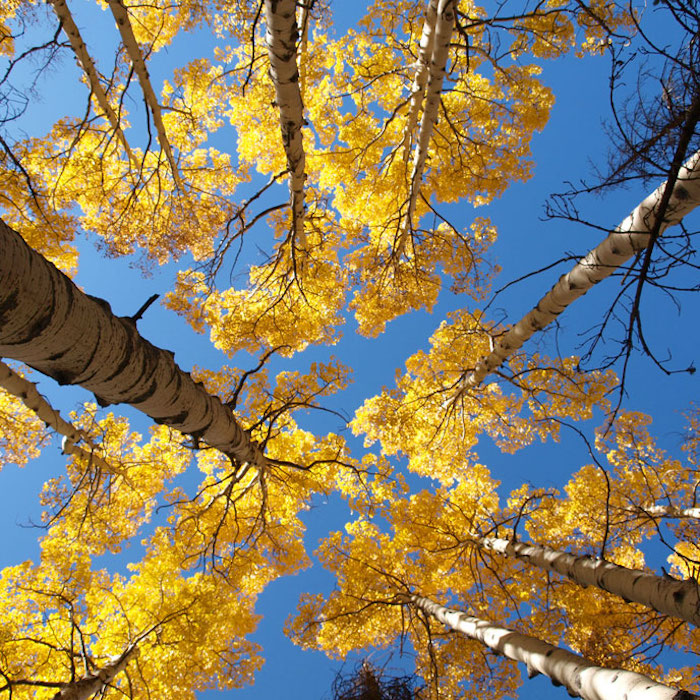
Although most of the western parks might not have as many varieties of the deciduous trees responsible for the riot of autumn color in the east, they can make up the difference in other ways. The sweeping vistas and dramatic contrasts of golden aspens and cottonwoods against a backdrop of evergreen forests or red rock canyon walls have graced many a magazine cover and calendar page, and there are plenty of opportunities for great fall hikes in the west.
Although Zion National Park gets plenty of well-deserved attention in the fall, another gem is just up the road in southern Utah.
Cedar Breaks National Monument has been rated by USA Today as "one of the top ten places to experience fall colors" in the United States. According to the park staff, the Alpine Pond Nature Trail is the hike to take for fall color at Cedar Breaks. Rated as "easy to moderate in difficulty," it's a two-mile double-loop route through forests and meadows. The lower trail offers excellent views of the "breaks," the eroded badlands where the edge of the plateau breaks away to a lower area, while the upper trail takes you past meadows, through a spruce-fir-aspen forest, and past ancient deposits of volcanic materials. Half-way through the loop, a natural, spring-fed pond offers a quiet location for a break. A cut-off trail at the pond allows you to make this hike a one-mile loop. A small stand of bristlecone pines can also be viewed from this trail. Best colors at Cedar Breaks are usually from mid-to-late September into October; a regional tourism bureau offers updated color reports.
In the northern Rockies, Glacier National Park offers some outstanding fall hikes, including one of my personal favorites. West of St. Mary along the classic Going-to-the-Sun Road is the Sun Point Nature Trail—and if you enjoy taking scenic photos, don't forget your camera! The trail covers about a mile each way, and includes the chance for some premier views of Saint Mary Lake with rugged mountain peaks in the background. You can return to your car from Sun Point or continue a short distance on this trail to Sunrift Gorge, a straight, steep canyon formed when a small stream cut through a natural break in the rock. For a longer, half-day hike, you can carry on to St. Mary Falls and Virginia Falls. You'll find basic information and a map depicting the location of these trails, and other hikes in the St. Mary Valley, at this link, and the park website includes details with plenty of other suggestions for hikes on the park's 700 miles of trails.
If you're planning a fall visit to Glacier, keep in mind that construction on the Going-to-the-Sun Road will limit your ability to drive all the way across the park beginning in mid-September. US Highway 2, which connects the east and west sides of Glacier along the park's southern boundary, is a year-round travel option. The park website includes the status of all the roads in the park.
West coast travelers who'd like an option to Yosemite in the fall might try Whiskeytown National Recreation Area in northern California. For fall day hikes, Superintendent Jim Milestone suggests the Brandy Creek Falls Trail (1.5 miles round trip) and the James K. Carr Trail to Whiskeytown Falls (3.4 miles round trip). Both are rated by the park as "moderate" in difficulty, and Jim points out that two new foot bridges on the route to Brandy Creek Falls will allow visitors to access the falls during high winter flows. He says both trails "are in mixed conifer and deciduous forest and if the cool temps come on at the right sequence we get outstanding fall colors. Both falls take on a yellow hue under the forest canopy in the fall light." The park website includes details on these and other trails in the park.
No matter where you live—or travel—in the fall, there's a great hike not too far away. Whether it's long or short, flat or steep, find one that fits your situation and enjoy a wonderful season of the year in the parks.
Stories about:
Story Categories:
A copy of National Parks Traveler's financial statements may be obtained by sending a stamped, self-addressed envelope to: National Parks Traveler, P.O. Box 980452, Park City, Utah 84098. National Parks Traveler was formed in the state of Utah for the purpose of informing and educating about national parks and protected areas.
Residents of the following states may obtain a copy of our financial and additional information as stated below:
- Florida: A COPY OF THE OFFICIAL REGISTRATION AND FINANCIAL INFORMATION FOR NATIONAL PARKS TRAVELER, (REGISTRATION NO. CH 51659), MAY BE OBTAINED FROM THE DIVISION OF CONSUMER SERVICES BY CALLING 800-435-7352 OR VISITING THEIR WEBSITE. REGISTRATION DOES NOT IMPLY ENDORSEMENT, APPROVAL, OR RECOMMENDATION BY THE STATE.
- Georgia: A full and fair description of the programs and financial statement summary of National Parks Traveler is available upon request at the office and phone number indicated above.
- Maryland: Documents and information submitted under the Maryland Solicitations Act are also available, for the cost of postage and copies, from the Secretary of State, State House, Annapolis, MD 21401 (410-974-5534).
- North Carolina: Financial information about this organization and a copy of its license are available from the State Solicitation Licensing Branch at 888-830-4989 or 919-807-2214. The license is not an endorsement by the State.
- Pennsylvania: The official registration and financial information of National Parks Traveler may be obtained from the Pennsylvania Department of State by calling 800-732-0999. Registration does not imply endorsement.
- Virginia: Financial statements are available from the Virginia Department of Agriculture and Consumer Services, 102 Governor Street, Richmond, Virginia 23219.
- Washington: National Parks Traveler is registered with Washington State’s Charities Program as required by law and additional information is available by calling 800-332-4483 or visiting www.sos.wa.gov/charities, or on file at Charities Division, Office of the Secretary of State, State of Washington, Olympia, WA 98504.
INN Member

The easiest way to explore RV-friendly National Park campgrounds.

Here’s the definitive guide to National Park System campgrounds where RVers can park their rigs.
Our app is packed with RVing- specific details on more than 250 campgrounds in more than 70 national parks.
You’ll also find stories about RVing in the parks, tips helpful if you’ve just recently become an RVer, and useful planning suggestions.
