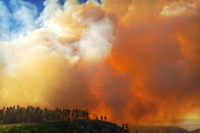
The Fuller Fire on the North Rim of Grand Canyon National Park covered more than 3,000 acres Thursday morning/July 12 photo courtesy of Christian Schroll
A wildfire ignited on Grand Canyon National Park's North Rim by a lightning strike in late June continues to grow, and at more than 3,000 acres has forced the closure of the Point Imperial Road and a number of trails on the rim.
On Thursday morning control of the firefighting effort was transitioned to Southwest Type 2 Incident Management Team #3. Additionally, more crews and equipment arrived Wednesday to battle the Fuller Fire, bringing the total force to roughly 200 personnel aided by three helicopters, five engines, one dozer, and three water tenders.
Late Wednesday afternoon an overflight estimated the size of the fire at 3,057 acres. It is located north of Fuller Canyon Road, about three miles west/southwest of Point Imperial. The North Rim Developed Area remains open.
The fire continues to burn in dead and down logs on the forest floor and aspen regeneration following the 2000 Outlet Fire. Fire managers have been trying to keep the fire East of Highway 67, North of the Fuller Canyon Road and Point Imperial Road, and South of the FS 610 Road and Saddle Mountain Trail.
The Fuller Fire is being managed for both resource and protection objectives. Resource objectives include returning fire to a fire-adapted ecosystem. Protection objectives include the protection of sensitive wildlife habitat. No structures are currently threatened.
Hot, dry conditions are expected to continue through the weekend. Winds will continue to be high but are expected to remain below Red Flag conditions. Continued fire growth to the north, south, and east are expected to continue until monsoonal moisture returns to the area. Fire managers will continue to use a full range of actions to direct or minimize the spread of fire as needed.
Current Trail Closures:
- The Arizona Trail is closed from Lindberg Hill, north to the park boundary
- The Ken Patrick Trail
- The Point Imperial Trail
- The Nankoweap Trail
- The Saddle Mountain Trail
- The South Canyon Trail
Current Road Closures:
- The Point Imperial Road is closed at the junction with the Cape Royal Road. The Cape Royal Road remains open.
- The FS 610 Road
- The FS 611 Road
Smoke is visible from Highway 67 and the North Rim, Marble Canyon, Cameron, and the South Rim. Winds from the West and Southwest are expected to continue to move smoke toward the East and Northeast. If it looks smoky, you may want to limit or avoid exercise or other outdoor activities. Visit http://wildlandfire.az.gov/links.asp#Smokefor more information on smoke and your health.


