The geology of the Colorado Plateau is fascinating, with its deeply grooved canyons, soaring buttes, and colorful outcrops. Capitol Reef National Park certainly wasn't shorted when this geology was laid down.
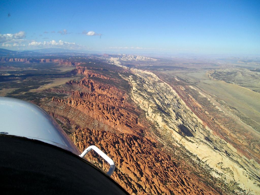
An aerial view of the waterpocket fold, Capitol Reef National Park / NPS file
Indeed, the park's name was inspired by the domes of Navajo sandstone that resemble the domes atop capitol buildings, as well as the sharp-edged "reefs" of rock that jut into the sky. But the hallmark of this park is the nearly 100-mile-long (161 km) Waterpocket Fold, which park geologists are quick to note "is a classic monocline: a regional fold with one very steep side in an area of otherwise nearly horizontal layers."
Take some time to study this hogback and you'll be duly impressed by the geologic forces at work here. The rock layers on the west side of the Waterpocket Fold have been lifted more than 7,000 feet (2,133.6 m) higher than the layers on the east. According to the Park Service, the "Waterpocket Fold formed between 50 and 70 million years ago when a major mountain building event in western North America, the Laramide Orogeny, reactivated an ancient buried fault. When the fault moved, the overlying rock layers were draped above the fault and formed a monocline."
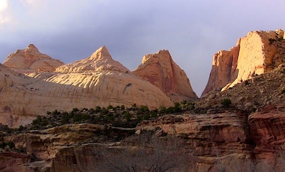
Formations such as Navajo Knob help explain how Capitol Reef National Park got its name. Marcelle Shoop photo.
The name Waterpocket Fold reflects this ongoing erosion of the rock layers, the park notes on its website. "Waterpockets" are basins that form in many of the sandstone layers as they are eroded by water. These basins are common throughout the fold, thus giving it the name "Waterpocket Fold." Erosion of the tilted rock layers continues today forming colorful cliffs, massive domes, soaring spires, stark monoliths, twisting canyons, and graceful arches.
This incredible landform is best seen from the air, though for most visitors that's impossible. The next best way to appreciate it is on foot, by exploring the park's trails.
The tilt of the Waterpocket Fold dies out at Thousand Lake Mountain near the northwestern boundary of the park. Rock layers in Cathedral Valley have a gentle inclination of three to five degrees to the east and appear nearly horizontal.
Deep erosion has carved Cathedral Valley's free-standing monoliths, or temples, out of the soft reddish-orange Entrada Sandstone, which was originally deposited as sandy mud on a tidal flat. Some of the cathedrals are capped by thin, hard beds of a greenish gray marine sandstone, the Curtis Formation.
The scenery of the Entrada Sandstone temples of Cathedral Valley is complemented by evidence of other geologic processes at work. The flowing and disolving of gypsum, a soluable mineral from the underlying Carmel Formation, created Glass Mountain and the Gypsum Sinkhole. Glass Mountain is an exposed plug of gypsum. The Gypsum Sinkhole formed when a gypsum deposit dissolved. Dikes and sills, which are thin bodies of igneous rock and small volcanic plugs, are found in Upper Cathedral Valley. These features formed during volcanic activity three to six million years ago.
Most of the erosion that carved today's landscape occured after the uplift of the Colorado Plateau sometime within the last 20 million years. Most of the major canyon cutting probably occured between one and six million years ago.
Even in this desert climate, water is the erosional agent most responsible for the carving of the landscape. The pull of gravity, in the form of rock falls or rock creep, plays a major role in the shaping of the cliff lines. Wind is a minor agent of erosion here.
The landforms are a result of different responses of various rock layers to the forces of erosion. Hard sandstone layers, like the red Wingate and the white Navajo Sandstones, form cliffs. Softer shale layers, like the Chinle Formation, form slopes and low hills. The barren slopes found in many areas are due in part to the presence of bentonitic clays in the shale which make an inhospitible environment for plants.

Rock Layers: Moenkopi Formation, Chinle Formation and Wingate Sandstone at sunset on the Fruita Cliffs, Capitol Reef National Park / NPS-Kit Frost
Another curious aspect of the park's geology are the black boulders found scattered throughout the Fremont River valley and along other drainages. Park geologists say these volcanic rocks came from the 20 to 30 million year old lava flows that cap Boulder and Thousand Lake Mountains off to the west. The boulders made their way to Capitol Reef during the end of the Ice Age when the high plateaus supported small mountain glaciers. Landslides, debris flows, and possibly heavy stream outwash from these glaciers carried the boulders to lower elevations in the park.
According to U.S. Geological Survey scientists, boulder-laden debris flows descended along the Fremont River and its southern tributaries, Pleasant and Oak Creeks. Numerous terraces and mesas, perched 100 to 400 feet (30.5-122 m) above the modern valley floors, are capped by coarse black boulders. Similar boulders that originated at Thousand Lake Mountain cap benches high above the northern valleys of the park. Such benches are visible along the Hartnet Road from the Cathedral Valley Campground all the way to the Fremont River.
East of the park, black boulders form flat benches where ancient floods emerged at the mouths of Pleasant and Oak Cree Canyons, i.e.: Notom Bench. These benches are the ancient floors of these streams. Since then, the creeks and the Fremont River have excavated canyons 200 feet (60.7 m) deeper into the tilted sandstone of the Waterpocket Fold. Deposits of black boulders extend into Upper Cathedral Valley. Just east of the park boundary along the Fremont River, a prominent flat terrace is mantled by several feet of river-worn black boulders, the ancient floor of Hartnet Draw.


