
The official NPS map of Death Valley National Park / NPS file
Death Valley National Park encompasses more than just the valley which, itself, is about 140 miles long and 15 miles at its widest. According to the National Park Service (NPS), Death Valley is “the largest U.S. national park outside Alaska at 3,422,024 acres.” That’s approximately 5,347 square miles (13,849 square kilometers). This is a park larger than either Big Bend or Yellowstone national parks, both of them large in their own right. With a park that size, you probably aren’t going to see everything you want in the space of a day or even a week, for that matter. But you can still see and do plenty, even if you have no more than three days.
Before we get started, let’s talk about preparation. If you read the Traveler 2012 and 2023 checklists, you’ll have an idea of how to get to this park, where to stay, and what to pack. It cannot be stressed enough that you should bring more water than you think you’ll need. Even if you visit during the cool-to-cold months of winter to bypass those record-setting heat temperatures, it’s still so dry you’ll need to drink every drop from those gallon jugs of water you’ve brought along. Seriously. Bring salty snacks too, for replacing all those salts you’ll lose through sweating.
Speaking of sweat, when visiting Death Valley during the summer season (May – September), it’s a good idea to curtail your activities during the hottest portion of the day. The park recommends visitors reduce or stop their activity by 10 a.m. due to extreme daytime temperatures. It’s hot, even in the shade. After all, Death Valley National Park holds the record for the hottest place on earth at 134 degrees F (56.7 degrees C) set back in 1913.
Many of the most iconic areas are within 15- to 30-minutes’ driving distance from the Furnace Creek-area lodging / campgrounds. So, even if your basecamp is in Stovepipe Wells or Panamint Springs, the times and distances you read here are based upon the Furnace Creek location.
Day 1

Sunrise over Zabriskie Point, Death Valley National Park / Rebecca Latson
Arise pre-sunrise, drive CA-190 to Zabriskie Point, and watch the sun bathe the Panamint Mountains, inch over the Death Valley, and finally shine upon the crenelated hills near the view area with a rich golden light. If you feel like a little hike, you can access Badlands Loop, Golden Canyon, and Gower Gulch from this spot. If you don’t feel like stretching your legs just yet, return to your vehicle and drive CA-190 back toward the Inn at Death Valley, turning left just past the hotel onto Badwater Road for a stop at Badwater Basin for a hike to the nearest salt flat some 282 feet (86 meters) below sea level. The NPS says the hike is approximately ¼ - ½ mile one-way, but other sites indicate it’s a mile to get to the closest salt pan. Based upon my own trip out there, I’m more inclined to say the walk from parking lot to salt flat is closer to one mile (2 miles roundtrip), but It’s flat, so the hike goes quickly and easily.

Looking north up Death Valley from a salt flat at Badwater Basin, Death Valley National Park / Rebecca Latson
Wear a hat and shirt to protect from the burning sun and prevent too much moisture loss too quickly. It goes without saying you should take plenty of water with you. Things heat up the moment that morning sunlight strikes the bright, white, reflective salt where there’s no respite the rest of the day until sunset. Protect your eyes from the brilliant whiteness of the salt with sunglasses. Like blinding white snow on a sunny day, the bright salt flat can hurt your eyes.

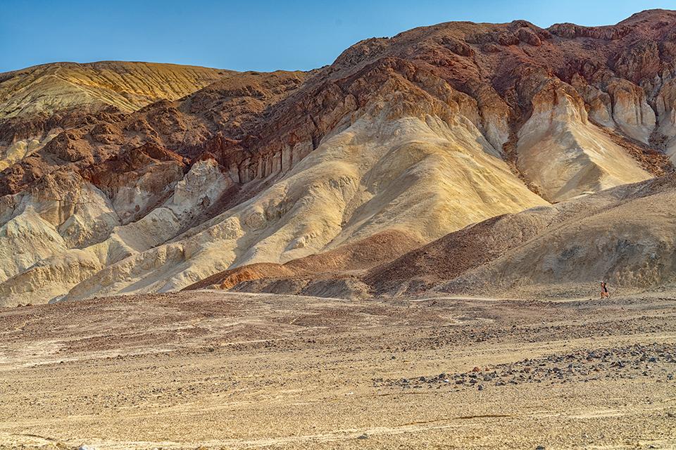
Viewing the colors at Artists Palette, Death Valley National Park / Rebecca Latson
After your salt flat adventure at Badwater Basin, head back north along Badwater Road, turning right onto Artists Drive toward Artists Palette for a view of the crumbly hillsides sporting celadon green, lavender, pink, orange, and red colors created by minerals in the eroding soils. From Artists Palette, return to your room / tent to don your swimsuit for a dip in the Inn at Death Valley’s pool (if you are staying there), or the Ranch at Death Valley’s spring-fed swimming pool, where you can purchase a pool pass even if you are not staying there. After your swim, go enjoy lunch at the Last Kind Words Saloon (the L.K.W.S. burger is quite tasty, btw). Take a nap or, if you’ve a mind to work off the post-prandial lethargy and happen to enjoy golf, why not try a round at the lowest-elevation golf course in the world - the Furnace Creek Golf Course at Death Valley. If you don’t golf, then wander around the outside portion of the Borax Museum (the interior is currently closed in anticipation of a restoration project) to inspect at close hand the tools and machinery used for borax mining back in the day. Or, spend a little time shopping for souvenirs at the General Store and the Oasis, an upscale shop selling western goods and clothing.

The outdoor exhibits of the Borax Museum at Furnace Creek, Death Valley National Park / Rebecca Latson
Before resuming your day’s adventures, stop at the Furnace Creek Visitor Center. If you want a park map, you’ll need to either show your park pass or pay the park entrance fee. You’ll also want to get a photo of yourself next to the visitor center’s iconic thermometer to show friends, family, and colleagues just how hot (or cold) it got during your stay.
Return to Zabriskie Point for sunset and stick around for stargazing. Death Valley is an International Dark Sky Park and the sky really sparkles after the sun sinks behind the Panamint Mountains.

Sunset and storm cloud at Zabriskie Point, Death Valley National Park / Rebecca Latson
Day 2
Get up again at dark-thirty and drive 25 miles from Furnace Creek to welcome sunrise at Dantes View. With an elevation of 5,575 ft (1,699 m) above Badwater Basin, the panorama is expansive and the temperature will be about 20 degrees cooler. Short trails lead away from either end of the parking lot to higher and more broadly encompassing views of the valley and surrounding mountains.
From Dantes View, you can either retrace your previous day’s route along Badwater Road, stopping to hike all or a part of the trails for Golden Canyon, Gower Gulch, or Badlands Loop, or bypass that option and continue your drive northwest on CA-190 past Furnace Creek toward Stovepipe Wells.
If you feel like a little hike, return to the Golden Canyon trailhead along Badwater Road, Death Valley National Park / Rebecca Latson
Along the way, stop and tour what remains of Harmony Borax Works before continuing to the Mesquite Flat Sand Dunes.

Learn how borax was mined at Harmony Borax Works, Death Valley National Park / Rebecca Latson

A large "sandbox" in which to play at Mesquite Flat Sand Dunes, Death Valley National Park / Rebecca Latson
After some playtime on the dunes, enjoy lunch at either the Toll Road Restaurant or Badwater Saloon in next door Stovepipe Wells or purchase a sandwich or wrap at the general store there before driving the unpaved road to Mosaic Canyon for a hike. Note: the entire Mosaic Canyon Trail is four miles out and back, but according to the NPS, most visitors opt to hike a half mile to the first set of canyon narrows then return to their vehicle.

Hikers exploring Mosaic Canyon, Death Valley National Park / NPS - Kurt Moses
To cap off Day 2, return to Dantes View for sunset and night sky views. Yes, sometimes it feels like you are doing quite a bit of driving, but everything is relatively close so it’s not too much time spent on the road.

Sunset at Dantes View, Death Valley National Park / Rebecca Latson
Day 3
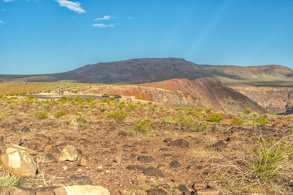
Drive toward the small community of Panamint Springs at the park’s western border then continue 12 miles further to Father Crowley Vista Point. The parking area and vault toilets are situated right next to Rainbow Canyon (aka “Star Wars Canyon”) where fighter jets once wowed onlookers as they wove through the canyon on test flights until a jet fatality cancelled further flights.
Father Crowley Vista Point parking lot beside Rainbow Canyon, Death Valley National Park / Rebecca Latson

A morning view over the Panamint Valley from Father Crowley Vista Point, Death Valley National Park / Rebecca Latson
From the paved lot, walk or drive ¼-mile on the gravel road off the parking area to witness stunning scenic views of Panamint Valley, the Panamint Mountains, and surrounding landscape.
Depending upon the time, why not stop for sustenance at the Panamint Springs Resort’s restaurant before heading back to Stovepipe Wells / Furnace Creek. On the weekend, breakfast, lunch, and dinner are available, otherwise it’s just lunch and dinner. You might want to gas up your vehicle, too, at the resort’s general store.
While Scotty’s Castle would be a great cap to your final day in the park, the area and castle remain closed due to a 2015 flood event followed by a 2021 structural fire. Instead, drive past Stovepipe Wells and turn left onto the road leading to the loop trail around 600-feet-deep Ubehebe (YOO-bee-HEE-bee) Crater.

Ubehebe Crater, Death Valley National Park / NPS - J.D. Hallett
For an alternative drive, turn right at Emigrant, a few miles before Stovepipe Wells, and follow Emigrant Canyon Road for 21 miles to the historic Wildrose charcoal kilns.

An aerial view of the Wildrose charcoal kilns, Death Valley National Park / NPS file
You could even hike a little of the trail leading to the summit of 11,331-feet-tall (3,454 meters) Telescope Peak, a strenuous 14-mile there-and-back, route with an elevation gain of 3,000 feet (914 meters) and fantastic views of the park. Depending upon your fitness level, you might even want to eschew everything else for Day 3 and opt to spend the entire day hiking up to and back from Telescope Peak.
Remember to peruse the NPS’ Death Valley website, then check again at the Furnace Creek Visitor Center to find out which trails and campsites are open. That 2022 flood event created lasting damage to areas within the park and some roads / attractions are still closed.
Take this suggested three-day itinerary and mold it to fit your own aspirations for what you want to see and do in this “hottest, lowest, driest” national park. After this first visit, you may decide a second or even third trip to Death Valley is in your national park future. It’s a big park, there’s much to see and plenty to do.

A starry sky over Dantes View, Death Valley National Park / Rebecca Latson


