
Buffalo Outdoor Center founder Mike Mills stands by the water near Steel Creek Campground in the Buffalo National River/Jennifer Bain
The October water level was too low to float on the Buffalo National River, so we scrambled over the gravel bar looking for crinoid fossils (ancient sea organisms), gaped at the limestone bluffs capped by sandstone that loom over the waterway, and enjoyed leaf peeping along the shore.
And when a chatty fellow wandered by, gushed about how beautiful it was here in northern Arkansas and vowed that a return trip was already being planned, Mike Mills was ready with his favorite saying.
“Welcome to heaven,” he said.
“Not that I believe this is heaven,” he added after a well-rehearsed pause. “I just believe you get to see it from here. It’s the peace.”

A crinoid fossil found on a gravel bar in the Buffalo National River/Jennifer Bain
Forty-eight years ago, Mills started renting canoes and guiding trips along the river he fell in love with as a kid on vacation. He slowly bought land, built cabins, grew the Buffalo Outdoor Center into a year-round business, and eventually built his dream home in the mountains above Ponca.
But the key date in this story is March 1, 1972. That’s when President Richard Nixon signed the bill that designated the Buffalo as America’s first national river after a grassroots movement to stop the U.S. Army Corps of Engineers from building a dam.
“With the creation of the Buffalo National River by Congress, there was a strategic and definitive understanding that not only were we attempting to preserve the waterway itself, but also the watershed that feeds the river — the tributaries and creeks,” park ranger Cassie Branstetter, branch chief of interpretation, told me. “There’s now 98,000 acres of land and that includes 11 per cent of the watershed that feeds into the river.”
Under the care of the National Park Service, the Buffalo still travels freely for 135 miles and is one of the few remaining undammed rivers in the lower 48 states.

Another view of the spectacular bluffs near Steel Creek Campground/Jennifer Bain
Fiftieth anniversary celebrations — run with help from the non-profit Buffalo National River Partners — were sprinkled throughout the year and included a history weekend around March 1, an art weekend in June with an Ozark music festival, a night sky star party in August becauase it's an International Dark Sky Park, and a “park prescription” weekend in October with yoga and a bio blitz.
At the tail end of the Buffalo’s 50th birthday year, I paid it a two-day visit. But first I studied the park map to visualize how the meandering wisp of a river is divided into upper, middle and lower districts for paddling and hiking, and how driving from one end to the other takes hours and involves zig-zagging along multiple highways.
That sociable moment on the gravel bar — one of just a handful of times when I saw fellow travelers — happened at the upper Buffalo near the Steel Creek Ranger Station and the start of Roark Bluff.
“Roark Bluff is probably one of the most photographed, and one of the prettiest, bluffs,” Mills enthused. “In my personal opinion, it is the prettiest bluff. Big Bluff comes to a close second. But this bluff just keeps going and keeps going, particularly when you’re on a canoe down underneath there and under all the sweetgum trees.”

The colorful leaf of a sweetgum tree, found on Lost Valley Trail/Jennifer Bain
Sweetgum trees were new to me, and I was smitten by their five-pointed, star-shaped leaves that turn yellow-purple-red in the fall — not to mention their weird-looking “balls” (spiny seed pods) that had fallen to the forest floor.
It’s funny what stands out when you travel, and what sticks with you when you get home.
Those sweetgums were sprinkled along the Lost Valley Trail, which is usually celebrated for American beech trees that turn yellow every fall.

These spiky balls are spiny seed pods from sweetgum trees/Jennifer Bain
Speaking of beech trees, it incensed Mills to see initials carved into their smooth bark — an act that’s illegal on public lands and a threat to forest health. “Beech trees are the ones everybody wants to carve their initials in,” he lamented. As well, the National Park Serve sternly warns that “repeated carving in trees can lead to fungal diseases and unwanted insect attacks.”
I’ll aways remember Mills as the “microtrash guy.”
On the daily hikes he takes for morning exercise, he picks up “what everybody else leaves” — namely, the tiny corners of wrappers. “People bite off the corner and spit it out. Most of the time you don’t find the whole wrapper.” He usually carries a Ziploc bag and sponge because people also pick up small rocks to scrawl graffiti on bigger rocks and he can use creek water to wet the sponge and rub off the fresh markings.
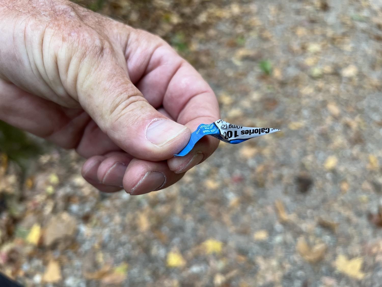
Mike Mills collects microtrash, usually the tiny end of a wrapper/Jennifer Bain
The Buffalo National River drew a respectable 1.5 million visitors in 2020. While people didn’t have to pay entrance fees, they did pour $66.3 million into nearby communities.
“Two, four, six cars,” Mills said when we pulled up to the Lost Valley trailhead and took stock of the parking lot on a dreary Monday morning with a looming downpour. “My rule of thumb is if there’s more than six cars I don’t go. I like to be more alone on the trail.”
Lost Valley Trail isn’t technically lost or a valley but rather a hollow that follows Clark Creek upstream into a narrow box canyon. The 2.5-mile hike punches above its weight with scenic rock formations, a natural bridge, caves, waterfalls and a beech grove.
But the creek flows underground for much of the year and I didn’t get to see it (something that would soon become a recurring theme). Mills, who is both a former marine and a former director of tourism for the state, did help me scramble through a rocky “natural bridge” and revealed how to get the most out of Cob Cave by climbing into it instead of just admiring it from the entrance.
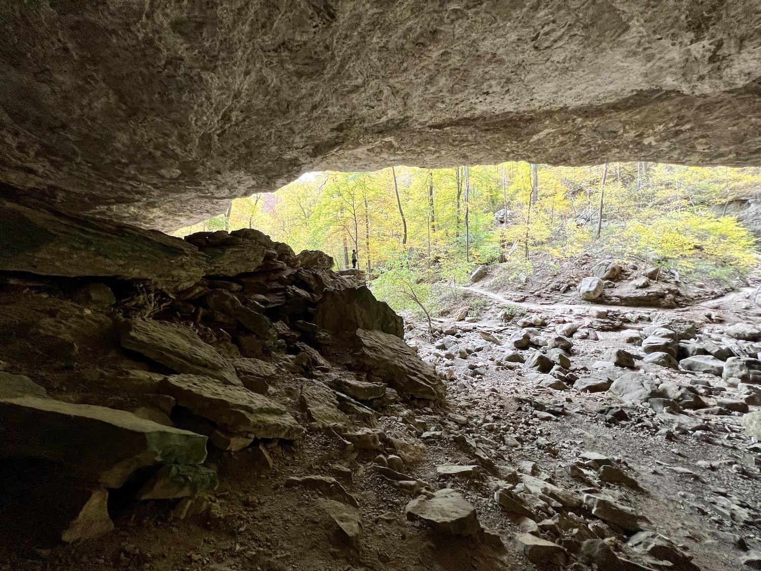
You have to go to the back of Cob Cave (which is more of a rock shelter) to grasp the depth of it/Jennifer Bain
“I always stress go to the back of Cob Cave because you don’t understand how big it is from down there,” he said. “You don’t know how big it is until you’re back here.”
People have long found shelter under this massive overhang, which Branstetter described as more of a rock shelter than a cave. University of Arkansas archaeologists led by state museum curator Sam Dellinger found tiny corn cobs and fragments of sandals, bags and baskets here in 1931. The cobs were 2,000 years old and proved that Native Americans used this space long before settlers arrived.
Arkansas (“the Natural State”) and neighboring Missouri (“the Cave State”) are both full of caves. At the Buffalo National River, the caves at Lost Valley and the Indian Rockhouse at Buffalo Point are open to the public, but the rest are closed due to White Nose Syndrome, a fungal disease that has decimated bat populations.
Just steps past Cob Cave is Eden Falls, which is usually a spectacular series of waterfalls plummeting over limestone bluffs. People typically climb 276 rock steps to the Eden Falls Cave and then crawl 200 feet into a large, dark room with an underground waterfall. But the region was plagued by drought this year and the waterfalls weren’t running in October.

These grooves along the edge of Lost Valley Trail are likely evidence of feral hogs rooting through the decaying leaves for food/Jennifer Bain
Instead, I pondered the existence of feral hogs after spotting long, deep grooves along Lost Valley Trail where one or more hogs had recently rooted for grubs and worms.
It was an unusual sight along this particular trail and one that reminded Mills that he wanted to share some of the changes he has witnessed here in the last half century. “Well, if you want to go back 50 years ago, there were no armadillos, there were no hogs and there were no road runners,” he said. “All of those were south of here — Texas, Louisiana, southern Arkansas. In the last 50 years they have all migrated from the south into the Ozarks.”
Hogs are dangerous but generally nocturnal so I never did see one.
Standing on the Ponca low-water bridge, Mills and I talked about what it was like to live here before a proper bridge and highway were built, and how replacing gravel roads with paved roads makes a world of difference to a person’s vehicle maintenance bills.
“The Buffalo is a fairly small park and its needs are often overlooked,” Mills lamented.
Barnstetter didn’t disagree, admitting there are a number of deferred maintenance projects and “it would be wonderful to have funding” to put a dent in the backlog.
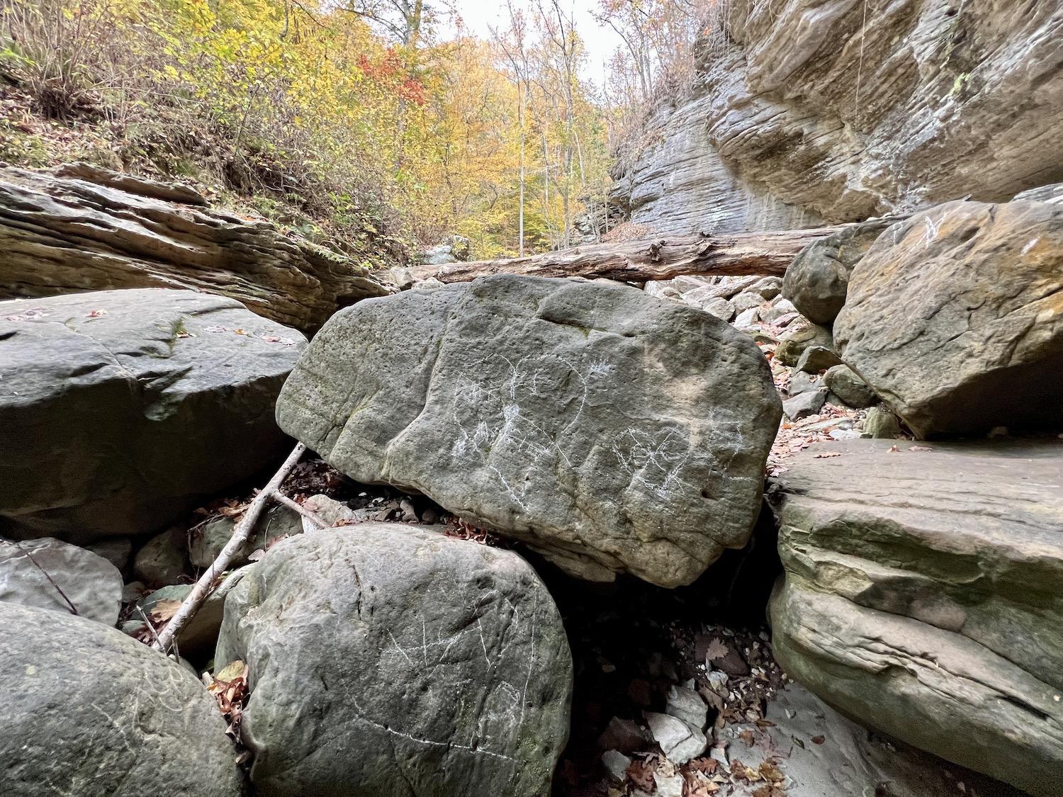
People are still compelled to scrawl graffiti in the Buffalo National River, although it's illegal/Jennifer Bain
Canoe rentals used to be a mandatory two days from Friday to Sunday, but now most people want single day rentals and are likely to cancel at the hint of rain or bad weather. Mills attributes this to “the softening of society.” Fifty years ago, gas was 40 cents a gallon (now it’s $4) and wages were $1.60 an hour (now they’re $15). Mills used to rent canoes for $12 a day — now he charges $100.
The Buffalo Outdoor Center (BOC) is concessioned to take canoes and shuttles into the park, but its cabins, lodges and center (with an office, retail store, deli and gas pump) are just outside the boundaries. Recreational kayaks have become popular in recent years and so have six-person paddle rafts that let people without great canoe skills enjoy the Class I and II river when the water is high.
“The number of people put on river now is the same, but the method is diversified so it’s safer,” concluded Mills, who is one of about 15 concessioners. Of course he's partial to the upper district, where canoe season runs March to June, but he concedes the season can run year-round in the middle and lower sections.

A distant view of the river from the Overlook Trail at Buffalo Point in the middle district/Jennifer Bain
“The majority of the visitation happens in this upper river even though Buffalo Point has a much longer season,” Mills pointed out. “Geologically this is the drama right here. You have the highest waterfall in middle America. The highest bluff in middle America. The best hiking trails. Up here you just go from one bluff to another to another. You have left the Boston Mountains and entered the Springfield Plateau geologically, so the scenery weakens at Erbie.”
The BOC’s most popular float is 10.7 miles from Ponca to Kyles Landing. Over four to six hours, it showcases Big Bluff and the Hemmed-in-Hollow waterfall, which are both the tallest of their kind between the Rockies and the Appalachians.

One of the river crossings (subject to water levels) in the upper district of the Buffalo National River/Jennifer Bain
The single biggest thing that has influenced what happens on the Buffalo River and in the Ozarks? Not politics, according to Mills. “People taking their pictures at Cob Cave or the waterfall or and posting that and then their friends wanting to duplicate them."
Visitors typically drive here from nearby states. Branson, Missouri, and Eureka Springs, Arkansas serve as gateways to the Buffalo National River. They’re each about an hour away and places I explored during a fall whirl through the Ozarks.
With more than 40 live performance theaters, Branson likes to boast that it has more seats than Broadway. Artsy Eureka Springs is famously full of historic Victorian homes and the haunted 1886 Crescent Hotel & Spa (one of the Historic Hotels of America, a program for the National Trust of Historic Preservation). More importantly, it's known as an LGBTQ oasis within the Bible Belt. There’s also a 67-foot-high Christ of the Ozarks statue on the expansive grounds where The Great Passion Play has been performed outdoors since 1968.
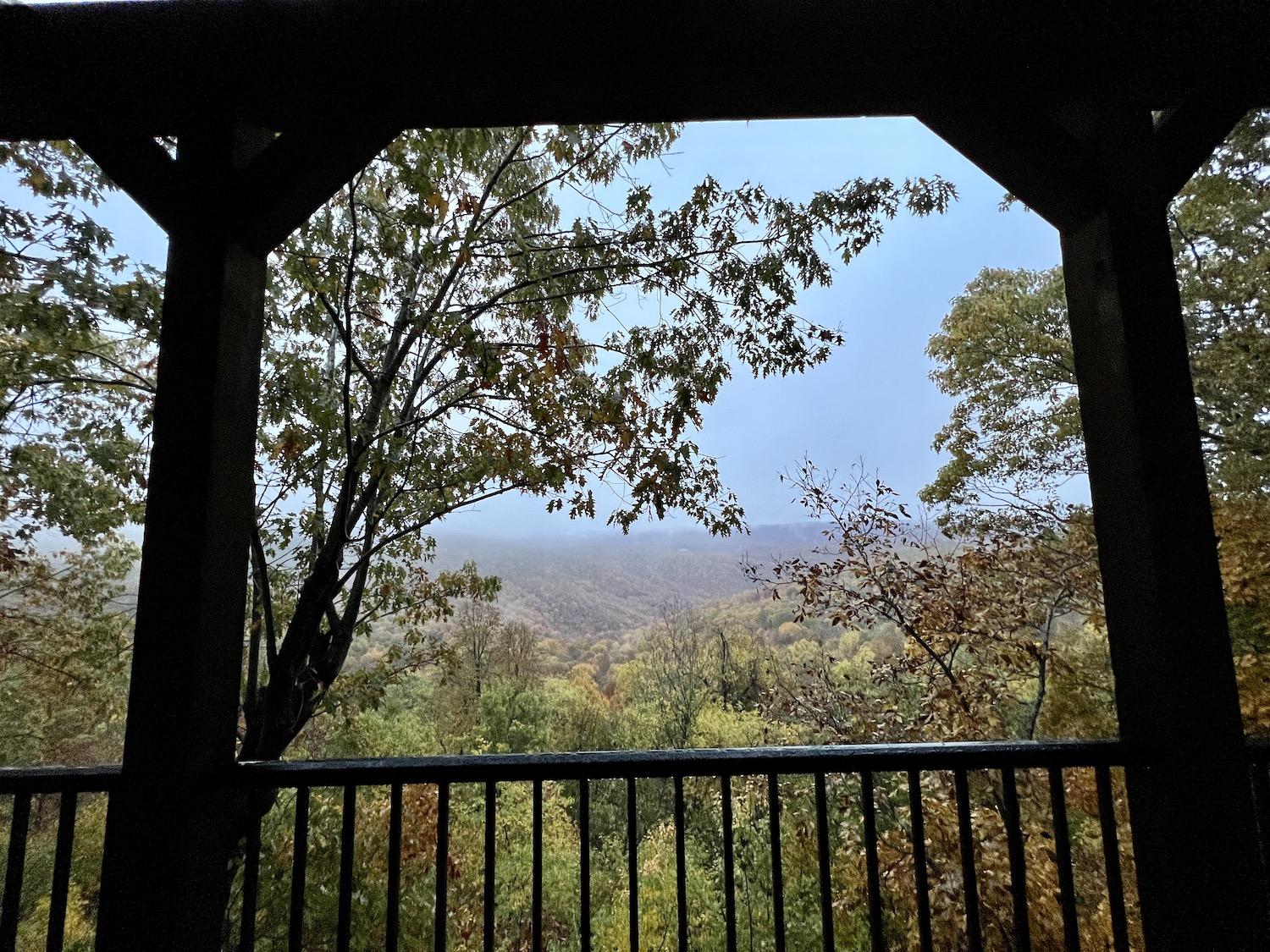
The view of the Buffalo River wilderness from the Buffalo Outdoor Center's Foxfire Cabin/Jennifer Bain
Ponca, population 10, is more my speed and I spent a night in one of the BOC’s newer mountain-top cabins with sweeping views of the Buffalo River wilderness, reading The Buffalo River Handbook by Kenneth L. Smith.
Ponca began as a booming mining camp around the turn of the century as Ponca City, Oklahoma residents invested in a lead and zinc mining operation. Ponca Camp, as the community was first known, swelled to more than 300 people by 1916.
Now the locals are vastly outnumbered by the Rocky Mountain elk. They were native to the Ozark hardwood forest, hunted into extinction by the 1840s and reintroduced by the Arkansas Fish and Game Commission in 1981. An initial herd of 112 has grown to 600 that feasts on field grasses in the Boxley Valley south of Ponca when it’s cool and moves into the shady forest when it’s warmer and young tree leaves appear.
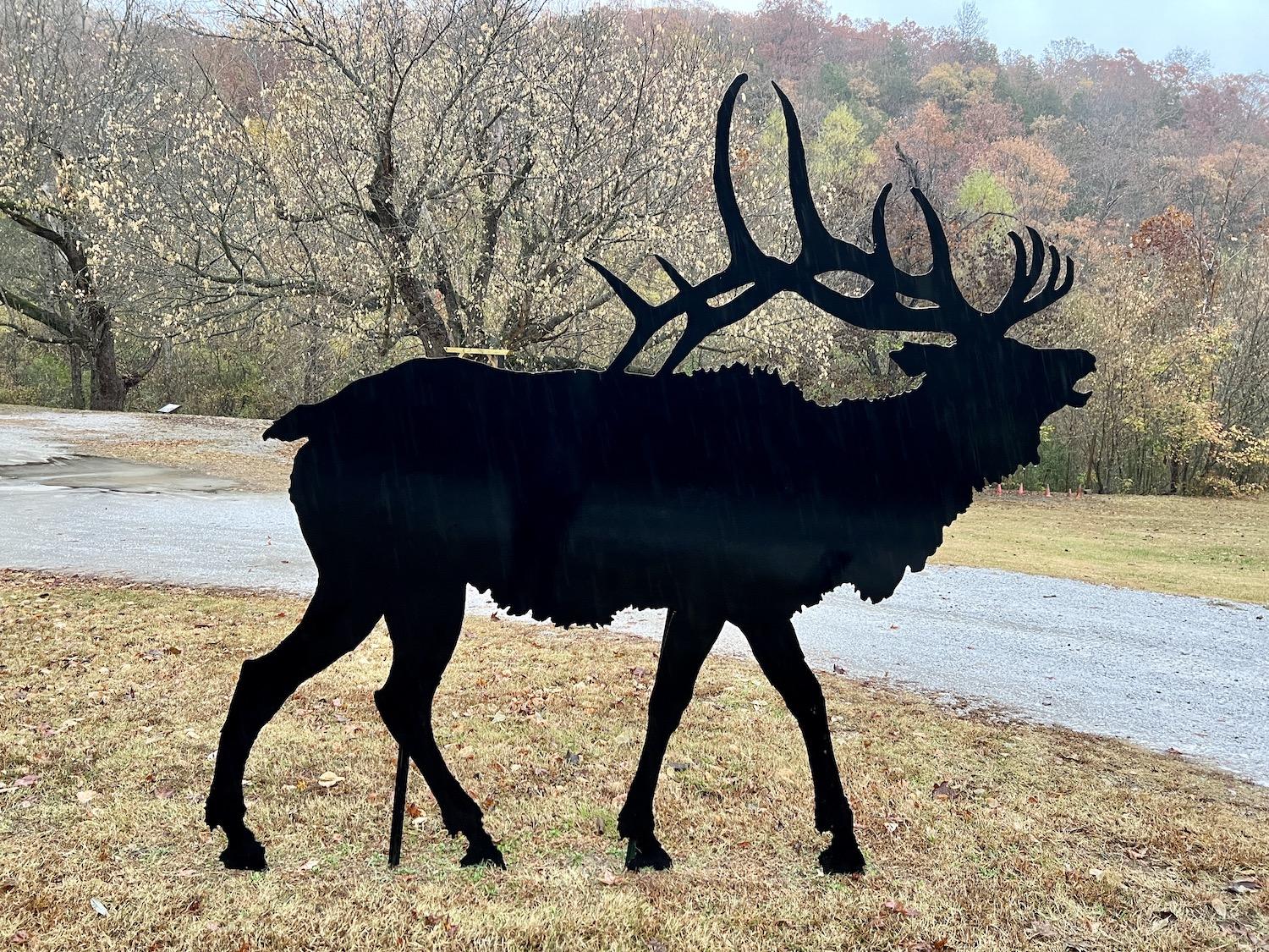
The only elk I spotted was at the Ponca Nature Center and made of steel/Jennifer Bain
During the September/October rut and in winter, elk can sometimes be seen all day long but the best time to spot them is at dawn and dusk. They live within the Buffalo National River but are usually spotted in fenced pastures that are either privately owned or leased for livestock or hay production. People are advised to watch from their vehicles after safely pulling off the two-lane highway.
I struck out on the elk front that first night and the next morning, and the Ponca Nature Center was closed so I couldn’t delve more deeply into the elk. The plus side of shoulder-season travel is escaping the crowds. The downside is the closures.
But I did get to wander through the Parker-Hickman Farmstead near Erbie and learned Alvin Parker and his brother arrived from Tennessee in the late 1830s and built a home from red cedar trees, joining the hand-hewn logs with half dovetail notches. The last owners — the J.D. Hickman family — lived on the farm from 1912 to 1978 and added a series of outbuildings.

You can walk right into the Parker-Hickman Farmstead from the late 1830s/Jennifer Bain
It rained most of my second day at Buffalo National River, and so rather than attempt hikes on my own, I drove the park from west to east to see more heritage buildings.
In Ponca, that meant seeing the ruins of Beaver Jim Villines’ boyhood home through a safety fence. The renowned trapper was born here in 1853 after his pioneer family settled in the area. Descendants later used the modest house — with its notched and hand-hewn logs — as a barn.

You can only admire the boyhood home of "Beaver Jim" Villines from afar because the structure isn't stable/Jennifer Bain
In the middle district, Gilbert ("the coolest town in Arkansas" because of its weather) is a favorite of Josh Isaacs from Branson’s Full Throttle Fishing Adventures, who took me crappie fishing on Bull Shoals Lake just over the border in Missouri. “Gilbert is just a place that I like to go, rent a canoe and camp,” he said nonchalantly. He volunteers with a search-and-rescue team, work that sometimes takes him to the Buffalo National River.
I was eager to see the artificats displayed in the Gilbert General Store (another approved canoe concessioner), which was established in 1901 and is listed on the National Register of Historic Places. But naturally it was closed, so I walked down to the Buffalo River instead and quietly pondered the low water levels.

The Collier homestead in the Buffalo National River's middle district dates back to the 1930s/Jennifer Bain
The Tyler Bend Visitor Center was also closed (Tuesdays and Wednesdays this time of year), so I poked around the Collier Homestead and learned from the interpretive signs that Solomon and Ida Mae Collier brought their children here from Kentucky in 1928 for a new life. They staked a claim on these 40 acres in 1931, hewed logs for a house and smokehouse, split shingles for the roof, tilled and planted the fields, and foraged for medicinal plants.
“On this farm you can see some of the American Dream of the 1800s-1900s,” a sign explained. “The 1862 Homestead Act made it possible for any family willing to work hard in tough frontier circumstances to own land `free and clear.’”
Finally, I made it to the lower district at the eastern end of the park. I hiked the short Overlook Trail for a panoramic view of the river and then headed out to the remote Rush Historic District for the Morning Star Mine Interpretive Loop Trail.

Fences keep visitors at a safe distance from old buildings in the Rush Historic District/Jennifer Bain
From the 1880s to the 1930s, Rush boomed with the disccovery of zinc carbonate ore. The first ore discovery was made at the Morning Star Mine, named by claimholder Jim McCabe for the moon’s early morning position over the mine.
There was nobody around to chat with but signage explained that the ghost town of Rush stands as mute testimony to the activities of a bygone era." The population peaked between 1914 and 1917 when more than 5,000 people lived and worked here and the war-time demand for zinc munitions products (bronze and brass shell casings) tripled the value of zinc. But the boom ended with the war and the mines were abandoned.
Just before the Morning Star Mine trail stood the remains of five buildings that were used as homes, a general store and a post office until the 1960s. They were off-limits so I respectfully admired them from afar, heeding the sign that said: “Walking in or near the buildings could be hazardous to you and accelerate their demise. Please help to preserve these historic structures by viewing them from a distance.”

This burst of color, on a dreary fall day, comes from the inedible and fallen fruit of the Osage orange tree/Jennifer Bain
On a dreary day, as the fall colors faded and the rain came down in bursts, several bumpy, lime green balls lying on the ground near the ruins jumped out. The "freaky fruits," as park staff described them in a Facebook post, had fallen from the Osage Orange tree (Maclura pomifera). They're not actually oranges and are considered inedible because of their latex secretions and woody pulp, but squirrels and deer love the small seeds inside them and Osage Nation members once used the tree’s wood to make bows.
As I drove north to bustling Branson, I decided it was okay that so much of the Buffalo National RIver was closed, off-limits or devoid of visitors on two rainy weekdays near the end of its birthday year. The major celebrations were over but I got to privately celebrate the solitude in a slice of Arkansas that has been allowed to stay free and wild, just as Mother Nature intended.

 Support Essential Coverage of Essential Places