
Location of Channeled Scablands points of interest, Ice Age Floods National Geologic Trail / Google Maps
If you’ve followed Part 1 and Part 2 of my explorations along the Eastern Washington portion of the Ice Age Floods National Geologic Trail, then you will have viewed images of giant current ripples, coulees miles across with basalt walls reaching 100 feet (30 meters) or more high, the site of an ancient waterfall that dwarfed Niagara Falls, and vast scoured & scraped vistas within an area known as the Channeled Scablands, created 18,000 – 13,000 years ago when colossal Ice Age floodwaters coursed through parts of Montana, Idaho, Washington, and Oregon.
In this Part 3, I’ll show you yet another Channeled Scabland landscape, one that is not only a part of the Ice Age Floods NGT, but a National Natural Landmark as well: Drumheller Channels National Natural Landmark.

Plaque at the Drumheller Channels National Natural Landmark view area, Ice Age Floods National Geologic Trail / Rebecca Latson
According to the National Park Service, a national natural landmark (NNL) is so named because it contains “outstanding biological and geological resources…designated … for their condition, illustrative character, rarity, diversity, and value to science and education”
In his book Washington’s Channeled Scablands Guide, author John Soennichsen writes “geologists now consider the Drumheller Channels to be the most spectacularly eroded area of its size in the entire world … the epitome of geologic chaos.” When you stop for that first view of Drumheller Channels scenery at the official overlook some miles outside of Royal City, Washington, you’ll agree it looks chaotic. This classic “butte-and-basin” panorama is home to basins, giant potholes, basalt buttes anywhere from 50 to 100 or more feet tall, and a maze of twisting, turning channels, some of which dead end, some of which are water-filled.

A first look at the "butte-and-basin" channeled scablands of Drumheller Channels National Natural Landmark, Ice Age Floods National Geologic Trail / Rebecca Latson
Picture in your head a braided river, with a network of water-filled channels separated by islands and sand bars, all weaving toward and away from each other. Drumheller Channels acted as an eight-to-twelve-mile-wide route for this braided, “broad cascade” of Ice Age floodwaters traveling at speeds up to 65 miles per hour (almost 105 km per hour) while eroding the surrounding topography and ferrying rich, fertile soil to other locations. Standing at the NNL overlook today, you can see this jig sawed swath of land bordered on either side by orchards, vineyards, and farmland, thanks to the Columbia Basin Project.
While quite a bit of Drumheller Channels may be viewed from the comfort of your air-conditioned car along well-maintained gravel roads, you should get out of your vehicle and onto the web of trails to really explore this NNL. Granted, these trails consist of faint jeep tracks or single-track paths sometimes looking like no more than tamped-down grass, but follow one of those trails and it might lead you right up to, and on top of, a basalt rock butte buttressed by walls of hexagonal basalt columns like Lady Finger cookies decorating the sides of an elongate cake.

Fortress walls of columnar basalts, Drumheller Channels National Natural Landmark, Ice Age Floods National Geologic Trail / Rebecca Latson
Have your camera or smartphone handy for capturing videos of birdsong-filled panoramas and photos of the trails, themselves. The trails make lovely leading line shots (my favorite photo theme) beckoning your audience to follow along your adventure. Oh, and be observant of your surroundings, not only for photo ops, but for rattlesnakes.

The narrow trail to a butte rimmed with basalt columns, Drumheller Channels National Natural Landmark, Ice Age Floods National Geologic Trail / Rebecca Latson
It’s those unique features of buttes with columnar basalts that lured me onto the Drumheller Channels landscape during one of my two half-day outings within this NNL. Hefting a camera pack and a tripod serving double duty as hiking staff, I followed the thin line of a trail to ultimately stand atop these photogenic columns while viewing the panorama below and beyond.

Columnar basalt tops and the scenery beyond, Drumheller Channels National Natural Landmark, Ice Age Floods National Geologic Trail / Rebecca Latson
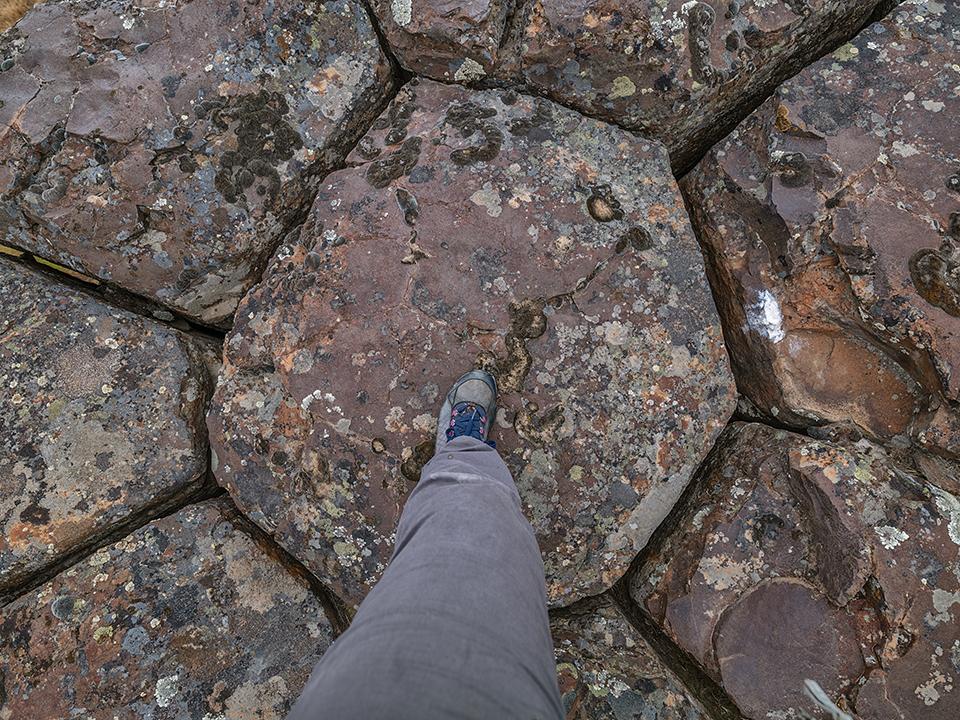
Standing atop columnar basalts, Drumheller National Natural Landmark, Ice Age Floods National Geologic Trail / Rebecca Latson
After turning onto the gravel road toward Crab Creek Marsh Unit #3 and driving approximately one mile, there is a pullout on the right side of the road, next to the main trail toward the butte (FYI, there is no sign marking the trailhead). While that YouTube video doesn’t detail getting to the butte top, I found a narrow trail leading to a cleft at the far end of the butte. Thankfully for me, rock-climbing skills were unnecessary, although that first bit of trail from ground level to butte top was a little steep for my short legs. I did it, with camera bag and tripod, so I’m pretty sure you can do it too, and you should, because once on top, you’ll marvel at the vistas and the feeling of standing upon landscape scraped clear of soils possibly hundreds of feet thick by floodwaters taller than that butte, surging through the area tens of thousands of years ago.
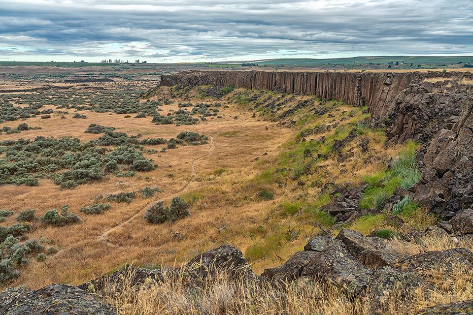
The landscape below and beyond the butte, Drumheller Channels National Natural Landmark, Ice Age Floods National Geologic Trail / Rebecca Latson
As luck would have it, the morning during my first trip out there provided wonderfully moody clouds – perfect accoutrements to already-interesting imagery. Photographers love clouds, so don’t ever let an overcast sky prevent you from a day’s exploration with your camera.
After many shots of basalt columns and the scenery beyond from my particular perch, I hiked across to the butte’s other side for wide-angle and telephoto shots of the panorama beyond. From there, I realized how much my view of the topography depended upon my perspective. From ground level, I gazed up the heights of butte walls and down into the depths of basin channels. Looking out from butte-top level, however, nothing appeared quite as tall or as deep. So, when you are out there, make sure you photograph this chaotic NNL landscape from both high and low vantage points.

Drumheller Channels landscape, Drumheller Channels National Natural Landmark, Ice Age Floods National Geologic Trail / Rebecca Latson
I eventually drove the remainder of the gravel road to the Crab Marsh Unit #3 parking area and wandered along the wide swath of mowed grass and reeds, listening to the fast flow of Crab Creek mixed with birdsong.

The green oasis of Crab Creek Marsh Unit #3, Drumheller Channels National Natural Landscape, Ice Age Floods National Geologic Trail / Rebecca Latson

The mowed reed and grass trail through Crab Creek Marsh Unit #3, Drumheller Channels National Natural Landmark, Ice Age Floods National Geologic Trail / Rebecca Latson

The landscape along the Crab Creek Marsh Unit #3 Trail, Drumheller Channels National Natural Landmark, Ice Age Floods National Geologic Trail / Rebecca Latson
Returning to my vehicle, I checked for ticks and found three on my pants legs. Spring and summer on the dry, grassy terrain of Eastern Washington mean ticks will literally be waiting with open arms to latch onto the unsuspecting hiker. To protect yourself from these pesky hitchhikers, spray your clothing with a tick/mosquito repellant like Sawyer Products Premium Permethrin spray-on insect repellent (available from Amazon). I use this on my field clothing (including my photo vest) and it works well ... when I remember to apply it, that is.
The following weekend, the plan for my second half-day visit involved driving into the heart of this NNL, much of which is within the Columbia National Wildlife Refuge. In addition to the general intention of photographing more Drumheller Channels landscape, my main goal for that trip involved hiking to a unique giant pothole, a photo of which I’d seen in one of my guidebooks and wanted to inspect for myself. Yes, a giant pothole.

A satellite view of the trail to a very large pothole, Drumheller Channels National Natural Landmark, Ice Age Floods National Geologic Trail / Google Maps
Ever heard of a “kolk?” I had not until reading about them in the Washington State Department of Natural Resource’s online publication describing Drumheller Channels. Kolks are vortices (whirlpools) occurring in “high-energy flow environments” that drill down and “pluck out pieces of rock from the streambed and ground out deep, rounded holes now exposed in the dry canyons (coulees) of the Channeled Scablands.”
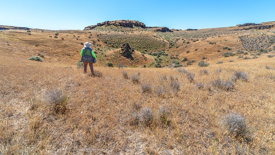
One heck of a pothole, Drumheller Channels National Natural Landmark, Ice Age Floods National Geologic Trail / Rebecca Latson
To capture the entirety of one of these giant potholes, you need a wide-angle lens. My 16-35mm lens did well enough, but my 14mm lens turned out to be the winner for this particular photo op. I included myself in this shot for scale. Even with me in it, it’s still difficult to really fathom just how large a pothole this is. Must have taken one heck of a kolk to pry the stones and soils out. Even then, that rocky area you see in the middle of this pothole was too solid and solidly emplaced to erode away or pluck out.
Traveling through Drumheller Channels / Columbia National Wildlife Refuge, you might think it’s all pretty dry, dusty and hot. Then, you round a corner and discover a breezy green “oasis” serenaded by frogs, insects, and birds, or even the white cascade of a small waterfall in the distance! Many oases pockmarking this NNL are seasonal, drying up in the heat of the summer. This reminds me to remind you to bring along plenty of water for your explorations. There are no services within the depths of this NNL / wildlife refuge and the dry Eastern Washington atmosphere sucks out the moisture before you realize it.

An oasis along a dusty, dry gravel road, Drumheller Channels National Natural Landmark, Ice Age Floods National Geologic Trail / Rebecca Latson
As you drive those gravel roads around buttes, basins, and green & golden marshes above a wide-open sky, don’t forget to stop, get out, and capture a leading line shot of the roads on which you travel. And keep that negative space (the sky) in your compositions, too, because it accentuates the vastness of the land.

The view down that gravel road through Drumheller Channels National Natural Landmark, Ice Age Floods National Geologic Trail / Rebecca Latson
Don't neglect the vegetation you see as you explore butte, basin, and oasis.
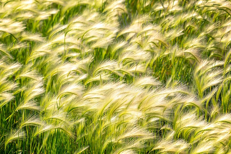
The feathery beauty of foxtail barley grass, Drumheller Channels National Natural Landmark, Ice Age Floods National Geologic Trail / Rebecca Latson
During spring and summer, morning light arrives early, giving way to harsher light by 10 a.m. Photographers must deal with what they are given, and I dealt with the harsh light by using a circular polarizer (CPL) to add a little color intensity, reduce glare on the water, and mitigate atmospheric haze. FYI, while editing your landscapes, you might also try that dehaze tool or slider that many, if not most, photo editing programs now provide.
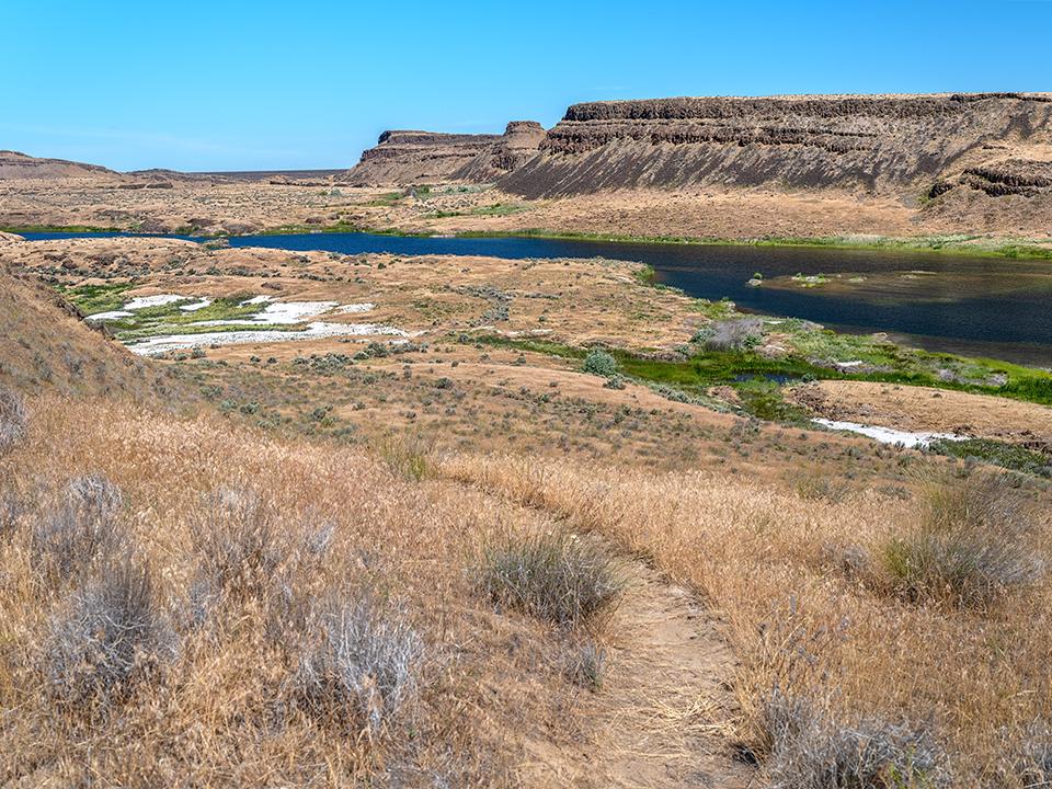
A view of Blythe Lake while heading down the trail from the giant pothole, Drumheller Channels National Natural Landmark, Ice Age Floods National Geologic Trail / Rebecca Latson
While I accomplished the things I specifically wanted to do and see within the two half days spent exploring Drumheller Channels, there really is plenty more to see than what you read here. Hopefully, this article will tempt that adventurous, photographic spirit of yours to come on over to Eastern Washington and check out the Channeled Scablands for yourself.
Before I forget, 2022 marks the 60th anniversary of the National Natural Landmarks Program. There are many NNLs out there in whatever state you live. Here, in Washington state, there are 18 NNLs, so you may also see a future photo article or two about them in addition to another article or two about the Ice Age Floods NGT.

Becky standing atop some columnar basalts, Drumheller Channels National Natural Landmark, Ice Age Floods National Geologic Trail / Rebecca Latson
Note: Rangers are out and about at Washington state parks and other public lands requiring a Discover Pass – especially during long holidays. While you might not need a pass to park at areas within the Columbia National Wildlife Refuge, you should still know the regulations and requirements . It might also be a good idea to go ahead and purchase a $10 day pass or $30 annual Discover Pass online at https://www.discoverpass.wa.gov/ just to play it safe while ensuring you have a pass to see all the cool spots in Washington state along the Ice Age Floods NGT.
References
To help me find my way around the area, the publications and websites below proved extremely useful, with the two books listing hikes and auto tours in addition to other interesting details and information about the Channeled Scablands landscape.
Bruce Bjornstad, On the Trail of the Ice Age Floods (Washington), 2017 Fourth Printing, Keokee Books
John Soennichsen, Washington’s Channeled Scablands Guide, 2012,The Mountaineers Books

 Support Essential Coverage of Essential Places


Comments
I went back quite aways in the articles & could not find the first 2 installments. Do you have a link for these ??????
Sure Russ, here you go.
https://www.nationalparkstraveler.org/2022/06/photography-national-parks...
https://www.nationalparkstraveler.org/2022/09/photography-national-parks...
Did you use the search field? It might be a little tricky to spot, but it's that magnifying lens icon on the upper right of the Traveler's Home Page. Click on that and you can type in keywords to help you with your search for any future articles.