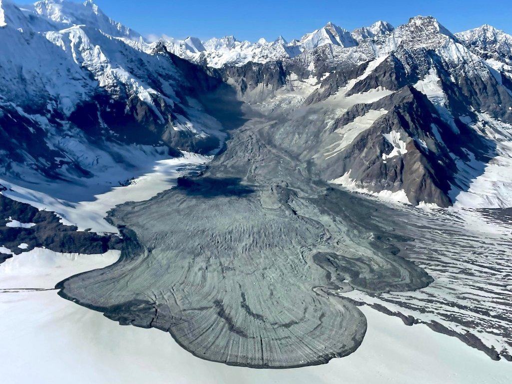
This new landslide occurred in a similar location to a massive, ~5,480-acre, landslide observed in 2016/Paul Swanstrom via NPS
As much as Glacier Bay National Park and Preserve in Alaska showcases rivers of ice, the park's landscape also has a reputation of letting go, literally, with a rush of mud, rocks, and other debris that coats glaciers from time to time.
Paul Swanstrom was flying over the park's icy landscape earlier this month when he spotted a massive landslide near the top of Lamplugh Glacier. According to park staff, the slide spotted on September 17 covered almost 2,000 acres on the glacier. While that's certainly big, it didn't come close to the size of a 2016 landslide in much the same place. That one covered 5,480 acres, according to staff.
This wasn't Swanstrom's first encounter with a landslide in the park. He has been flying over Glacier Bay for 20 years, hauling sightseers and ferrying climbers with his Mountain Flying Service company. His route from Haines and Skagway typically goes over the Johns Hopkins Glacier. Back in 2012 he spotted a landslide covering a roughly 5-mile stretch of the Johns Hopkins Glacier. That landslide coursed down an unnamed valley that descends beneath 11,750-foot Lituya Mountain in Alaska's Fairweather Mountains.
“This thing is huge. It’s 9 kilometers long, so 5.5 miles long," Dr. Marten Geertsema, a research geomorphologist for the provincial Forest Service in British Columbia, told the Traveler at the time from his Prince George office. "On the Canadian side it triggered a 3.7-magnitude earthquake. The (U.S. Geological Survey) recorded it at 3.4. That’s quite large for a seismic signal (from a landslide)."
Two years later, in 2014, a slide on February 16 occurred on the flanks of Mount La Perouse. According to Columbia University seismologist Colin Stark, that slide was triggered by the collapse of a near-vertical mountain face at an elevation of 9,200 feet. The sediment slid in a southeasterly direction, stretching across 4.6 miles and mixing with ice and snow in the process. Preliminary estimates at the time suggested the landslide involved 68 million metric tons of material.


Add comment