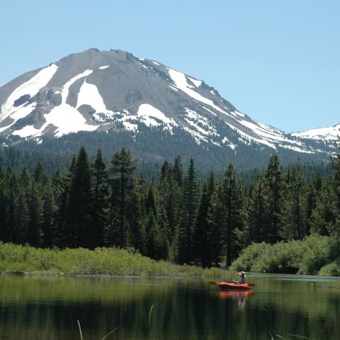
Smoke from the Dixie Fire was creating unhealthy air conditions in Lassen Volcanic National Park/NPS photo from 7-24-21
Editor's note: This updates with information from Lassen Volcanic Superintendent James Richardson.
Rain fell Tuesday in northern California, dampening somewhat the Dixie Fire and seeming to slow its movement towards Lassen Volcanic National Park, according to park Superintendent James Richardson.
“I’m sure it slowed down the fire a bit," he said by phone.
"Right up until this rain we were at the record for dryness and what we call 'energy release component' for our fuels," he went on. "That’s at the 97 percentile, where 100 percent would be almost you look at it and it bursts into flames. The fuels are that dry. If you walk in the woods, it’s just crunch, crunch, crunch. The needles and the grass and the twigs. It’s just crunchy.”
Still, the unpredictable nature of the fire prompted a ban on backcountry camping in Lassen, and the Warner Valley and Juniper Lake areas were closed to all visitors because there was only one-way in, and one-way out, said Richardson. The Drakesbad Guest Ranch in Warner Valley also was closed.
The fire, which erupted from an unknown cause on July 13, covered more than 208,000 acres Tuesday morning, and was just 23 percent contained. It was about a dozen miles southeast of the national park and had the potential Tuesday to move north -- towards Lassen -- two or three miles.
The temporary closures were intended to improve the safety of visitors and emergency responders, a park release said. In addition to the closures, park staff were warning visitors that "air quality has recently been unheathy or worse, due to the nearby Dixie Fire. Strenuous outdoor activitiy is not recommended during unhealthy air conditions."
A temporary fire restriction was in place for the park's Butte Lake Campground. The restriction was in response to extreme drought conditions contributing to severe wildfire risk and the inundation of the country's national wildfire response system. The fire restriction prohibits any open flame, including campfires and charcoal grills.
Ignition sources that can be turned off and do not produce ash are permitted. This is generally limited to devices that address basic camper needs of cooking and lighting only. Campers at park campgrounds without restrictions are asked to be especially cautious when using designated campfire pits or any open flame. Approximately 95 percent of all wildfires in California are caused by human activity.
The Pacific Crest Trail (PCT) is closed between Highway 70 and 36, south of the park. PCT through hikers are encouraged to take an alternative route to Highway 44 near Old Station to continue their journey.


 Support Essential Coverage of Essential Places


Comments
New normal? I hope not!