A new paved pathway through Pacific Rim National Park Reserve turns trees that were cleared for the project into boardwalks, railings and fences/Parks Canada
“Going in the right direction on the trail.” That’s the literal translation of the Nuu-chah-nulth name — ʔapsčiik t̓ašii — for a new paved pathway in Pacific Rim National Park Reserve, but there are layers of possible meaning. The name can refer to a person’s personal life journey or to being mindful of the environment and all living things. When the name is used collectively, First Nations Elders say “the land we walk on is made from the dust of our ancestors — in our life journey, we walk it carefully, respectfully, with humility and dignity.”
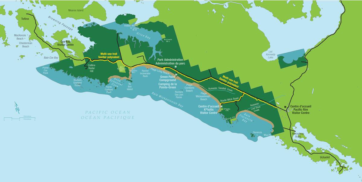
This is how Pacific Rim’s superintendent Karen Haugen explains the nuanced name chosen for a 25-kilometre (16-mile) multi-use pathway that’s being built across the park reserve’s Long Beach Unit between Tofino and Ucluelet. Pronounced “ups-cheek ta-shee,” the pathway will help people explore, boost safety for cyclists, create an alternative to motorized transport and serve as an example of an environmentally and culturally responsible infrastructure building.
ʔapsčiik t̓ašii is on the western coast of Vancouver Island in the traditional territories of the Tla-o-qui-aht First Nation and Yuułuʔiłʔatḥ First Nation. Parks Canada is working with both to ensure the pathway though lush rainforests, second-growth bogs and ocean beaches presents a cultural experience for visitors.

A map shows the pathway — marked in bright yellow — on park reserve land along a highway between Tofino and Ucluelet/Parks Canada
While about 95 per cent of the pathway is now paved, ʔapsčiik t̓ašii will remain an active construction zone until the fall. The next step will be to build the Wayii — the escarpment area overlooking Long Beach between the Green Point campground and the Long Beach parking lot. It required some geotechnical work and took a bit longer. Parks staff will also design and install information panels, rest areas and cultural information plus a Highway 4 crossing near Radar Hill Road.
A grand opening for the $51-million ($41-million USD) pathway, built by Hazelwood Construction, is slated for April 2022. The idea dates back to 2016 and construction began in 2018 after consultations with stakeholders. The pathway follows much of Highway 4 between Tofino and Ucluelet and has long been requested by local and First Nation communities and visitors. “People wanted a safe way to connect Tofino and Ucluelet, and connect to the park reserve,” says Haugen. “Now people will be able to bike and hike. This is a safe, green way.”
“Being able to smell the forest, taste the salty air, see rare species and hear the roar of the ocean is an experience beyond compare,” she adds.
Parks Canada can’t block visitors from accessing the pathway-in-progress, but warns visitors must respect Covid-19 restrictions and ensure the safety of First Nations community members. Staff are working on a visitor safety plan that considers weather, human-wildlife coexistence, finishing pathway work and maintenance requirements. It will continue to work closely with the First Nations’ administrations and the Elders Working Group as these assessments and safety measures are implemented.

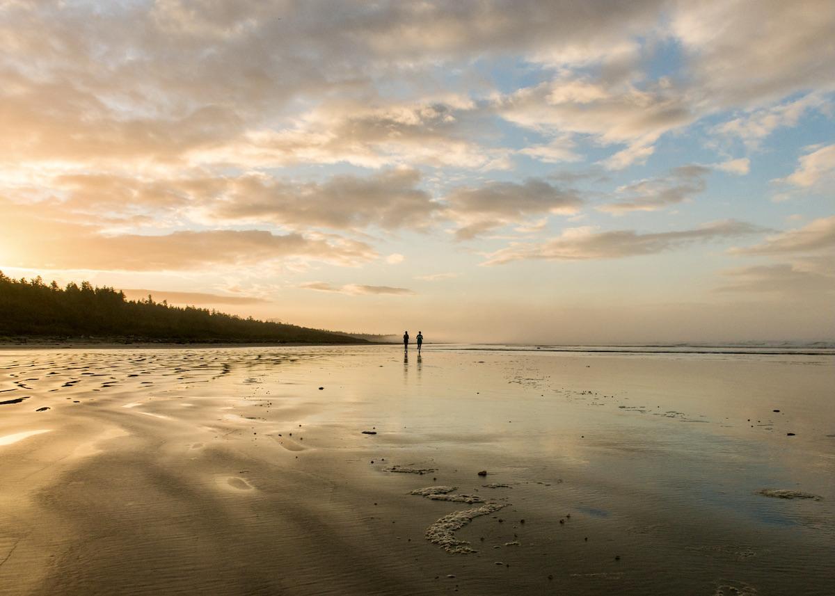
The pathway takes visitors along the Pacific Ocean/Parks Canada
“We also want to respect Covid-19 as the pathway goes right beside First Nations communities," notes Haugen. "It’s impossible to actively stop people from going there, but we are asking them to respect that it is an active construction zone. You’re using it at your own risk really.”
Parks Canada manages a national network of heritage places that celebrates the contributions of Indigenous peoples, their histories and cultures, as well as the special relationship Indigenous peoples have with lands and waters. At Pacific Rim in British Columbia, Haugen’s team, together with local First Nations, manages three separate regions of the national park reserve — the Broken Group Islands, West Coast Trail and Long Beach.
“Pacific Rim is often seen as the place that connects the people and communities in the region, and ʔapsčiik t̓ašii is the result of a vision shared by members of all the local communities, as well as visitors, for many years,” says Haugen. “Once complete, ʔapsčiik t̓ašii will offer Canadians of all ages and abilities a safe, sustainable and accessible pathway, all while protecting the ecologically and culturally sensitive environment found in the park reserve.”

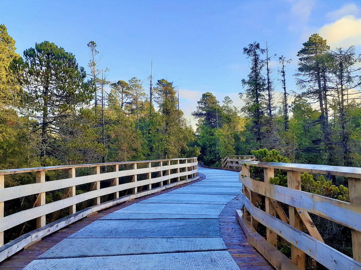
Boardwalks protect sensitive bogs/Parks Canada
The First Nations chose members of the Elders Working Group to provide important project guidance. As well as selecting the path’s name, the group has already blessed the path site, determined a route that doesn’t disturb culturally sensitive sites, and identified opportunities for economic benefits for First Nations.
“In many ways, the name speaks to the direction Parks Canada is taking to improve collaboration with local First Nations,” says Haugen. “By working together, developing ʔapsčiik t̓ašii can be a healing journey.”
The entire pathway will be paved with asphalt. It’s 3.5 metres (11.5 feet) wide and will be fenced from the highway. There are also some boardwalk sections to protect the bog. “The Elders Working Group said that what resources we took out, we put back in in some way, shape or form,” says Haugen, so expect to see wooden crosswalks and fence posts.

Two workers build an amphibian highway crossing/Parks Canada
Haugen says a Detailed Impact Analysis outlined key recommendations to limit impact to the environment through design and construction mitigation. A Watercourse Report by Current Environmental detailed construction mitigation measures to reduce the impacts of working within streams. It protects and restores fish-bearing streams with culverts installed according to fish passage criteria, and habitat enhancements implemented to offset losses.
From this document, an environmental management plan was written to outline the environmental performance standards and responsibilities to be carried out by the contractor. It identified restrictive timing windows when working around sensitive species and habitats such as salmon and salmon habitat. The Department of Fisheries and Oceans reviewed the plan and authorized work to proceed.
In a plan designed by Barb Beasley, founding director of the Association of Wetland Stewards for Clayoquot and Barkley Sounds, several amphibian tunnels were installed under the highway between Tofino and Ucluelet to help amphibians such as Northern Red-legged Frogs. The frogs, a species at risk, breed in bogs and are sensitive to urban development.

The Northern Red-legged frog needs protecting/Parks Canada, Thomas Kitchin and Victoria Hurst
There will be multiple parking lots and entry points along the pathway.
Starting in 2022, pedal assist electric bicycles will be allowed on ʔapsčiik t̓ašii. They can only provide power assistance when the bike is being pedalled and generate a maximum of 500-watt motor power. They must stop when a bike reaches 32 kilometres (20 miles) an hour on level ground. Class 2 or 3 e-bikes with an accelerator (throttle) aren’t pedal assist e-bikes and can only be ridden on roads.
Once Pacific Rim National Park Reserve and Tofino’s portion of the are complete, there will still be a roughly one-kilometre (half-mile) gap between where the park reserve’s path will end and where Ucluelet’s existing path begins. That land lies on Alberni-Clayoquot Regional District lands. Parks Canada hopes there will eventually be a full connection between the communities.

 Support Essential Coverage of Essential Places


Comments
Is there a guide to assist Englsh-speaking folks in how to properly and respectfully pronounce the names mentioned?
The amphibian crossing is cool. What about more wildlife crossings in the United States. Here's three wildlife crossings I would build immediately. Donner Pass over I-80, I-70 near Vale in Colorado, and I-40 in Pigeon River Gorge.
I was able to get the pronounciation for the main pathway and so “ups-cheek ta-shee" is noted in the story. But I didn't do that for the various First Nations. The community of Ucluelet is "You-clue-let." Hope that helps a little.
Here's a start, Rick:
https://www.first-nations.info/pronunciation-guide-nations-british-colum...
Thanks - I bookmarked that page.
Hi Rick, FirstVoices.com is a great resource to learn how to pronounce indigenous languages. The Nuu-chah-nulth language page is here: https://www.firstvoices.com/explore/FV/sections/Data/Nuu-chah-nulth/Nuu%...(Barkley).
You should be able to find many of the words on here, and a general guide to pronouncing Nuu-chah-nulth words.