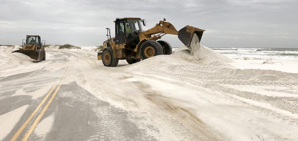
Hurricane Sally buried portions of Gulf Islands National Seashore in sand/NPS
Editor's note: This updates with the cyclone renamed as Tropical Storm Delta and with the latest forecast showing its arrival on the northern Gulf Coast earlier than previously expected.
Storm-weary Gulf Islands National Seashore, which just started to reopen areas after recovering from Hurricane Sally, could find itself in the path of another hurricane later this week.
Just this past weekend the seashore that stretches along the Gulf Coast from Mississippi to Florida reopened Johnson Beach in the Perdido Key Area and the Naval Live Oaks Area, as well as the Okaloosa Area. The three areas will open on their normal operating schedules.
Restrooms and pavilions will be open in those areas, however Johnson Beach Road beyond the main parking lot will remain closed as crews continue to clear sand and debris from the road. Additionally, the Perdido Key Discovery Trial, destroyed by Hurricane Sally, will remain closed until further notice. Entrance fees will be required at the Perdido Key and Okaloosa areas.
All areas of the national seashore were closed Saturday, September 12, ahead of Hurricane Sally making landfall on the Gulf Coast. The Fort Pickens and Santa Rosa Areas remain closed to all visitors (pedestrians, bicyclists, and vehicles). The Fort Barrancas Area remains closed due to NAS Pensacola closure.
J. Earle Bowden Way, Highway 399 between Pensacola Beach and Navarre Beach, and Fort Pickens Road were severely impacted by the storm and will not resume normal operations for several months. A timeline for road reconstruction or limited reopening is not available currently. Opal Beach remains heavily inundated with sand, but damage to facilities was limited. In the Fort Pickens Area, boardwalks, pavilions, the ferry pier, the old camp store, and all historic wooden structures were all damaged.
You can find current closure information here.
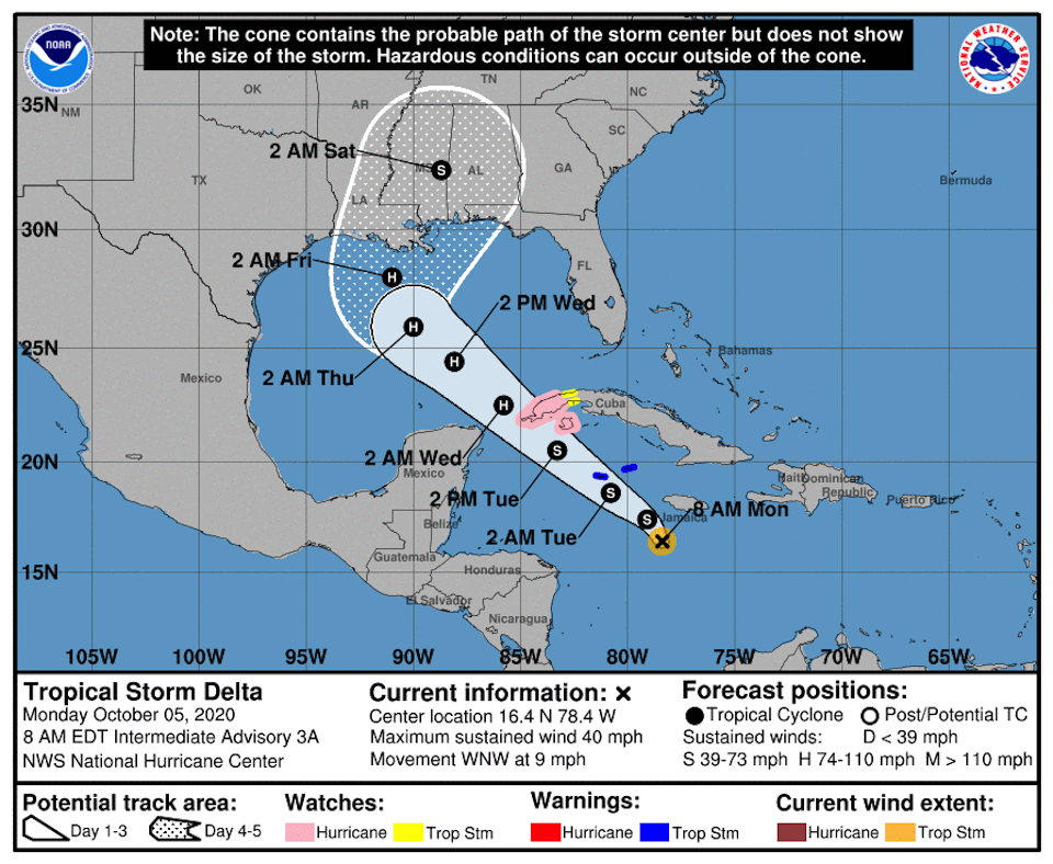
This week could again be stormy at the national seashore. On Sunday the National Hurricane Center said "Potential Tropical Cyclone 26," later renamed Tropical Storm Delta, could build into a hurricane by the time it reaches the northern Gulf Coast early Friday.
"While there is large uncertainty in the track and intensity forecasts at these time ranges, there is risk of a dangerous storm surge, wind, and rainfall hazards along the coast from Louisiana to the western Florida Panhandle," the center said Sunday.

Tropical Storm Delta was forecast to squarely hit the northern Gulf Coast early Friday/National Hurricane Center


Add comment