With Hurricane Dorian moving up the Eastern Seaboard, national parks from Georgia to North Carolina were closed and bracing for the storm.
While Everglades National Park reopened Wednesday as the hurricane had drifted too far north to impact it, parks from Cumberland Island National Seashore north to the Outer Banks Group that includes Cape Hatteras National Seashore, Wright Brothers National Memorial, and Fort Raleigh National Historic Site were closed and awaiting the storm.
"Hurricane force winds could begin as early as midday Thursday and continue throughout Friday," B.G. Horvat, chief of interpretation and public information officer for Cape Lookout National Seashore, said Wednesday. "The amount of rain we receive will largely depend on the exact track and forward speed of Dorian. Heavy wind, rainfall, storm surge, and flash flooding are possible."
The Outer Banks group of parks closed at the end of the day Tuesday. Dare County, North Carolina, officials issued a mandatory evacuation order Tuesday afternoon for all visitors to the Outer Banks within its county.
"The state of emergency includes restrictions on ocean swimming due to dangerous surf conditions and strong rip currents along the beaches. Everyone must stay out of the water as it is unsafe for even the most experienced swimmers," the order stated.
Hyde County, North Carolina, issued a similar order for Ocracoke Island.
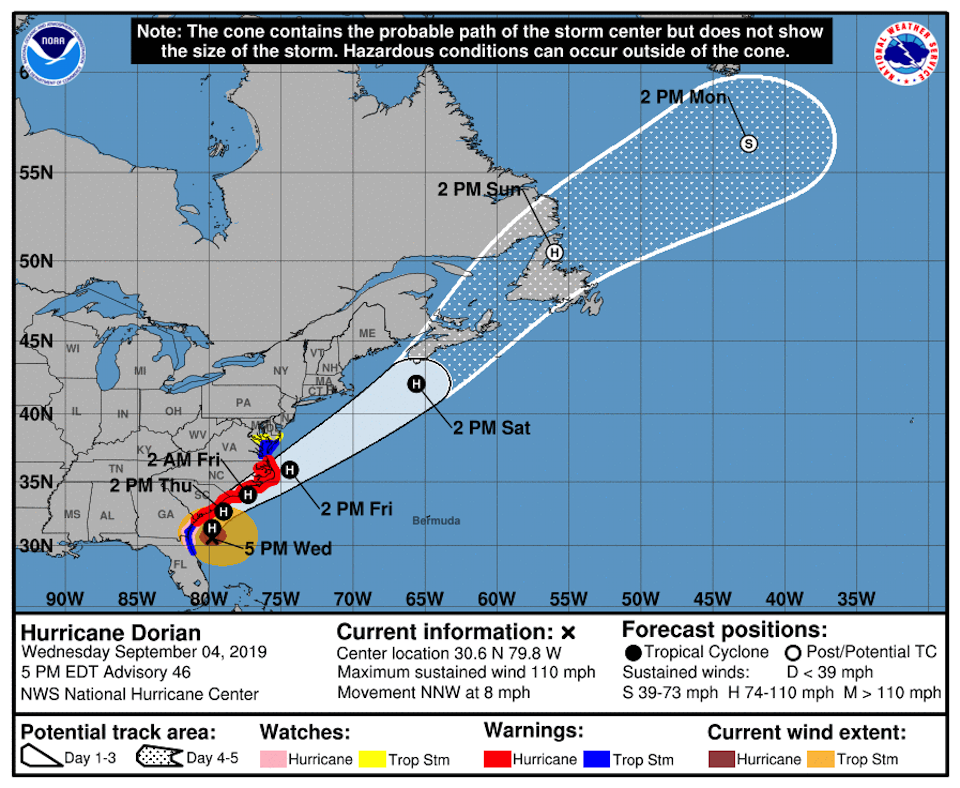
"On the forecast track, the center of Dorian will approach the coast of South Carolina tonight, move near or over the coast of South Carolina on Thursday, and move near or over the coast of North Carolina Thursday night and Friday," the National Hurricane Center forecast Wednesday evening. "Reports from an Air Force Reserve Hurricane Hunter aircraft indicate that maximum sustained winds have increased to near 110 mph with higher gusts. Some fluctuations in strength are possible tonight, followed by slow weakening Thursday through Friday."
The Hurricane Center also issued a tropical storm warning for the area from the North Carolina/Virginia border to Chincoteague, Virginia, and for the Chesapeake Bay from Smith Point southward. A tropical storm watch has been issued from north of Chincoteague, Virginia, to Fenwick Island, Delaware, for the Chesapeake Bay from Smith Point to Drum Point, and for the Tidal Potomac River south of Cobb Island.


