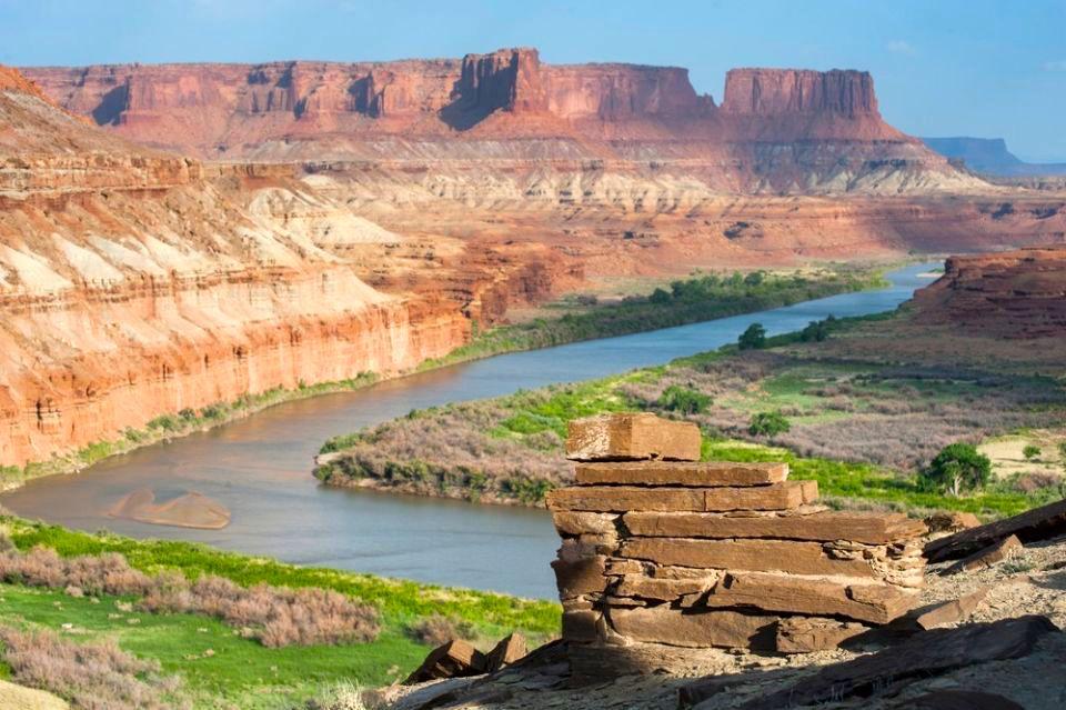
The Green River from Fort Bottom Overlook/NPS, Neal Herbert
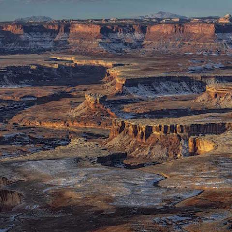
Whether you’re traveling by car or by jeep, the approaches to Utah’s Canyonlands National Park rank among the most scenic in the West. Following Utah Highway 211 down Indian Creek Canyon into the Needles District, or jouncing along a rugged backcountry route into the park’s western side, you’re witness to geologic processes acting on a vast scale.
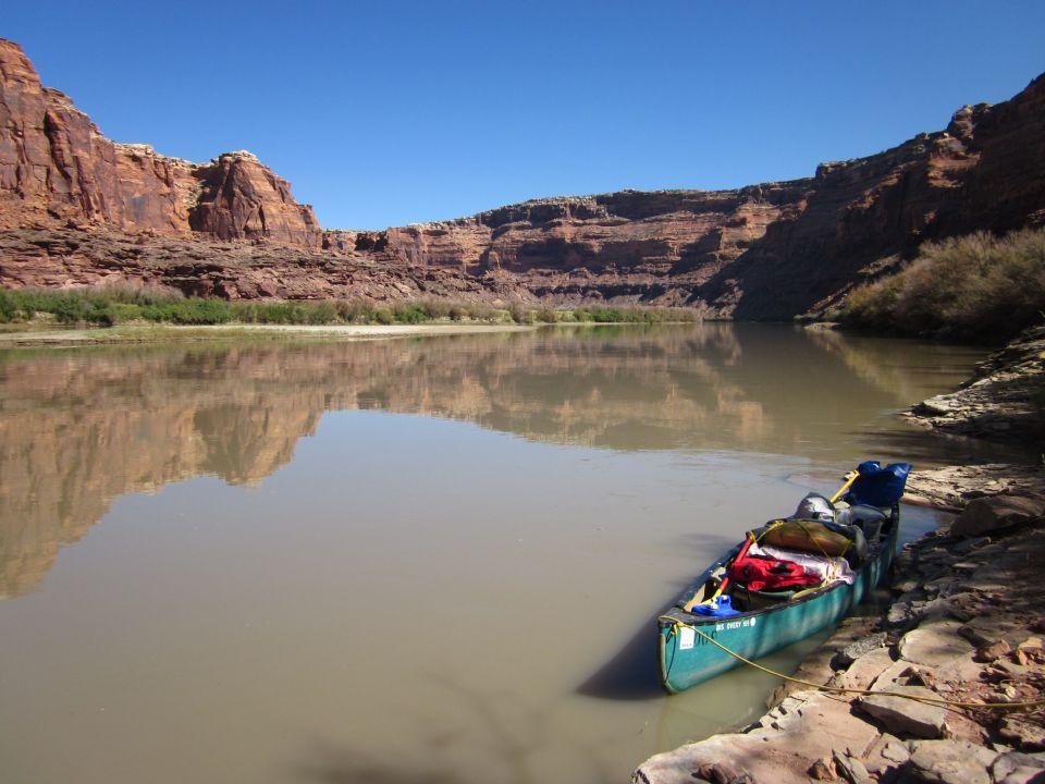
There’s another entrance to Canyonlands, though, which runs at river level, and this is the one my wife and I like best. This spring Bessann and I steered our canoe down the Green River into the northern end of the park, heading for its confluence with the Colorado River 50 miles downstream. It was a slower approach, one which let us savor the sights and sounds along one of the Southwest’s great desert waterways.
Five days earlier we’d put our boat in the river at Crystal Geyser, 70 miles upstream from the park boundary. We allotted ten days for the whole trip, although strong paddlers can do it in less time. Many boaters finish their trip at Mineral Bottom, just upstream from the park, which has road access from Utah Highway 313. This, however, omits the scenic climax that is Canyonlands.
Colin, our shuttle driver with Tex’s Riverways in Moab, saw us off at Crystal with some good words about watching the wind and keeping safe. His co-workers would meet us with a jet boat at Spanish Bottom, three miles below the Confluence, for the two-hour ride back up the Colorado River to civilization. This high-powered craft is the only way (short of bringing an outboard motor) to transport a canoe back from deep inside the park. Moab’s Canyonlands River Tours also offers this service.
Last year the National Park Service issued 570 permits for flatwater boating in Canyonlands, mostly for canoeists and kayakers floating the Green River in Stillwater Canyon. (Meander Canyon on the Colorado River can also be floated from Moab to the Confluence, but it receives somewhat less use.) Those wishing to continue on through the rip-roaring rapids of Cataract Canyon need a whitewater permit, no canoes allowed. We were content with the easy paddling on the Green, a trip we’ve made four times now.
All of our camps were “high bank,” well above the sandbars that line the river in autumn and which offer nearly unlimited camping spots. Fortunately, most of the campsites we wanted were available. Several times we shared a site with a congenial couple from Ventura, California, who were enjoying the river by pack raft, a method that is growing in popularity.

The Green River from Turks Head camp/Bessann Swanson
There’s no lottery system for the flatwater section of the Green, at least not yet, which is a welcome exception to other popular whitewater trips such as Utah’s San Juan River. You do need to obtain a permit beforehand through a Park Service website [https://www.nps.gov/cany/planyourvisit/flatwater.htm], pay a fee, and bring all required safety and camping gear, including a fire pan and waste disposal system. These measures keep the campsites and river environment attractive. The park’s river rangers stress the importance of not leaving human waste behind and avoiding cryptobiotic soil crusts. Sandbar camps are great for minimizing one’s impact, but heavy runoff this spring put them all under water.
This year’s trip came with a bonus: a chance to see one of Utah’s newest wilderness areas. North of Canyonlands, the Green River forms the eastern boundary of the 54,643-acre Labyrinth Canyon Wilderness, designated earlier this year as part of the mammoth John D. Dingell, Jr. Conservation, Management, and Recreation Act, which Congress passed in March. The west bank of Desolation Canyon, farther upstream on the Green, was also designated wilderness in this bill, and 63 miles of the river were designated under the 1968 Wild and Scenic Rivers Act. The reach of the Green we floated is designated as “scenic,” a label that certain fit. The new wilderness area, which is administered by the U.S. Bureau of Land Management, takes in notable sights such as Trin-Alcove Bend, where three narrow canyons converge at the river, and Bowknot Bend, where one can climb to a stunning vantage point of the Green flowing in two directions.
Just as swinging a backpack onto your shoulder at the start of a long hike stirs memories of previous wilderness treks, the first dip of a paddle into a wild river announces the start of another pleasant voyage. This section of the Green is demarcated into two canyons, each named by Major John Wesley Powell following his historic voyages in 1869 and 1871. (We were 150 years in following the first of these.) Labyrinth Canyon, which Powell’s party named for its huge, looping meanders, presented no hazards, leading Powell to exult that, “There is an exquisite charm in our ride down this beautiful canyon. We are all in fine spirits. We whistle or shout or discharge a pistol to listen to the reverberations among the cliffs.”

Green River in Labryinth Canyon/Fred Swanson
Bessann and I had left our pistols at home, so we sat back and listened to the Canada geese as they protested with loud honks our drifting through their waters. Great blue herons lifted off from the bank with stately wingbeats, while overhead a golden eagle soared alongside the cliffs. As afternoon shadows lengthened, we searched the bank for a break in the tangle of tamarisk and willow, finding a small bench on which to pitch our tent. Further on, the campsites grew steadily more scenic.
A dozen miles of Labyrinth Canyon’s east bank are accessible to off-road vehicles, thanks to a dirt road that reaches the river at Spring Canyon. This brings considerable ATV and dirt bike traffic to part of the river corridor. We were glad to leave their echoing noise behind as we entered Canyonlands on day five, fighting an afternoon wind which presaged a spring storm. Wind is the canoeist’s biggest hazard on the Green, and at the first sign of an approaching squall we put in to shore. It’s remarkable to see foot-high waves moving upriver, driven by thunderstorm down-drafts. The storm passed by and we ventured on to Hades Camp, named either for its exposure to the sun or the broken-down cliffs of shale which surround it. Another storm brewed up as we pitched the tent, and I checked the guylines before disappearing inside. We emerged the next morning from a soaked tent to witness a refreshed, glistening world.
The river gives one the sense of a geologic cyclorama, revealing new vistas with every bend. By now we were deep within the Permian crust of Canyonlands, as revealed in the striking layers of White Rim and Cedar Mesa sandstones. These form continuous cliffs in many places, but at one looping bend of the river, a remnant of the White Rim sits turban-like atop a softer layer, forming the aptly named Turks Head. It watches over one of the most attractive campsites on the entire voyage.
Ancient remnants of Puebloan people, including granaries, stone dwellings and rock art, appear here and there in overhangs and on isolated boulders. Wildflowers were beginning to paint the slopes, too, including the deep-red claret cup cactus. We wished we could return in mid-May, when whole gardens of prickly pear and beavertail cacti would be in bloom.
Cruising on the swift current made the miles go by easily, except for one afternoon when we encountered the notorious upriver wind that often rages on clear days in spring. This time there was no place to land, so we stuck close to shore, digging hard with our paddles. Camp came as a relief that evening. We awoke to a clearing sky and a light northerly breeze, the southbound canoeist’s best friend.
Rivers have long been travel corridors, so there was human history to see along the way, from pictographs and petroglyphs left by ancient inhabitants to the unusual inscriptions left at several points on the river in 1836 by the trapper Denis Julien. There are cabin remnants such as the one perched above the river at Fort Bottom, but generally these remote canyons proved to be too much for even the hardiest Mormon farmer. At Anderson Bottom, a mile-long former sandbar, settlers had tried their luck since the 1880s with little success. Its most recent resident was Karl Tangren, who ran a rough-and-ready marina to serve motorboaters cruising the two rivers. His facilities, according to Samuel Schmieding’s administrative history of Canyonlands, included “a tent frame house, tavern, electric gas pump, boat dock, derrick, water system, fencing, domestic animals, fruit orchard and concrete dance floor.” Following Canyonlands’ establishment in 1964, Park Service officials spent several frustrating years trying to obtain the property and evict Tangren—a not-too-pleasant chapter in the park’s early history, but necessary in order to restore the natural values of this landscape. No sign of the old encampment remains, although the site is still used for the annual “Friendship Cruise” of motorboats coming from Green River and Moab.
The Park Service, in fact, had plans of its own to develop the Green River corridor after the park was established. A 1965 master plan depicted a paved loop road reaching the river at Upheaval Bottom, complete with boat marina, lodging, and campground. Thankfully, the agency moved away from this scheme and with today’s careful management, the river retains much of its wild aspect. We were able to enjoy the perfect stillness of the river at dusk and dawn, hikes to nearby rock art sites and dry waterfalls, and nights spent under a brilliant starlit sky.
By the time we reached Spanish Bottom, we were ready for hot showers and a fresh meal. Tex’s jet boat arrived right on time, and we boarded for the scenic, though noisy, voyage up the Colorado to the landing site at Potash, 15 miles below Moab. The contradiction inherent in these two modes of travel was not lost on us, but we were grateful for the chance to immerse ourselves in these amazing canyons, where the grandeur of cliff and tower mingles with the ribbon of life that marks a desert river.
Traveler footnote: Frederick Swanson writes about the West from his home in Salt Lake City. His website is www.fredswansonbooks.com.

Nightfall on the Green River/Fred Swanson


 Support Essential Coverage of Essential Places


Comments
Have done this twice with 1 windy 5 days ( double the effort & 1/3 the pleasure ). Other trip magnificent. YOU and mother nature ,non busy, not crowded . Considerable planning required. Saw Big Horn. MUCH Tamarisk . Sandy beach areas - great camping. No trash. pristine. Article accurate.
Thank you so much for sharing your adventursome trip through Canyonlands.. The only "away from" civilization that I have done is the REd river in Alberta Canada. It was great to see the amazing views at eye level instead of from the top of a viewing stand. Our state is a collection of incredible experiences. We must keep it safe. My son, David, is a big backrafter and he thrives on getting refreshed by going into the past. He also takes a lot of photos some of which I try to paint. Again thank you for sharing your delight. Helen