Aerial image of rock slide triggered by large earthquake at Kālue Point in the coastal backcountry/ NPS, Nainoa Keana‘aina.
Powerful earthquakes shook Hawai'i Volcanoes National Park on Friday, causing landslides, opening fissures near the Jaggar Museum, and prompting officials to close the park to visitors and non-emergency personnel for the immediate future. To the southeast outside the park, ruptures along the East Rift Zone downslope of the Kīlauea volcano continued to ooze lava and spray fountains of molten rock into the sky.
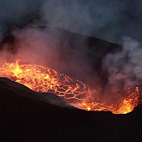
Two powerful quakes, a 5.4-magnitude temblor that shook the park around 11:30 a.m. local time and a 6.9-magnitude quake that struck about an hour later, rattled the park. The second earthquake "triggered rock slides on park trails, crater walls, and along sections of Chain of Craters Road," a park release said. The 5.4 quake "caused a coastal cliff to collapse into the ocean near the Hōlei Sea Arch. Narrow fissures appeared in the ground at an overlook near Jaggar Museum, and throughout the day, rocks fell into the lava lake within Halema‘uma‘u Crater at the volcano’s summit, creating dark ash clouds."
Throughout the afternoon smaller earthquakes and aftershocks were reported. There were no reported injuries.
“Safety is our main priority at Hawai‘i Volcanoes National Park, and it is currently not safe to be here,” said Superintendent Cindy Orlando. “We will monitor the situation closely, and reopen when it is safe to do so."

Aerial image of Kīlauea Volcano's summit crater, Halema‘uma‘u, taken on NPS overflight today following large earthquake/NPS, Nainoa Keana‘aina
Hikes were canceled and about 2,600 visitors were being evacuated from the park Friday afternoon and into the evening. Guests at Volcano House hotel and Kilauea Military Camp were being relocated, and all non-emergency park employees were sent home.
U.S. Geological Survey personnel have been monitoring the park's Kīlauea volcano and the Pu'u 'Ō'ō cone on the volcano's East Rift Zone for several weeks due to increased seismic and volcanic activity. A 5.0-magnitude earthquake around 10:30 Thursday morning triggered a small collapse at Pu‘u Ō‘ō vent that sent a rose-colored plume billowing skyward. The plume was visible throughout Hawaii Volcanoes National Park and neighboring communities.
Later Thursday afternoon fissures along the spine of the vent opened, creating lava fountains and sprays of molten rock through parts of the Leilani Estates community, which was evacuated.
According to the USGS Hawaiian Volcano Observatory, the active eruption outside the park in the Leilani Estates community was continuing Friday afternoon, with some fissures running several hundred yards.
"The sixth and most recent fissure is on the eastern edge of the subdivision. Not all fissure vents remain active and no far-traveled lava flows have formed," the observatory reported.
"HVO geologists will be in the area overnight to track additional activity that may occur, and other scientists are closely tracking the volcano's overall activity using various monitoring data streams," it added in a statement.
Rock falls and ash plumes at Pu‘u ‘Ō‘ō Crater were prompted by Friday's earthquake.
Hawai‘i Volcanoes National Park, a UNESCO World Heritage Site and International Biosphere Reserve, extends from sea level to 13,677 feet and encompasses the summits and rift zones of two of the world’s most active volcanoes, Kīlauea and Mauna Loa.


 Support Essential Coverage of Essential Places


