The rental car was taking a beating, so we decided to turn around. Recent rains had eroded the road and created serious ruts in the shortcut we were taking from Mojave National Preserve into the new Castle Mountain National Monument. After the car went up on three wheels climbing out of the last arroyo, we slapped high fives for successfully retracing our track back to the main road.
We’d much rather explore Castle Mountain than explore options for extracting a car from where we really shouldn’t have gone in the first place. A helpful and cautious park ranger had emphasized that a tow company would not willingly or cheaply save us from ourselves.
It was spring in the desert, meaning reasonable temperatures and lots of flowers, a perfect time to visit. I had already visited Mojave National Preserve several times, and at 1.6 million acres, the third-largest National Park System unit in the Lower 48 states, there is lots to explore. But the big draw this visit was my National Parks Conservation Association colleague David Lamfrom introducing us to the wonders of Castle Mountain, one of President Obama’s additions to the National Park System. David manages NPCA’s California Desert program.
When Congress created Mojave National Preserve in 1995, over 29,000 acres in and around the Castle Mountains on the preserve’s east side were not included because of gold mining. The 8,340-acre privately held Castle Mountain Mine Area ceased mining operations in 2001, which allowed President Obama to include 21,000 acres of federal land surrounding the mining area as one of three California desert national monuments he designated in February 2016. The other two monuments connected Mojave to Joshua Tree National Park (Mojave Trails National Monument) and Joshua Tree to the San Bernardino Mountains (Sand to Snow National Monument), just to the east of Los Angeles. This newly expanded pallet of protected areas covers 5.2 million acres of vitally important wildlife connectivity stretching mroe than 200 miles from the desert at the Nevada border, over the 11,000-foot San Bernardino mountains, and into the Angeles National Forest.

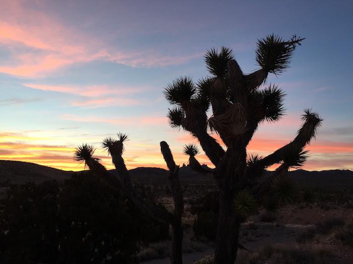
Castle Mountain sunset/Jim Stratton
My girlfriend, Craig, and I headed north from Palm Springs, where we were visiting my mom in her winter habitat, through Joshua Tree and Mojave to Nipton, California, a wide spot on Highway 164 on the north side of the preserve near the Nevada border. We wanted to explore more and drive less, so we reserved one of the five rooms in the Nipton Hotel. Built in 1904, the hotel is the only place to stay in this part of the preserve, and with its associated trading post and sporadically open café, it is the perfect basecamp from which to explore Mojave and Castle Mountain. The hotel is nothing fancy, but has an antique charm; while it is over 100 years old, it is clean and cozy.
On our drive to Nipton, we stopped at the Kelso Depot Visitor Center for maps, our NPS passport stamps, and hiking advice. The park ranger there directed us to a fairly easy hike up the Teutonia Peak Trail through a thick Joshua Tree forest highlighted with a few scattered junipers. At the confluence of the Mojave, Sonoran, and Great Basin deserts, Mojave serves up some very unique and varied environments. It turns out that the world’s largest Joshua Tree forest stretches for about 65 miles through Mojave’s Shadow Valley, right where we were hiking…way more Joshua Trees than there are in Joshua Tree National Park. From the side of Teutonia Peak, we had a very nice view towards the Ivanpah Valley and our destination for the next day, Castle Mountain.
The one downside to Nipton is the café is only open occasionally. We were able to get breakfast there one morning, but our evening meals required driving to Nevada. Our first night found us driving north on Interstate 15 to Primm – a Disneyesque mess of casinos, gas stations, outlet malls and amusement rides just across the Nevada border. We could not have found ourselves in a place more diametrically opposite to the wonders of the desert. Thankfully, after we found food, the desert sky quickly erased Primm’s electronic lights and, at 3,000 feet above sea level, Nipton’s dark skies gave us plenty of stars to ponder.
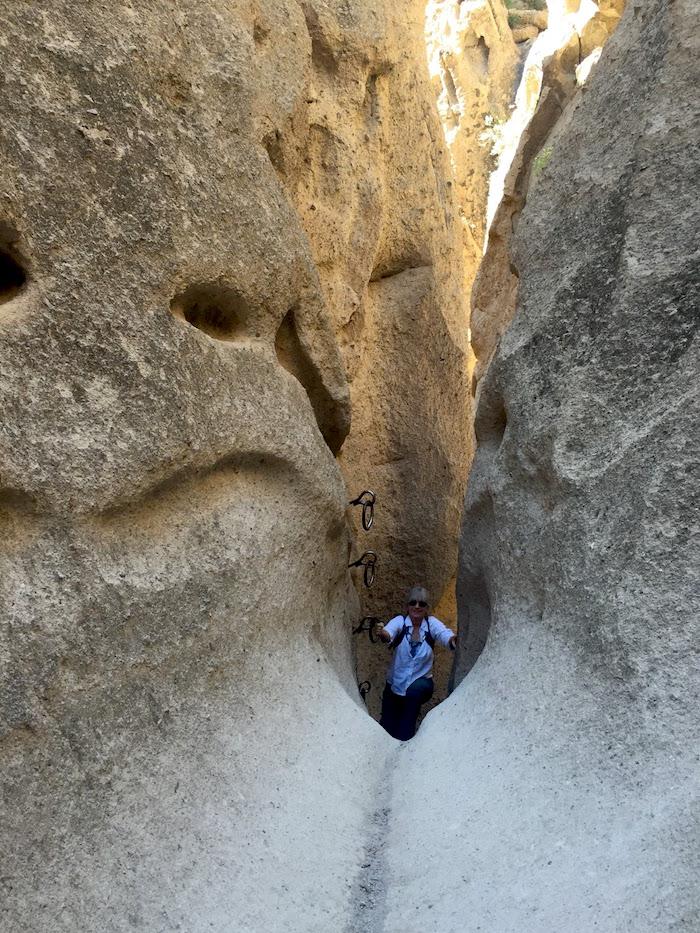
Our plan was to meet David early the next afternoon in Nipton and head into Castle Mountain – a new park unit for me and stamp #190 in my quest to visit all 417 Park Service units. So we rose early and headed an hour back into Mojave for a morning hike around Hole-In-The-Wall, where we learned about the local hikes at the small visitor center. There is a must-do hike into the heart of Banshee Canyon, where a series of metal rings set into stone give you the purchase necessary to pull yourself up and over the rocks on the Rings Loop Trail. There is also a longer Barber Peak trail that we partially did, leaving the full loop for next time when we plan to stay in the local campground.

The Rings Loop Trail at Mojave National Preserve/Jim Stratton
Back at Nipton, we met David and set off on our afternoon excursion into the newly minted Castle Mountains National Monument. The park ranger at the Kelso Depot visitor center had discouraged us from taking our SUV into Castle Mountains, saying we really needed a high clearance 4WD vehicle. But David said an SUV would be fine, so off we went down the Ivanpah Road heading for the west side of the new monument.
On the way, we drove slowly through the Ivanpah Valley looking for desert tortoise alongside the road. David is a serious tortoise junkie, so we were hopeful his tortoise karma would help us encounter one of these vanishing denizens of the desert. The Mojave population is listed as threatened due to habitat reduction. Since the 1980s, the population has been reduced in some areas by 90percent, so we knew our chances to see a tortoise were slim. They were undoubtedly around, as Ivanpah has one of the highest concentrations in the preserve, but none showed themselves.
After our little adventure on the washed-out shortcut, we found ourselves deep in the Castle Mountains and off on a hike. Since this is a mining district, there are numerous old roads that provide good hiking, so we didn’t have to go cross-country. We saw lots of jackrabbits and good looking desert bighorn habitat, but alas, no bighorns revealed themselves. Historically, there were also antelope and wolves in the area, and we speculated as we walked among the Joshua Trees and cholla cactus just how cool it would be to have those two species back in the park.
As the afternoon merged into evening, a full moon rose above the craggy peaks, and the evening light lit the rocks with pastel blues, reds and purples. I have to say it was “sparktacular.” I was especially surprised to see a thick blanket of grass growing across the landscape. One expects the desert to be sand and cactus, so these native desert grasses seemed out of place, but David assured me this is one of the things that makes the California desert so unique. The evening light reflecting off those grasses made for especially fine photographs.
As darkness drove us back to the car, we headed out on Walking Box Ranch Road to Searchlight, Nevada, where we found dinner in a funky Nevada border town that wasn’t at all like Primm. Thankfully.
If you are interested in exploring Castle Mountain, I would suggest accessing it from the Searchlight side. The road is in pretty good shape and you have far less chance of getting lost on the maze of old roads…unless getting lost is what you desire. Then there is no better place than the desert.
Editor's note: Author Jim Stratton long served as the Alaska regional director for the National Parks Conservation Association. For more of his stories, check out his blog.

Panoramic View from Teutonia Peak Trail, Mojave National Preserve/Jim Stratton


