The Spruce Lake Fire has grown to nearly 5,000 acres, leading Crater Lake National Park officials to close some areas in the park/NPS
A forest fire burning in the backcountry of Crater Lake National Park in Oregon was approaching 5,000 acres in size Saturday and has led to some closures in the park, including a section of West Rim Drive, part of the Pacific Crest Trail, and several other trails.
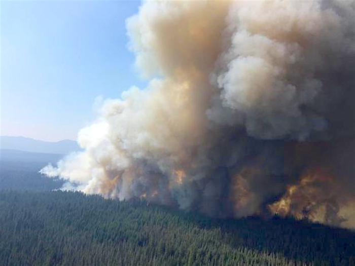
More than 500 firefighters, aided by engine units and seven helicopters, are battling the Spruce Lake Fire, which was lightning sparked late last month and measured at 4,668 acres Friday night.
Due to potentially hazardous conditions created by the fire, the following road and trails were closed to entry and use until further notice:
- West Rim Drive from Rim Village to North Junction
- Pacific Crest Trail, from the intersection of Dutton Creek Trail north to the North Entrance Road
- Boundary Springs Trail
- All of Bald Crater Loop Trail
- Bert Creek Trail
- Discovery Point Trail
- Lightning Springs Trail
- Rim Trail from Discovery Point to North Junction
Park officials said visitors to Crater Lake were not at risk.
"The closure is due to fire activity from the Spruce Lake Fire, which is burning on the west side of the park," they said. "The embers from the fire have spotted near West Rim Drive. All other roads in Crater Lake National Park remain open as well as all entrances to the park. Visitors can bypass the closure on West Rim Drive by taking East Rim Drive."
The Spruce Lake Fire, first spotted on July 24, is being managed collectively with the Blanket Creek Fire. The fires are being managed with a full suppression strategy. The trail closure is being implemented to reduce threats to public safety associated with fire activity and fire suppression operations.
"It has been running to the east and southeast, pushed by west winds deeper into Crater Lake National Park. The fire is generally burning west of the West Rim Road, and has spotted across the road in at least one site," Saturday morning's fire report noted. "The local lodgepole pine forest, with lots of pitch, sunlit crowns, and many dead trees, is conducive to spotting and rapid fire spread."
Fire bosses were hopeful that as the fire continues to grow it will encounter "several natural and manmade barriers that will slow its spread. Wetter areas along creeks and bogs initially confined the fire and, as it continues east toward the steep slopes of the caldera and Crater Lake itself, the vegetation becomes more sparse and patchy."

More than 500 firefighters were battling the Spruce Lake Fire, from the ground and overhead in the air with helicopters/NPS


Comments
http://www.oregonlive.com/pacific-northwest-news/index.ssf/2017/08/wildf...