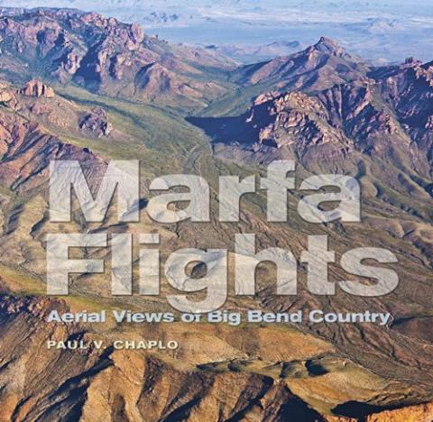

Paul Chaplo has created a visual narrative of the Big Bend country of Texas, seen through the eyes of an artist. In a world of drones and Google Earth, Chaplo created his images the old fashioned way: looking through a viewfinder while getting bumped around in a Cessna 172.
This 192-page, beautifully printed book was published by the Southwestern Studies in the Humanities Program at Tarleton State University ($23.95 paperback) and showcases the stark and compelling landscapes of western Texas, punctuated by the riparian greenery of the Rio Grande River. It's a land of contrast, with rocky peaks and fault lines, mesas and canyons. There is nearly no evidence of human habitation, and it seems like you're viewing a landscape that isn't quite complete yet. Most of the images are horizontal oblique showing the landscape below, and in the far distance, which puts the land in context.
Chaplo is a fine art photographer from Texas, who has exhibited widely, including the Museum of Modern Arts in New York City, and the National Museum of American Art in Washington. He's done an admirable job of documenting this big land, and if you enjoy an aerial perspective of our world, you'll enjoy this book.


