One of the great adventures of exploring Gates of the Arctic National Park and Preserve in Alaska is the opportunity to float or paddle one of the six designated Wild and Scenic Rivers flowing through this park and preserve. Not only will you experience the thrill of white water in places, but you’ll be viewing the landscape and wildlife from a different perspective.
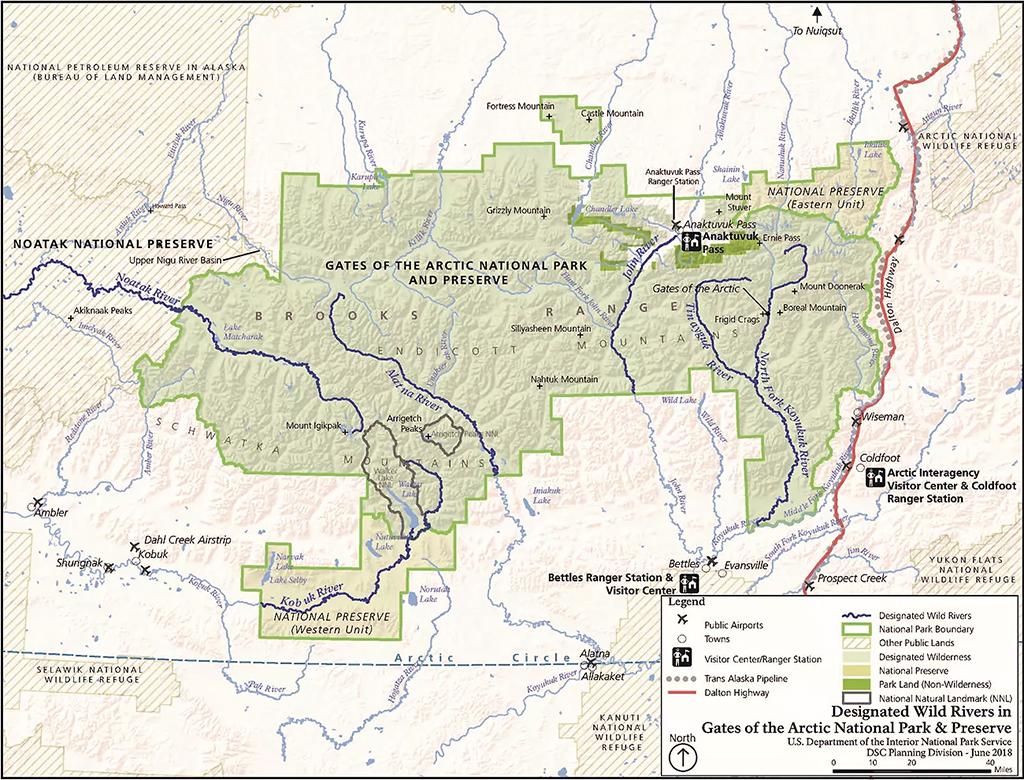
Wild and Scenic Rivers map, Gates of the Arctic National Park and Preserve / NPS
As the National Park Service so aptly states:
Rivers have been byways for wildlife and humans for centuries. They are the veins and arteries through the heart of the Gates of the Arctic wilderness.
If you intend to travel along one of these rivers in this national park and preserve, you will need to plan carefully to ensure a safe and enjoyable journey.
There is no development, infrastructure, or services within this park and preserve. There are also no roads in Gates of the Arctic, nor are there any established trails. To access this landscape, you will be flying or hiking in from the Dalton Highway bordering the park. For ease of transportation, you should carry rafts, inflatable canoes, packrafts, or other collapsible boats. Most charter operators will not haul rigid canoes. If you are going to rent watercraft from a local vendor, be sure and make your arrangements with them before you arrive, as supplies and equipment are often limited.
What kind of water activity will you experience? That depends upon a variety of conditions.
According to park staff:
Waters average Class I and II, with a few Class II-IV rapids, but river conditions constantly change. Challenges associated with arctic river travel include very cold water temperatures, dramatically fluctuating water levels, logjams, strainers and sweepers, and some rapids. Generally, the highest water is in May and June. High water has its drawbacks - it can make it difficult to find suitable campsites. Many northern rivers have aufeis, sometimes called overflow ice. As rivers begin freezing in the fall, they flow up and over the new ice, creating layer upon layer of ice. By winter’s end, these layers may be more than 15 feet thick. Often covering extensive areas of northern rivers, aufeis can block river channels or calve into the river like icebergs, so constant awareness of the river conditions in front of you is important. Aufeis persists in some rivers until late summer.
Rivers change every spring during break-up, sometimes dramatically. And water levels also change constantly; a summer storm fifty miles upriver can cause a major rise in river levels where you are. Rivers in areas with permafrost react quickly to rain, as the water does not soak into the ground but is channeled directly to the rivers. Northern rivers can be low one day and be in flood stage two days later. Remember that this is a remote wilderness in an extreme environment and conditions can change rapidly.
Depending upon which river you travel, there will be a variety of access and take-out points. Contact an air taxi operator to find out where they are able to drop you off and pick you up on each river.
You will travel through a different part of Gates of the Arctic depending upon which river you choose to navigate.
West Gates Of The Arctic

The Alatna River, Gates of the Arctic National Park and Preserve / NPS file
The Alatna flows from the Endicott Mountains 145 miles(233.4 kilometers) southeast to the Koyukuk River. The first twenty-five miles (40.2 kilometers) from the headwater lakes are rocky and can be very shallow and during low water, a portage of several miles from the Summit Lake may be required and lining boats may be necessary.
Download and read the Alatna Wild and Scenic River Values Report.

The route of the Alatna River, Gates of the Arctic National park and Preserve / NPS
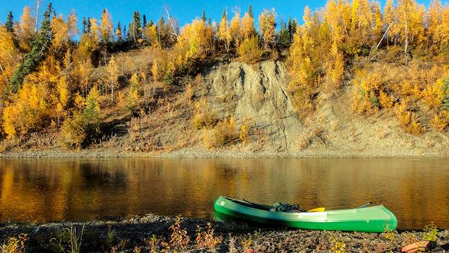
Kobuk River, Gates of the Arctic National Park and Preserve / NPS file
The 380-mile-long (611.6 kilometers) Kobuk River originates in the Endicott Mountains in the Brooks Range and flows west to Kotzebue Sound. There are a few short stretches of extremely rugged rapids in the stretch just below Walker Lake (up to class V). You’ll find good opportunities for sport hunting (in the preserve only), fishing, and wildlife observation. The river’s wide valley, exceptional rapids, and outstanding biota provide remarkable natural resources.
Download and read the Kobuk Wild and Scenic River Values Report.

The route of the Kobuk River, Gates of the Arctic National Park and Preserve / NPS

The Noatak River, Gates of the Arctic National Park / NPS-Penny Knuckles
Flowing west, the Noatak River is one of the longest designated Wild Rivers in Alaska. Entirely above the Arctic Circle, it traverses alpine tundra, rolls through canyons and over plains, and ends up in a flat coastal delta where it drains into Kotzebue Sound. this high-use area is a designated wilderness concern. Vegetation around lakes at the various put-in and take-out points is being destroyed and the impact is detracting from the area's wild character. After arriving, move directly to the river to camp on gravel bars. Use existing trails between lakes and the river and do not build fires on the tundra.

The route of the Noatak River, Gates of the Arctic National Park and Preserve / NPS
Central Gates Of The Arctic
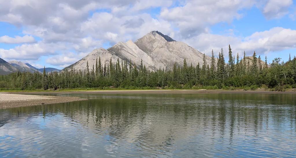
The John River, Gates of the Arctic National Park and Preserve / NPS-Steve Behrns
The John River flows south 136 miles from the 6,000-foot-high Endicott Mountains to its confluence with the Koyukuk River. The river’s notably low valley and narrow corridor contribute to its unique character and you will see alpine tundra and forested valleys along the river’s route.
Download and read the John Wild and Scenic River Values Report.

Route of the John River, Gates of the Arctic National Park and Preserve / NPS
East Gates Of The Arctic
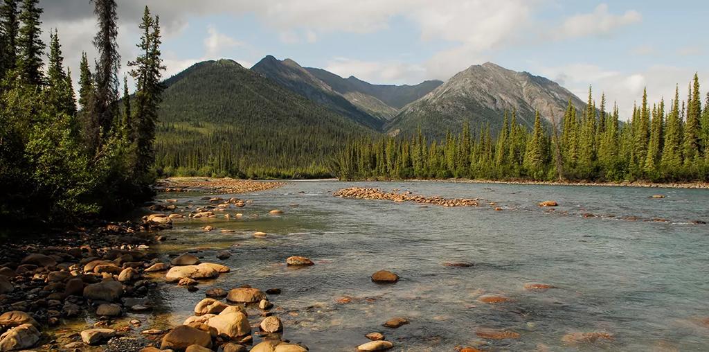
North Fork of the Koyukuk River, Gates of the Arctic National Park and Preserve / NPS-Josh Spice
The North Fork of the Koyukuk flows from its headwaters on the south flank of the Arctic Divide through broad, glacially carved valleys in the rugged Endicott Mountains of the Central Brooks Range. The river bisects the iconic Frigid Crags and Boreal Mountain, dubbed the "Gates to the Arctic" by Bob Marshall. The North Fork joins the Middle Fork and can be run all the way to Bettles Field.
Download and read the Koyukuk Wild and Scenic River Values Report.

Route of the Koyukuk River, Gates of the Arctic National Park and Preserve / NPS
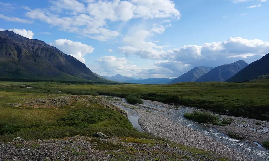
The Tinayguk River, Gates of the Arctic National Park and Preserve / NPS-Steven Gang
Starting from the Endicott Mountains, the Tinayguk River flows nearly 45 miles south to its confluence with the North Fork Koyukuk River. The Tinayguk River starts as a trickle high up in the Endicott Mountains and is the longest tributary of the North Fork of the Koyukuk, which both lie entirely within the pristine wilderness of Gates of the Arctic National Park. Access is difficult; most floaters hike in from Anaktuvuk Pass or the North Fork of the Koyukuk with packrafts.
Download and read the Tinayguk Wild and Scenic River Values Report.
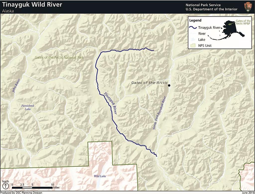
Route of the Tinayguk River, Gates of the Arctic National Park and Preserve / NPS
Outfitters And Guides
There’s plenty of planning and preparation for floating one of the wild and scenic rivers. Perhaps you would rather leave most of the work to an outfitter or guide. You can do that using the services of National Park Service authorized CUA holders and concessioners in Gates of the Arctic National Park and Preserve.

Floating the water in Gates of the Arctic National Park and Preserve / NPS file


