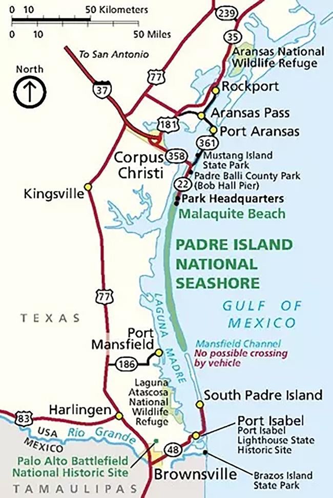
It’s easy to get to Padre Island National Seashore in Texas since it is not out in the middle of nowhere … unless you happen to be exploring the drivable 66 miles (106.2 km) of sandy coastline. Other than that, this park unit is reachable by four different commercial airports, anywhere from 38 miles (61 km) to 264 miles (425 km) away.
Area map around Padre Island National Seashore / NPS graphic
If you are using your smartphone or vehicle GPS app, the park’s website warns that GPS systems and digital map services sometimes place the Malaquite Visitor Center’s address several miles from its actual location. To remedy that issue, try entering or selecting "Malaquite Visitor Center" as a town or waypoint, or entering the coordinates for the visitor center:
Decimal Degrees: 27.42425 North, 97.29908 West
Degrees-Minutes-Seconds: 27° 25' 27.3" North, 97° 17' 56.688" West
From the Malaquite Visitor Center:
- Corpus Christi International Airport: 45 minutes, 38 miles (61 km) from the visitor center.
- San Antonio International Airport: 2 hours and 45 minutes, 183 miles (295 km) from the visitor center.
- Brownsville South Padre Island International Airport: 3 hours, 192 miles (309 km) from the visitor center.
- George Bush Intercontinental Airport (Houston): 4 hours, 264 miles (425 km) from the visitor center.
There is no public transportation available to the park.
You can fuel/charge up anywhere before and after crossing the John F. Kennedy Memorial Causeway to or from Corpus Christi.

Map of available gas stations near Padre Island National Seashore / Google Maps

Map of EV charging stations. Green pins denote public level 1 and level 2 charging locations, orange pins are public stations with quick charge ports / Plugshare.com graphic


