You are here

Guadalupe Mountains National Park

The Landscape Of Far West Texas Just Beyond Guadalupe Mountains National Park
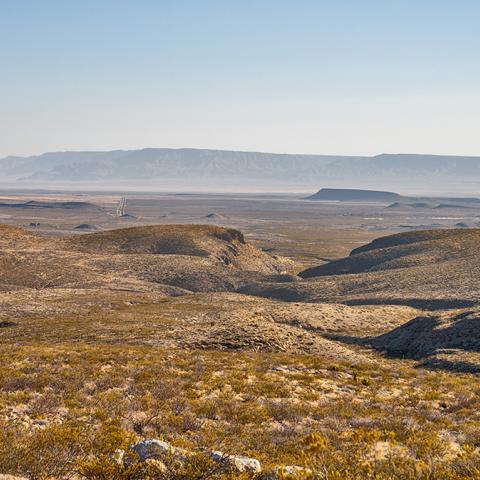
A hazy wide-angle view of arid mountains and valleys within far West Texas, just beyond the boundary of Guadalupe Mountains National Park

As you turn your view away from El Capitan Peak at Guadalupe Mountains National Park and instead look out south and west into far West Texas, it's hard to imagine that where arid mountains and valleys now stand, there was once a tropical ocean some 260 million years ago.

Rebecca Latson

Gypsum Dunes At Salt Basin, Guadalupe Mountains National Park

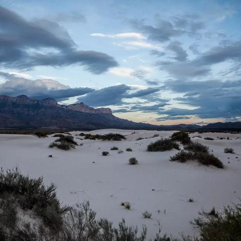
A cloudy, pre-sunrise view of white sand dunes with mountains in the background, Guadalupe Mountains National Park

Salt Basin is the name of the graben, or a down-dropped block of the earth’s crustal rocks created when faulting caused this downward movement some 26 million years ago, at about the same time Guadalupe Peak was uplifted more than two miles to its present position. The water that was present at the time evaporated, leaving gypsum and salt deposits at Salt Basin.

NS/Giraffeascope

Say "Hi" To The Chihuahuan Spotted Whiptail Lizard, Guadalupe Mountains National Park

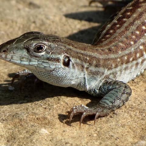
A close up view of a lizard with brown and beige stripes and beige spots on the brown stripes, Guadalupe Mountains National Park

Despite the rather barren-looking landscape of the Chihuahuan Desert within Guadalupe Mountains National Park in far West Texas, there is life. Meet the Chihuahuan spotted whiptail lizard, a species native to the United States. Did you know, according to the New Mexico Herpetological Society, "All Chihuahuan spotted whiptails are female (parthenogenetic). Eggs are unfertilized and hatchlings are clones of the mother."

National Park Service

The Cool Green Respite Of Smith Spring, Guadalupe Mountains National Park

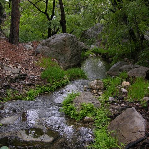
A frothy line of water with green vegetation, rocks, and trees on either side, Guadalupe Mountains National Park

According to the National Park Service, "Smith Spring is one of several springs along the base of the Eastern escarpment. There is no reliable water in the high country. When it rains, water quickly enters a series of cracks and joints in the limestone, later emerging in springs like this below the escarpment. The water from Smith Spring goes underground just a short way below the spring, later reemerging at Manzanita Spring. At this point you have entered a lush riparian (streamside) woodland. This beautiful oasis is made possible by the water emerging from the spring.

NPS/D. Buehler

The Trail Route Up Guadalupe Peak, Guadalupe Mountains National Park

The outlined route along the Guadalupe Peak Trail, Guadalupe Mountains National Park

Guadalupe Peak Trail is one of the most iconic, popular, and strenuous hikes in Guadalupe Mountains National Park. This 8.4-mile (13.52-kilometer) roundtrip hike with an elevation gain of 3,000 feet (914.4 meters) to an awe-inspiring view over El Capitan and the West Texas landscape.

National Park Service

Golden Sunlight Over A Moody Morning At Guadalupe Mountains National Park

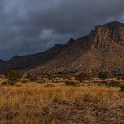
A golden sunrise over a moody morning at Guadalupe Mountains National Park

According to the National Park Service, "Guadalupe Mountains National Park protects the world's most extensive Permian fossil reef, the four highest peaks in Texas, an environmentally diverse collection of flora and fauna, and the stories of lives shaped through conflict, cooperation and survival."

Rebecca Latson

Salt Flat And Western Escarpment Of The Guadalupe Mountains, Guadalupe Mountains National Park

A broad white salt flat leading to a view of the southernmost point of the Guadalupe Mountains and El Capitan, Guadalupe Mountains National Park

As you drive eastward from El Paso, Texas, toward Guadalupe Mountains National Park, one of the first things to catch your eye after about an hour’s worth of driving is the light-colored rock of El Capitan at the southernmost point of the park lifting itself high above the atmospheric haze. What you see as you approach this landform is the Western Escarpment of the Guadalupe Mountains, one of the best-exposed geologic cross sections in the world.

Rebecca Latson

INN Member

The easiest way to explore RV-friendly National Park campgrounds.

The Essential RVing Guide to the National Parks

Here’s the definitive guide to National Park System campgrounds where RVers can park their rigs.

Our app is packed with RVing- specific details on more than 250 campgrounds in more than 70 national parks.

You’ll also find stories about RVing in the parks, tips helpful if you’ve just recently become an RVer, and useful planning suggestions.

The Essential RVing Guide to the National Parks

FREE for iPhones and Android phones.