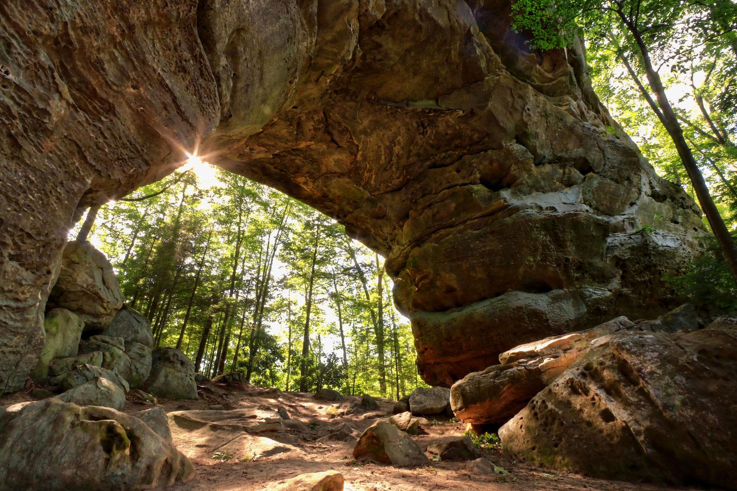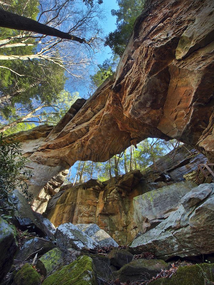
South Arch of Twin Arches at Big South Fork National River and Recreation Area/NPS file
The Sandstone Arches Of Big South Fork National River And Recreation Area
By Kim Kobersmith
Arches National Park in Utah is the undisputed champion of its namesake formations. But another, less celebrated, national park site across the country has one of the highest concentrations of arches in the eastern United States.
The Big South Fork National River and Recreation Area is 125,000 acres of rugged terrain along a wild tributary of the Cumberland River. Spanning the Kentucky and Tennessee border, its centerpiece is a deep 600-foot gorge carved by the slow, epic force of water. This canyon country contains hundreds of natural arches and their often accompanying companions: rock shelters and waterfalls.
The park sits on the Cumberland Plateau in the western Appalachian Mountains - a large, flat tableland that rises 1,000 feet above the adjoining landscape. Its sandy, rocky layers were laid down over 350 million years ago as sediments in an ancient shallow sea. The weight of the deposits – thousands of feet thick – compressed the sediments into limestone, shale, sandstone, and coal. In time, flowing water in rain, creeks, and rivers cut its path through the plateau’s layers of sandstone to create dramatic geological features.
The varying textures of the sandstone layers create a differential erosion pattern. Some is easily crushed by hand into a fine sand, while some is mixed with iron oxides lending its congealing properties. The top layer of much of the plateau, a concrete-like rock called Rockcastle Conglomerate sandstone, is one of the most enduring. Along gorge edges, the softer layers beneath the capstone gradually wear away and what remains are elevated spans of sandstone: arches.

Split Bow Arch is one of the stone wonders at Big South Fork National River and Recreation Area/NPS file
Visiting arches at Big South Fork is a different experience than at arid Western destinations. Because of the nature of plateau country, the formations are often carved out level with, or even below, the viewer, and can’t be seen from long distances. Vegetation also hinders viewing. In the Eastern deciduous forest, these natural rock arches are tucked into forested hillsides. Visitors can only catch fleeting glimpses until they emerge, close-up, from the canopy.
Perhaps the biggest difference in exploring these Eastern arches, though, is solitude. Since this canyon country isn’t as well known, it just doesn’t get the same crowds as Western parks, or even nearby Eastern parks. It has been called a “lonely and magical landscape.”
Not that they are completely unknown, as humans have long utilized the rock landforms of the region. Nomadic hunters arrived in 10,000 BC. They found shelter in the region’s large rock cavities until about 1,000 BCE, when a shift to agriculture drew them to fertile river bottoms on larger streams. The rock shelters retained clues of the early residents, but 98 percent of them have been looted and vandalized, losing knowledge of that history forever
In the 1800s, when small groups of European settlers moved in, rock shelters became a source of saltpeter, or potassium nitrate, used for gun powder. The descriptively named Wagon Arch became part of a road bringing settlers into the area.
The crown jewel in the collection of features at the Big South Fork is dramatic Twin Arches, the largest sandstone arch complex this side of the Mississippi. The larger South Arch spans 135 feet, while North Arch is 61 feet high. The park also includes the highest waterfall in Kentucky and descriptively named formations like Cracks-in-the-Rock and Devil’s Jump.
Hundreds of arches and rock shelters of a variety of sizes await to be discovered by the adventurous explorer, and some prime specimens are accessible by hiking trail or road. A guide book, “Natural Arches of the Big South Fork,” focuses on 25 of the area’s accessible rock landforms. Author Arthur McDade was a park ranger in Big South Fork when he became overwhelmed and awed by the park’s unique geological features.
“Big South Fork offers a lot of recreational opportunities,” said McDade in an interview, “but visitors will fail to find its essence if they do not see at least several arches. The geologic features are part and parcel of the story of this country and a quintessential part of that environment.”
While exploring, please don’t climb on or damage any of the formations so they may be enjoyed by others. McDade recommends visiting in the winter time after trees have shed their leaves in order to see and photograph them more clearly. Here are four recommended geological hot spots in the park:
Twin Arches, in Tennessee, were formed by headward erosion along a narrow ridge. The 1.2-mile round trip hiking trail from Twin Arches Trailhead leads to exploration under, through, and over these gems. “Fat man’s squeeze” is a secretive passage through the side of one of the arches. The longer Twin Arches Loop trail has a section that passes by several huge rock shelters once used by Native Americans, early settlers, and saltpeter miners.

Needle Arch at Big South Fork National River and Recreation Area/NPS file
Split Bow Arch, on the Kentucky side of the NRA, is one of the most accessible arches in Big South Fork. It is unusual in that a narrow finger of the bluff split away from the main bluff. When large chunks of rock fell, a high, thin bridge was all that was left. You can see the 51-foot-wide arch from an overlook just 100 feet from a small parking area, or on an easy 1.3-mile round trip hike that takes you through the arch. Accessible from the Bear Creek Scenic Area.
Yahoo Falls, Kentucky, has it all, geologically speaking. The trail passes behind the 113-foot falls into one of the largest rock shelters in the park, used by numerous ancient peoples. The nearby Yahoo Arch, in adjacent Daniel Boone National Forest, was created by erosion at the back of a rock shelter. Tree cover, interlaced roots, and abundant rhododendron give it a Tolkien-like feel. A 3-mile round trip hike explores all three features.
Needle Arch, Tennessee, also accesses three geologic features. The arch is a thin, delicate span 35 feet wide that was left standing alone when the back of the rock shelter of which it was once a part eroded. A short side trip goes to 60-foot Slave Falls and a large rock shelter. Access the 3.2-mile round trip hike from the Sawmill trailhead.
These arches are transitory in the geological sense. They will all collapse one day. Until then, they stand as testament to the converging forces of nature that have formed, shaped, and whittled the landscape of Big South Fork National River and Recreation Area.


Add comment