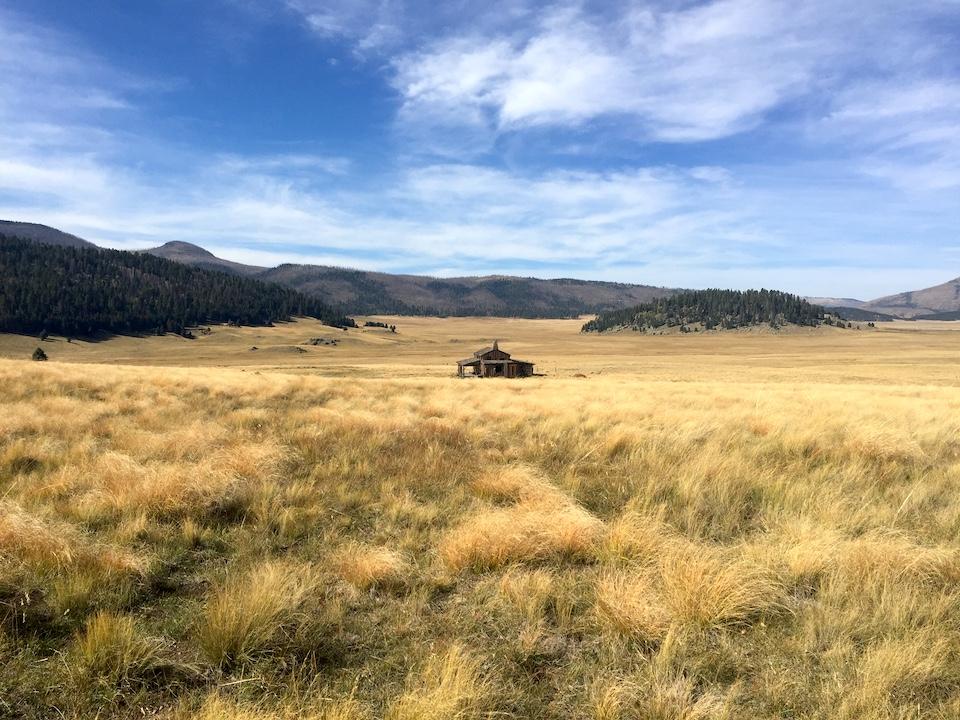
The "Missing Cabin" was used in the past as a movie set/Barbara Jensen
Editor's note: There are well-known units of the National Park System, and then there are those that are publicity-forsaken outposts. But that doesn't make them any lesser. Indeed, they are overlooked jewels. Barbara Jensen, a self-described wanderer, recently found her way to one of those jewels.
To get to Valles Caldera National Preserve, I head northwest from Albuquerque on NM 550, which unfolds in long, undulating curves through the high desert. Rolling down my window, I smell sage and juniper in the cool morning air. At San Ysidro, I turn right onto Highway 4, winding past small houses with gardens of corn and squash, horses grazing, and up through a river valley that narrows as the road rises.
By the time I pass through the small mountain town of Jemez Springs, the valley has become a pinched, red-walled canyon. I come to Soda Dam, a chalky-looking natural feature stretching over the river that formed from white calcium carbonate deposits from a spring. The contrast is fascinating, and I stop to clamber around an easy path on the back side of the mineral dike. Though it looks soft, the white rock is sharp under my hands; the water is cool as it pours under this stone bridge made from ancient marine shell deposits. I try to imagine such an immense passage of time.
This thought gets me back into the car to find Valles Caldera. As I drive through the Santa Fe National Forest, I pass Jemez Falls campground. One of three camping sites along this stretch, it's the closest to the national preserve. First-come, first-served, and only ten dollars a night until May 2021.
As I mull this, I round a bend, and a huge, arcing meadow greets my eyes. Golden and coppery grasses fill a broad bowl, the surrounding low mountains covered in pine forest sprinkled with aspen, their leaves turning vibrant yellow, orange, even fiery red in the early autumn. I turn off the highway and descend into the wide maw of the sleeping caldera.

The "dam" at Jemez Springs/Barbara Jensen
The Jemez Mountains are volcanic in origin, and the Valles Caldera is the result of a supervolcanic eruption, created by a collapsed dome after a massive magma release about 1.25 million years ago. It's easy to mistake my first view of the five-mile-wide Valle Grande for the full Valles Caldera, which stretches a phenomenal 13 miles across. Some of the hills and peaks I mistook for outer boundaries are in fact inner resurgent domes, created like volcanic bubbles by more magma refilling the chamber from below. They're not as low as they seem, since the caldera sits at roughly 8,000 feet. Redondo Peak is the impressive central dome, an 11,253-foot mountain to be taken seriously. At least seven other peaks here rise close to, or over, 10,000 feet.
At the visitor's center, I ask about a backcountry access permit. I clarify, "There's no camping anywhere within the preserve, right?"
White-haired Ranger Dave eyes me, clearly wondering if I'm up to something. "No camping. Day hikes only. It will take you an hour just to drive back there," he informs me. "And you have to be back here by 4:30," he tells me pointedly, handing me my hang tag.
I grin. "I will." He smiles, somewhat reassured. But not completely.

San Antonio Creek in Valles Caldera National Preserve/Barbara Jensen
I don't blame him. Even as I drive the rocky back road past cabins from the historic Baca Ranch, I remind myself not to underestimate the wildness of this area, home to deer and elk, plus bobcat, mountain lion, and bear.
But today I'm on a scouting mission, sampling routes. La Garita Trail follows an old logging road up into the hills, like most of the trails in the preserve. I hike past both healthy ponderosa and wildfire-charred spikes of trees that tower over foot-tall baby pines. Once I get to the first open meadow, I stop for water, appreciating the long view south. Bear bells jingling on my daypack, I follow a secondary logging road to a saddle where the other side of the mountain, and another quiet valley north, are all that I can see. Rito de los Indios Trail follows its namesake stream above Valle Toledo to the east, where tiny San Antonio Creek snakes through.
By two o'clock, I exit the main entrance and park across the highway at Coyote Call trailhead, still within the preserve. This easy, well-marked three-mile loop lets me traipse through sparkling aspen groves flourishing within another burn scar. A quarter-mile in, I veer right, taking the Rabbit Ridge spur. At the top of this one-and-a-half mile climb, I come to a marker: I have reached the boundary with the backcountry of Bandelier National Monument.
From Rabbit Ridge, I look out across the volcanic basin. So much to see. It's getting late. I'm up to something, all right. I'm planning to return, camp nearby, and spend several days hiking Valles Caldera, letting this powerful landscape transform my perspective.
Resources
More trail information available in Sixty Hikes Within Sixty Miles: Albuquerque by David Ryan and Stephen Ausherman, 3rd edition, 2019.
Barbara Jensen is a writer and artist who likes to go off-grid, whether it's backpacking through national parks, trekking up the Continental Divide Trail, or following the Camino Norte across Spain. For over 20 years, social work has paid the bills, allowing her to meet and talk with people living homeless in the streets of America. You can find more of Barbara's work on Out There podcast and www.wanderinglightning.com Contact: @wanderlightning , [email protected]


Comments
There is a new hiking book specific to the Valles Caldera National Preserve called "Hiking Trails in the Valles Caldera Naitonal Preserve" by Coco Rae. Great book. For information on issues related to the Valles Caldera go to www.caldera-action.org.
You can find the trail guide to VCNP at https://vcnp-trails.com/