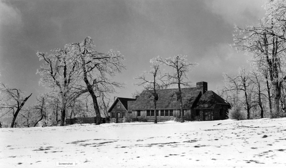
The historic wayside that once stood at Big Meadows in Shenandoah National Park/NPS archives
When Robert Lee Cubbage went to town to record the title to 75 acres his brother, George, sold to him for $100 in 1919, he was carving out yet another family holding on at Cubbage Mountain, as it's known in today in Shenandoah National Park.
Nearby were Floyd Cubbage, H.J. Cubbage, D.P. Cubbage, Jacob Cubbage, George A. Cubbage, Ambrose Cubbage, and a few other relations. Many of them turned up in the legal filing that recorded Tract 309 in Page County, Virginia, on July 24 that year.
"Beginning at a large stone in a division line of the lands of said George A. Cubbage and William Cubbage near a cherry tree; thence running along said division line in a westerly direction about 300 or 400 yards to a pile of rocks in a line of the lands of Elly Good; thence in a northern direction along said line of Elly Good about 150 yards to a chestnut oak and a gum tree on top of the mountain, where the lands of Elly Good and William Lucas; thence in an easterly direction about 20 yards along the William Lucas line to two stationary rocks; thence in a northern direction about 300 yards to a rock in H.J. Cubbage's line; thence in a northern direction 300 or 400 yards to three pines and a pile of rocks at a corner of Herbert Cubbage's land; then an easterly direction about 100 yards down the mountain to a planted stone in Jacob Cubbage's line; thence following the Jacob Cubbage line in a southern direction about 300 yards to the top of Grave Yard Ridge; thence an easterly direction along said Jacob Cubbage line about 100 yards to a gum tree in Ambrose Cubbage's line; thence in a southerly direction along said Ambrose Cubbage's line about 225 yards to a planted stone at the top of the ridge; thence an easterly direction down the ridge a new line about 200 yards to a planted stone; thence a southerly direction continuing a new line 400 or 500 yards to the beginning; contained about 75 acres (more or less)."
The description remains a portrait of an earlier day on Cubbage Mountain in what would become Shenandoah National Park. It was a time when families owned large tracts of land, shared fence lines, and lived on what they could nurture from the landscape that, records show, became weary from overuse.
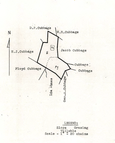
The Cubbage family claimed a large swath of land on the western side of today's Shenandoah National Park/NPS archives
"Grazing land is thin, has been badly managed and is in a nonproductive condition," reads a later assessment of the 75 acres Robert Lee acquired. "Slope land has no timber and has been badly burned over."
Such insights into the past of Shenandoah National Park are held within an interactive website the park brought on line back in May. Though the site currently requires a lot of time to drill down into and is only in its formative stage, the history it reveals offers rich, and surprising, chapters of Americana.
"We believed the Bible, and Jesus told us we're not to kill, we're to love everybody, and to go to war and fight was opposed to that, so we took a stand against that," recalled H. Weaver Reitz, a conscientious objector from Pennsylvania who spent 1944-46 in a Civilian Public Service camp in the park.
He lived in what had been a Civilian Conservation Corps camp that was abandoned after CCC crews finished their work in the park.
"A man at our draft board, he told me that I shouldn't be allowed to live in the United States, they should move me out," remembered Reitz.
A short video in which Reitz recounted his two years in the park during World War II is among the rich nuggets of history to be found. (It's among four attachments tied to the 435 acres that George Pollock owned and later sold to the federal government for the park.)
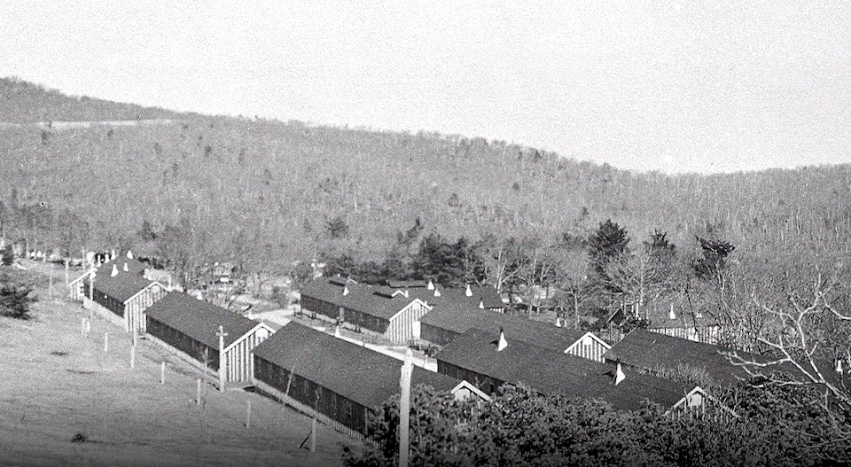
The converted CCC camp that Reitz lived in for two years during World War II/NPS archives
The website is the brainchild of Daniel Hurlbert, a geographic information systems staffer at Shenandoah. He coaxed it to life from a 1997 publication of real estate records of the area.
"Who owned it, what was on those tracts, how many apple orchards they had, how many out buildings. It was a really nice publication," Hurlbert recalled during a phone conversation. "And then in '99 we were able to get these historic county tract maps restored, and part of that restoration was to digitally scan those.
"We realized this was a perfect opportunity to merge the lands records, which were published in more of a tabular form, with a digital interface you could actually query and use," he said.
The work slowly progressed, and in 2013 he began working with graduate students at North Carolina State University to polish the appearance of the information to make it more user friendly for the general public.
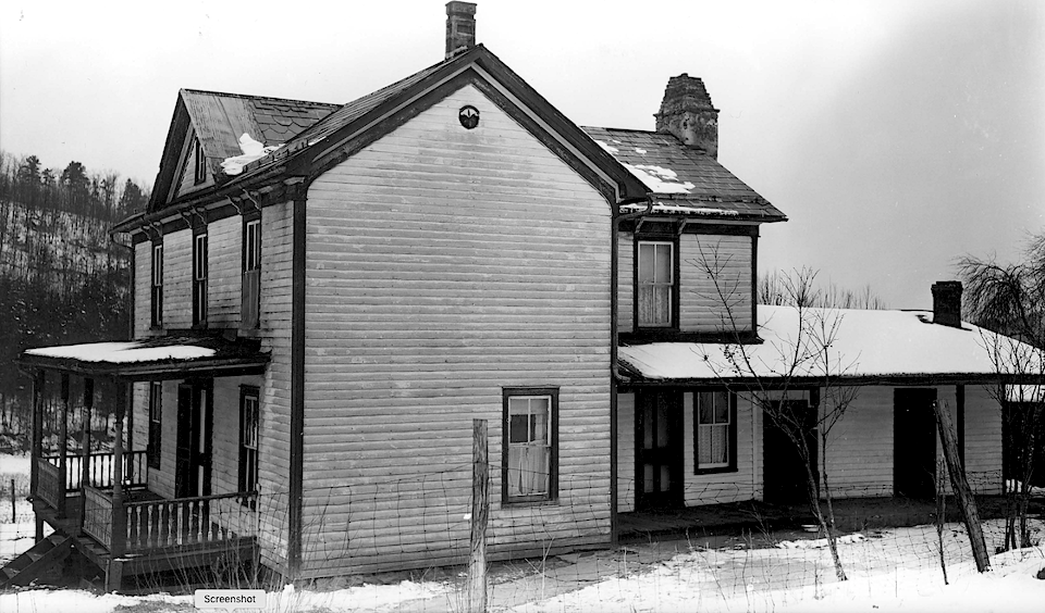
The Hensley place in Rockingham County in Shenandoah National Park/NPS Archives
“It was last year we finally developed the functionality and the user interface that you use now online," said Hurlbert.
Though the "user friendliness" of the web page needs more refinement -- photo information is lacking at the moment -- for those keen on Shenandoah or interested in history of the Appalachian region in general, the site can open interesting windows to the past. (The site also has valuable present-day information, too, such as a breakdown of Shenandoah's hiking trails, roads, entrance stations, parking lots, streams, and mile markers.)
Search for Fannie Lamb, and not only will you find the parcel of land now known as Big Meadows, but also a CCC brochure from 1937 celebrating the fourth anniversary of the corps at Camp Fechner.
Being among the first camps to be established in the United States, it has enjoyed a success and popularity seldom given to a CCC camp. It is situated in the very center of the recently created Shenandoah National Park and has been visited by thousands of people from all over the United States. ... Since its establishment in 1933, Camp Fechner has steadily grown from a bleak and barren mountaintop meadow to one of the show spots of the Skyline Drive. During the first few months of its establishment, it was found necessary to build a twenty-feet high stockade almost entirely around the camp in order to protect the tents and buildings from the continuous gales which sweep across the cleared area.
Also among the documents to be discovered is a May 18, 1933, letter from Park Service engineers detailing what work CCC crews would do in Shenandoah.
"One gang will be assigned to opening up and grading a trail, following in general the existing Appalachian Trail between Panorama and Fisher's Gap," wrote J.R. Lassiter, the engineer in charge. "One gang will be allotted to such work on the Skyling Drive as the Bureau of Public Roads may direct. This work will, in the main, consist of flattening slopes, opening ditches, removing loose and scattered stones, and for other types of road maintenance. There will be other gangs from this camp to clean up the woods surrounding Skyland and down through the upper White Oak Canyon territory."
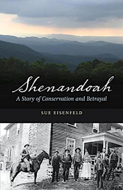
A nice companion for those exploring the homesteader history of Shenandoah on this website is Sue Eisenfeld's book, Shenandoah, A Story Of Conservation and Betrayal. This 162-page narrative (with another 31 pages of acknowledgements, notes, and bibliography) follows Eisenfeld and her husband as they seek out old homesteads and family cemeteries that have been grown over by the park's returning woodlands. Ms. Eisenfeld recounts the stories of cast-out residents. It's not a new story, but has been repeated time and again since Europeans arrived on the shores of the continent. In national park history, it played out in that other great Appalachian park, Great Smoky Mountains National Park, along the Blue Ridge Parkway, and elsewhere in the park system. It continues even today as inholdings are purchased. But this book is poignant. Some of the homesteaders' claims dated back to the 1600s when the king of England bequeathed a great expanse of the “New World” to Lord Fairfax. The beauty of Virginia’s high country can’t be denied, and Ms. Eisenfeld’s book won't let us forget those who were uprooted here, so that that beauty could be preserved long after they gone.
Some documents detail how much landowners were paid for their property. Newman Sisk, for instance, received $121 for his 24 acres, and $8 for eight apple trees.
The estate of N.W. Hensley, though, received $10,410 for his 138 acres, his house and other outbuildings, including a 12-foot by 12-foot by 8-foot log built "apple house," all located not far west from the park's present-day Swift Run Entrance. There also was a second house used by his son, spring house, hen houses, corn house, meat house, wash house, and hog pen.
At the Shenandoah National Park Trust, Executive Director Susan Sherman applauded the project and the information it makes available.
"While Shenandoah is one of the country's most beloved natural-area national parks, it's also a living history book," she said. "This interactive platform provides an intriguing format to unearth some of our rich cultural history. The electronic format means that people across the globe can be learning about our park and the individuals who lived in these mountains long before the park was established."
At the park, Hurlbert said more information will be added to the site as it becomes available.
“It’s a work in progress," admitted Hurlbert. "It will continue to grow as we get more content released through our museum specialists and archives, and as we find things in the public domain that we can link in to this project."


Add comment