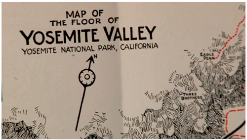
What can you glean from glancing at a map? If it's a road map, folks will look for routes to their destinations, interesting sidetrips, population centers. Topographical maps can provide rich details of landscapes and help us navigate through them.
In this episode from Yosemite Nature Notes, Producer Steven M. Bumgardner, aka Yosemite Steve, introduces us to the map wonders of Yosemite National Park. There's even a cameo appearance by Ken Burns!
In the blurb promoting this video, Yosemite Steve points out that "(W)hen Joseph Walker passed through in 1833, there were none, but today, thousands of maps portray Yosemite National Park. From a land grant created during the Civil War, to modern computer mapping, these maps also tell the story of the protection of Yosemite."
The video runs 9:30, but it's worth the watch. In it you'll glimpse maps of ancient glaciers of Yosemite, old maps of the Yosemite Valley, and, of course, trail maps.
Story Categories:
A copy of National Parks Traveler's financial statements may be obtained by sending a stamped, self-addressed envelope to: National Parks Traveler, P.O. Box 980452, Park City, Utah 84098. National Parks Traveler was formed in the state of Utah for the purpose of informing and educating about national parks and protected areas.
Residents of the following states may obtain a copy of our financial and additional information as stated below:
- Florida: A COPY OF THE OFFICIAL REGISTRATION AND FINANCIAL INFORMATION FOR NATIONAL PARKS TRAVELER, (REGISTRATION NO. CH 51659), MAY BE OBTAINED FROM THE DIVISION OF CONSUMER SERVICES BY CALLING 800-435-7352 OR VISITING THEIR WEBSITE. REGISTRATION DOES NOT IMPLY ENDORSEMENT, APPROVAL, OR RECOMMENDATION BY THE STATE.
- Georgia: A full and fair description of the programs and financial statement summary of National Parks Traveler is available upon request at the office and phone number indicated above.
- Maryland: Documents and information submitted under the Maryland Solicitations Act are also available, for the cost of postage and copies, from the Secretary of State, State House, Annapolis, MD 21401 (410-974-5534).
- North Carolina: Financial information about this organization and a copy of its license are available from the State Solicitation Licensing Branch at 888-830-4989 or 919-807-2214. The license is not an endorsement by the State.
- Pennsylvania: The official registration and financial information of National Parks Traveler may be obtained from the Pennsylvania Department of State by calling 800-732-0999. Registration does not imply endorsement.
- Virginia: Financial statements are available from the Virginia Department of Agriculture and Consumer Services, 102 Governor Street, Richmond, Virginia 23219.
- Washington: National Parks Traveler is registered with Washington State’s Charities Program as required by law and additional information is available by calling 800-332-4483 or visiting www.sos.wa.gov/charities, or on file at Charities Division, Office of the Secretary of State, State of Washington, Olympia, WA 98504.
INN Member

The easiest way to explore RV-friendly National Park campgrounds.

Here’s the definitive guide to National Park System campgrounds where RVers can park their rigs.
Our app is packed with RVing- specific details on more than 250 campgrounds in more than 70 national parks.
You’ll also find stories about RVing in the parks, tips helpful if you’ve just recently become an RVer, and useful planning suggestions.

Comments
Kurt, thanks so much for highlighting this video. As a young Scout in Australia I used to spend hours studying maps, digesting the spatial representations that came to life when I actually hiked or camped in the areas that related to the maps. It's something I still do now but I now I also enjoy using Google Earth which adds the third dimension to the map. I didn't realise there were others who had a similar interest.
The historical perspective was also most interesting, in particular how the original boundaries were drawn and changed due to the discovery of mineral wealth in the area.
Like Terressa Whitaker in the video I also have "bins" of maps.
Though unlike Terressa, I have and will never ever throw a map away :-)
Fun video, thanks!