You are here

All Photos

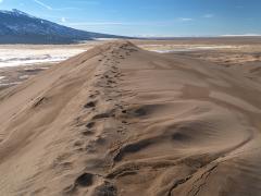
The View At The Top Of A Dune Ridge, Great Sand Dunes National Park And Preserve

Whatever season you visit this national park, a must-do activity is to hike up to the top of a dune. The sand is velvety soft, but still takes a little effort to climb. An easy way to hike up to the top of a dune is to switchback your way up. Once you are at the top, following the dune ridge is the easiest way to continue onward, and from the ridge top, you have a broad view around the park.

Rebecca Latson
bootstrap

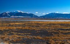
A View Of Great Sand Dunes National Park And Preserve From San Luis Lakes State Wildlife Area

If you are interested in the geology of Great Sand Dunes National Park and Preserve, a great place to view the overall geologic system of the park is from San Luis Lakes State Wildlife Area just off of Lane 6 N, almost halfway between the community of Mosca and the turnoff onto Colorado State Highway 150 toward the park. From this vantage point, you can see all four primary components of the Great Sand Dunes geological system: mountain watershed, dunefield, sand sheet, and sabkha.

Rebecca Latson
bootstrap

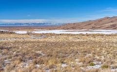
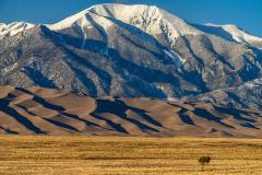
The View From A Tall Sand Dune, Great Sand Dunes National Park And Preserve

Hike to the top of any sand dune within this national park and you've got a great view of the land below and beyond. In this image, you see the Sangre de Cristo Mountains to the east, with the flat, snow-covered flat expanse of land below where Medano Creek will flow during spring and summer. Look closely enough and you might even be able to see the trail in the snow created by hikers leaving the parking area and heading toward the dunefield.

Rebecca Latson
bootstrap

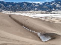
A Magnet On A Sand Dune, Great Sand Dunes National Park and Preserve

How many of you have hiked the dunes at Great Sand Dunes National Park and Preserve and noticed black patches or black ripples in the otherwise beige palette of the soft sand? What you are seeing are black magnetite grains in the sand. Magnetite is magnetic, and if you place a magnet on the sand, you'll pick up clumps of black magnetite grains. For real, and not an April Fool's joke! Cool, right?

Rebecca Latson
bootstrap

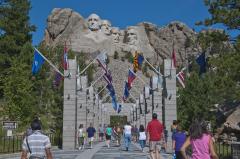
Walking The Avenue Of Flags At Mount Rushmore National Memorial

"Majestic figures of George Washington, Thomas Jefferson, Theodore Roosevelt and Abraham Lincoln, surrounded by the beauty of the Black Hills of South Dakota, tell the story of the birth, growth, development and preservation of this country. From the history of the first inhabitants to the diversity of America today, Mount Rushmore brings visitors face to face with the rich heritage we all share."

National Park Service
bootstrap

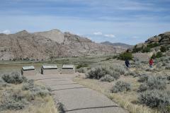
Split Rock Viewpoint, Mormon Pioneer National Historic Trail

The 1,300-mile Mormon Pioneer National Historic Trail is not a single hiking trail but rather, a route traveled by Mormons who fled Nauvoo, Illinois, to the Great Salt Lake Valley in 1846-1847. Along this route you can see some amazing landscapes while learning about this route and the hardy people who traveled it.

National Park Service
bootstrap

The Essential RVing Guide

The Essential RVing Guide to the National Parks

The National Parks RVing Guide, aka the Essential RVing Guide To The National Parks, is the definitive guide for RVers seeking information on campgrounds in the National Park System where they can park their rigs. It's available for free for both iPhones and Android models.

This app is packed with RVing specific details on more than 250 campgrounds in more than 70 parks.

You'll also find stories about RVing in the parks, some tips if you've just recently turned into an RVer, and some planning suggestions. A bonus that wasn't in the previous eBook or PDF versions of this guide are feeds of Traveler content: you'll find our latest stories as well as our most recent podcasts just a click away.

So whether you have an iPhone or an Android, download this app and start exploring the campgrounds in the National Park System where you can park your rig.