For most visitors to Capitol Reef National Park, short day hikes are a perfect way to explore the park. But there are some incredible backcountry adventures for those looking to explore the hinterlands.
Day Hiking
There are 15 day hiking trails with trailheads located along Utah Highway 24 and the park's Scenic Drive. These trails offer the hiker a wide variety of options, from easy strolls along smooth paths over level ground to strenuous hikes involving steep climbs over uneven terrain near cliff edges.
Hikes may take you deep into a narrow gorge, to the top of high cliffs for a bird's eye view of the surrounding area, under a natural stone arch, to historic inscriptions.
With that in mind, here's a look at some of the most popular day hikes, according to the park staff.
For a great insight into hiking possibilities at Capitol Reef, check out this story from Michael Lanza, author of Before They're Gone, A Family's Year-Long Quest To Explore America's Most Endangered National Parks:
We stand on the rim of an unnamed slot canyon in the backcountry of Utah’s Capitol Reef National Park, in a spot that just a handful of people have seen before us. We’ve arrived here after hiking about two hours uphill on the Navajo Knobs Trail, and then heading off-trail, navigating a circuitous route up steep slickrock and below a sheer-walled fin of white Navajo Sandstone hundreds of feet tall, stabbing into the blue sky. Now I peer down at the narrow, deep, and shadowy crack that we have come to rappel into, and feel a little flush of anxiety.
Now, before you head down the trail, remember, this is a desert environment, so go prepared. The summer sun is intense, and some trails rise to 6,900 feet (2,100 m) in elevation. Head out with plenty of water, wear a wide-brimmed hat, and apply, and carry with you for reapplication if need be, a good quality sunblock.
For your own and other's safety, stay on established trails; do not shortcut switchbacks or throw rocks. Hiking routes shown on this map are for location reference only. Routes are not trails and are not maintained.
Camping is not permitted within sight or sound of any trail, road or developed area except at established campgrounds. Before taking overnight trips, contact a park ranger who can suggest backcountry camping areas. A permit is required for backcountry camping and can be obtained at the visitor center free of charge.
Possession, destruction, or removal of any animals, plants, rocks or artifacts is prohibited.
Backpacking
Capitol Reef also offers many hiking options for serious backpackers and those who enjoy exploring remote areas. Marked hiking routes lead into narrow, twisting gorges and slot canyons and to spectacular viewpoints high atop the Waterpocket Fold. Popular backcountry hikes in the southern section of the park include Upper and Lower Muley Twist Canyons and Halls Creek. Backcountry hiking opportunities also exist in the Cathedral Valley area and near Fruita.
Here's a look at some of the park's popular backcountry routes:
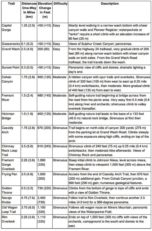
Saddle Arch along the Upper Muley Twist Canyon Trail. NPS photo.
Highlights of the hike are narrow canyons, expanses of slickrock, large arches, and dramatic vistas from the top of the Waterpocket Fold. The canyon offers many opportunities for side trips and off-trail exploring.
The route is marked with rock cairns and signs, but carrying a topographic map is recommended. It is extremely hot in summer and water sources are unreliable; carry adequate water.
Use caution in narrow canyons, particularly during the flash flood season (typically July-September). From the Upper Muley Twist Canyon trailhead, the total round trip distance is 15 miles (24.1 km) and is best done as an overnight hike.
From the Strike Valley Overlook parking area, the trip is 9 miles (14.5 km) and can be done as a long day hike or as an overnight. Backcountry permits are required for all overnight trips and can be obtained at the visitor center.
The highlight of the hike is a deep, narrow, twisting canyon with large alcoves. The canyon offers many opportunities for side trips and exploring. From 1881 to 1884, the canyon served as a wagon route for Mormon pioneers traveling south toward San Juan County. The canyon was thought to be narrow enough to "twist a mule" hence the name Muley Twist.
The Post Cut-Off Trail is marked with rock cairns and signs, but carrying a topographic map is recommended. It is extremely hot in summer and water sources are unreliable; carry adequate water. Use caution in narrow canyons particularly during flash flood season (typically July-September).
Beginning at the trailhead on the Burr Trail Road and hiking down canyon to the Post parking area via the Post Cut-Off Trail is a nice 6 mile (9.7 km) hike, but necessitates leaving a vehicle at each end. If you don't have two vehicles, turn around when you get to the sign indicating the Post Cut-Off Trail for a nice 8 mile (12.9 km) round trip hike.
A hike through Lower Muley Twist Canyon can be done as a long day hike or as an overnight trip starting and ending at the Post parking area; total distance 15 miles (24.1 km). Hiking the entire canyon from the trailhead on the Burr Trail Road and back is best done as a two to three day trip; total distance is 21.3 or 23.4 miles (34.3 or 37.7 km) depending on the route. Backcountry permits are required for all overnight trips and can be obtained at the visitor center.
The Halls Creek drainage is a large beautiful canyon bounded by the high cliffs of Hall Mesa on the east and the steep slickrock slopes the Waterpocket Fold on the west. Numerous side canyons beckon the hiker with sufficient time for exploration. The highlight of the hike is the 3-mile (4.8 km) Halls Creek Narrows, a classic example of a "slot canyon" which so typifies the canyon country of southern Utah.
Deeply incised into the white Navajo sandstone, it is hidden, secret, and mysterious. A trickling perennial stream and deep shade from the arching canyon walls create a cool, moist oasis in the midst of the surrounding desert. The route is largely unmarked, so carrying a topographic map is recommended.
The route is extremely hot in summer. Water can usually be found at the Fountain Tanks and in the narrows. Use caution in narrow canyons particularly during the flash flood season (typically July-September).
Lower Spring Canyon. NPS photo.
Spring Canyon is deep and narrow with towering Wingate cliffs and Navajo domes. It originates on the shoulder of Thousand Lakes Mountain and extends to the Fremont River. The route is marked with rock cairns and signs in some places, but many sections are unmarked and carrying a topographic map and GPS unit is recommended.
It is extremely hot in summer and the only usually reliable water source is at the spring in Upper Spring Canyon, 1.5 miles (2.4 km) west of the junction with Chimney Rock Canyon. Use caution in narrow canyons during the flash flood season in July through September and any other time that storms threaten.
Burro Wash, Cottonwood Wash and Sheets Gulch Slot Canyons
These are classic examples of "slot canyons" which so typify the canyon country of southern Utah; deep, narrow secret places within the Waterpocket Fold.
The routes are largely unmarked. A few rock cairns may mark key points; carrying a topographic map is recommended. It is extremely hot in summer and water sources are unreliable; carry adequate water. Use caution in narrow canyons during flash flood season (typically July-September).
All three canyons are difficult hikes and only experienced canyon country hikers should attempt these routes. All contain obstacles in the form of dry falls and chock stones (large boulders wedged in narrow slots) which must be climbed over. The canyons are extremely narrow in places; most people will have to work their way through sideways. Often there are pools of water that may require deep wading or short swims.
The Hamburger Rocks are small dark colored hoodoos with hamburger-like shapes within the Navajo sandstone. The white colored slope they are perched on accentuates the rocks. The route is unmarked and carrying a topographic map is recommended.
The hike is extremely hot in summer; carry adequate water. Water can usually be found at the Muley Tanks about 200 yards (180 m) north of Hamburger Rocks but would need to be purified. Use caution in narrow canyons during the flash flood season (July-September).
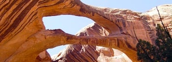
Brimhall Arch. NPS photo.
A rugged hike through a narrow canyon rewards the hiker with a close-up view of Brimhall Natural Bridge, a double span. The route is largely unmarked, so carrying a topographic map is recommended.
It is extremely hot in summer and water sources are unreliable; carry adequate water. Use caution in narrow canyons during flash flood season (July-September).
From the Halls Creek Overlook trailhead, the total round trip distance is 4.6 miles (7.4 km). The hike can be done as a long day hike. Backcountry permits are required for all overnight trips and can be obtained at the visitor center.

