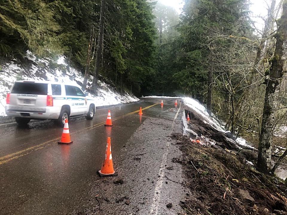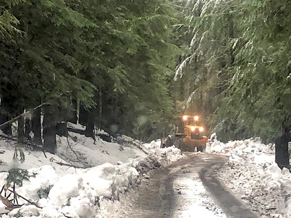
Heavy rains and snow unleashed flooding and mudslides at Mount Rainier National Park/NPS
Heavy rains and snowfall unleashed flooding and mudslides at Mount Rainier National Park, where visitors and park staff were evacuated from park facilities Friday and Saturday.
Several roads outside the park in central Washington were damaged by the slides, included State Route 706, according to a park release. All roads leading into the park were closed Saturday night, and there was no access to Paradise or the Longmire Historic Landmark District.
National Park Service staff cleared an emergency access route to evacuate National Park Inn guests and remaining NPS staff members from Longmire. On Friday and Saturday, staff from the park and the Pierce County Fire District 23 and Pierce County Department of Emergency Management worked cooperatively to support the voluntary evacuation of Ashford residents stranded by floodwaters near the park’s entrance on SR 706.
“Park staff are working around-the-clock, and in close partnership with the Rainier Guest Services team and state and local officials to protect life, health, and safety of residents, visitors, and employees first- and protecting critical infrastructure related to our nationally-significant buildings and roads, second," said Tracy Swartout, the park's deputy superintedent.
Essential staff remaining on duty within the park were focused on maintaining emergency access and services for remaining critical NPS staff and stranded residents outside the park, as well as securing critical water, wastewater, electrical, and drainage infrastructure inside the park.

Park crews kept open an emergency route to Longmire/NPS
Continued flooding within park boundaries was causing damage to roads, trails, and historic structures, including the National Park Inn at Longmire and other nationally-significant buildings within the Longmire National Historic Landmark District. Several buildings in Longmire had lost critical systems as sump pumps have been unable to keep up with water intrusion, the park reported.
Crews are were evaluating road and drainage system damage between the Nisqually entrance and Longmire; however, continuing precipitation was hampering crew progress. Initial indications are that the park’s main entrance road had sustained some damage near Sunshine Point (where a catastrophic flood washed out the entrance road in 2006).
Elsewhere in Mount Rainier, access to the Carbon River area was blocked due to a significant washout on Pierce County’s Fairfax Forest Reserve Road, and SR 410 was blocked by four landslides between Enumclaw and the park entrance. Pierce County was projecting the Fairfax Forest Reserve Road would require a long-term closure.
Once precipitation slows across the park, critical systems are protected, and waters begin to recede, park staff would conduct a more comprehensive evaluation of in-park road and infrastructure impacts. Significant damage to roads, trails and utilities in multiple areas within the park is anticipated, with more damage likely to be found as the snow melts this spring, park staff said.
Visitors should anticipate delays in access to Longmire, Paradise, and the Carbon River area, even as state roads open outside the park.
For updates to WSDOT-maintained roads outside the park, including SR706 and SR410, visit the WSDOT traffic alert and twitter sites. For Pierce County road updates (including Fairfax Forest Reserve Road that leads to the Carbon and Mowich areas of the park), visit their website. For updates related to roads and infrastructure inside the National Park, Mount Rainier will continue to provide updates via Facebook, Twitter and as needed, with press releases.


Comments
The Nisqually Entrance may remain closed for a while. Here is the state DOT geotech report and an impressive photo of the damage to SR 706 at Goat Creek:
https://twitter.com/wsdot_tacoma/status/1226610989170188293
While work by the State DOT is underway to reopen Highway 706 there has been little information forthcoming from Mt Rainier NP about damage within the Park. Second hand information gathered from a woman's hiking group from conversation she had with a Park employee and a concessinaie employuee suggests 6 feet of mud and debris over park roadway in several places and was suggested to her will take manmoth effort to remove and stabalize the road and could last until end of March making the reopening of 706 in mid-March mute for those who have reservations for the National Park Inn mut. We have had our reservations cancelled for Frbruary 23-25.We have re-booked for March 29-31 but are not hopefu at this point. Maybe not as bad as 2006, but then with no information coming directly from the Park Service, is disappointing.