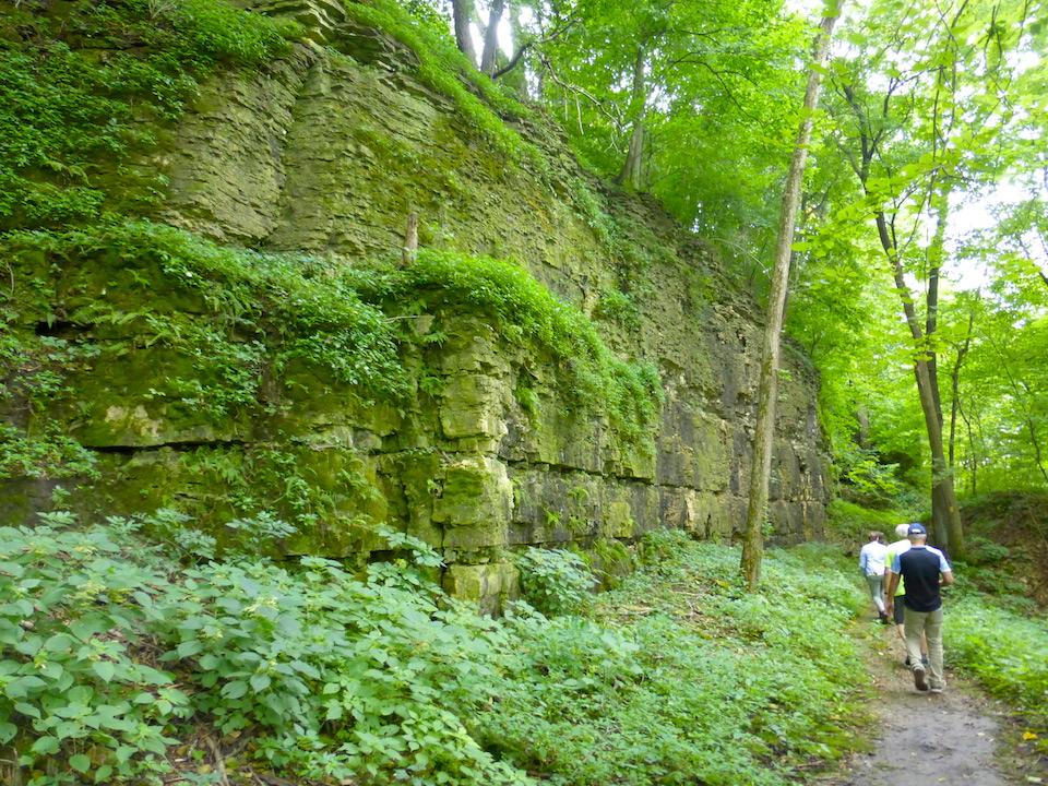
A portion of the Ice Age National Scenic Trail runs along a bluff near the Rock River near Janesville, Wisconsin/David and Kay Scott
During an August visit to Wisconsin we had an opportunity to hike portions of the Ice Age National Scenic Trail. The hikes were interspersed with downtime that included consuming Wisconsin’s food staple, cheese curds, and its unofficial state beer, Spotted Cow. Hiking a portion of the Ice Age Trail, the entire length of which meanders through Wisconsin, is reason enough to visit our nation’s 23rd state. Having the trail twist and turn through a land filled with cheese curds and Spotted Cow is a major bonus.
Wisconsin, like much of the northern United States, has been shaped over millions of years by glaciers that alternately crept southward from the Arctic before retreating back north. These massive ice flows carved lakes and sculpted the Wisconsin landscape, grinding and moving rocks, many of which remained behind when the climate warmed. Debris deposited by the melting glaciers help document a history of the state’s glaciation. While much of the evidence left by early glaciers has been erased by wind and water, the most recent glaciation’s farthest advance that occurred approximately 10,000 years ago provides a general outline of today’s Ice Age Trail National Scenic Trail.
Ice Age Trail was designated a national scenic trail by Congress in 1980 following years of effort by Wisconsin citizens, who had worked establishing trail segments. Today’s trail of approximately 1,200 miles continues as a work-in-progress with more than 600 miles of finished trail segments plus more than 500 miles of connecting routes.
From the eastern terminus in northeastern Wisconsin’s Potawatomi State Park, the trail meanders southwest near the Illinois state line before looping north and taking a sharp turn west to its western terminus at St. Croix Falls on the Minnesota border. Much of the eastern and western sections of the trail are relatively complete. Major portions of the long north-south stretch in the state’s midsection remain unfinished.

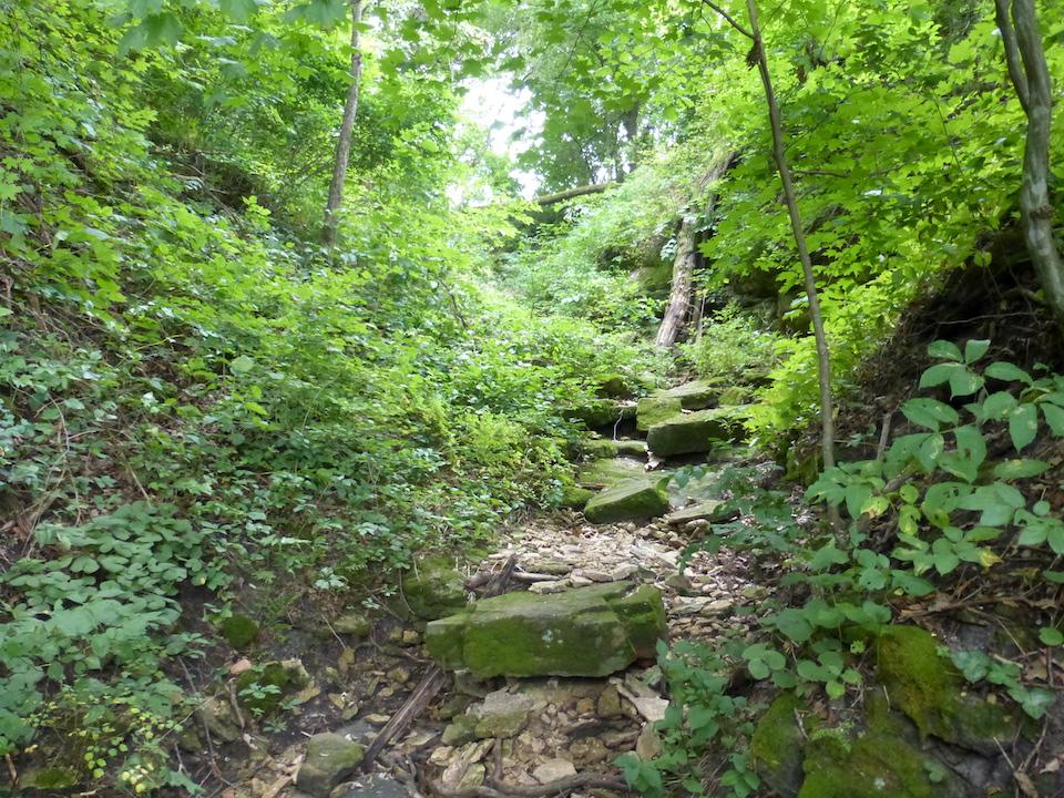
Sections of the Ice Age National Scenic Trail, such as the Devil's Staircase, can challenge you/David and Kay Scott
The trail is managed by a partnership of the National Park Service, the state’s Department of Natural Resources, and the Ice Age Trail Alliance. The Alliance, with a mission to “create, support, and protect a thousand-mile footpath tracing Ice Age formations across Wisconsin,” has 20 chapters based in more than 30 counties along the route. With occasional assistance of groups such the Boy Scouts, chapter members volunteer considerable time for trail construction and maintenance.
Our own experience hiking two southern stretches of the Ice Age Trail took place about 75 miles southwest of Milwaukee during a visit to Wisconsin’s Rock County. The county’s two largest communities are Beloit, a town of 37,000 on the Illinois border, and nearby Janesville, where the trail passes through multiple parks, including impressive Rotary Botanical Garden that was developed on the site of an abandoned sand and gravel quarry. Janesville, with a population of 64,000, is the largest urban community on the entire trail and considered its southern gateway.
Dennis James, chapter coordinator for Rock County Ice Age Trail and our local trail guide, commented that the Ice Age Trail differs from most of the other national scenic trails in that the Wisconsin trail, by design, passes through small towns where hikers have access to an occasional bed, hot meal, and shower. Some stretches actually follow a community’s main street. Small communities being located along the route offer the advantage of reducing the need for hikers to carry large amounts of food.

The Rotary Botanical Garden along the Ice Age National Scenic Trail/David and Kay Scott
Members of the Alliance are particularly proud of “trail angels,” local citizens who offer to provide shuttle service to and from segments of the trail. Some lodging operations provide shuttle service from the trail to their facility. Local citizens welcome showing off their communities to the hikers.
Ice Age National Scenic Trail is generally flat and doesn’t offer the great scenic views of other national scenic trails, such as the Appalachian National Scenic Trail. Hikers can also be besieged by mosquitos and deer flies, especially in the North Woods section heading toward Minnesota.
Dennis said the Alliance recognizes hikers who complete the entire trail with Thousand-Miler status, which conveys a certificate and patch. Hiking end-to-end generally requires 2 ½ to 3 months, although in 2019, 34-year-old trail runner Annie Weiss covered the entire trail in 21 days and 18 hours. This broke the previous best time recorded by a male runner in 2007.
Traveler postscript: The Ice Age National Scenic Trail is perfect for a fall hike.
David and Kay Scott are authors of “Complete Guide to the National Park Lodges” (Globe Pequot). Visit them at www.facebook.com/DavidKayScott


Comments
Wisconsin is not "generally flat." The authors visited one out of 30 counties crossed by the Ice Age Trail, drank some beer, and based an article on stereotypes. I have visited 129 (and counting) units of the National Park System and can assure readers the Ice Age Trail does in fact have "great scenic views."
That next-to-last paragraph really does an injistice to the trail, the state, and the article itself. Trust us ... as much as we love our beer and cheese curds, there's also plenty to look at and plenty of mosquito-free days and stretches of the trail. But don't take the easy way out -- come hike the trail and see for yourself! Otherwise some good info here.
Actually, we have hiked other portions of the Ice Age Trail during previous trips to Wisconsin. Numerous trips to the West have included hikes on portions of the Pacific Crest National Scenc Trail, and during trips to the East, portions of the Appalachian Nationa Scenic Trail. A couple of images included in the article illustrate that there are some excellent scenic views along the Ice Age Trail, but I'm not sure they compare with many views on the Pacific Crest Trail including a section through the Warner Valley of California's Lassen Volcanic National Park. Likewise, above tmberline in the White Mountains of New Hampshire. This doesn't make hiking the Ice Age Trail any less enjoyable, only different. Also, let it be noted that we also drank beer during these other trips. Not Spotted Cow, but Sierra Nevada Torpedo is quite tastey.
Points well taken, David, but it would seem the whole purpose of the trail system is the country's rich variety. Comparing one trail to another is like comparing one kid to another; they're all beautiful and different. Those of us who have walked the IAT (I've done just under 500 miles myself) also know that it's only "generally flat" in relation to the Swiss Alps, and those who aren't ready for a real workout aren't going to get far. The folks who have been crafting this trail for decades -- not to mention the geographical forces of the eons -- have built in some pretty impressive topographical variation. The bluffs of Devil's Lake and Gibraltar Rock may not be as tall, but they're no less beautiful and impressive than anything else out in nature. The eskers, moraines, potholes, kettles, kames, erratics and other residue of the ages tell a different and no less compelling story.
If we really HAVE to compare, though, there's no place in the country that can compete with Wisconsin's beer. ;)
I agree completely. Our home state of Georgia has one of America's best beaches on Cumberland Island National Seashore, but for most travelers it probably doesn't visually compare to beaches along Oregon's and Northern California's Pacific Coast. Still, Cumberland Island's beach is one of our favorite places to stroll. For what it's worth, Wisconsin has long been one of our most enjoyable states to visit although we have become too wimpy to withstand the winters. With regard to beer, give Georgia's SweetWater 420 Extra Pale Ale a try.
Looks like Sweetwater has advanced just about to the southern border of Wisconsin but no further -- going to have to go to Illinois to buy some, but it looks to be worth the trip. Thanks for the recommendation!
Define scenic. I am continually in awe of the scenic views along the Ice Age Trails.
You do yourself a disservice if you only hike the segments near towns. I've hiked a variety of segments ranging from south-central Wisconsin to the northern segments and have found them all to be enjoyable in their own way. The variety of experiences one can have with different types of terrain and ecosystems on this trail make it a gem, in my opinion. You're not going to have the 100 mile views of some of the mountainous trails, but so what? There are many different aspects of nature that are worth experiencing, and this trail gives you the opportunity to sample a good number of them. If you go in with an open mind, you might be surprised what you can discover.