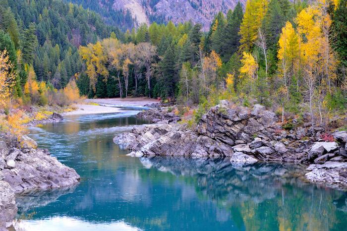
The U.S. Forest Service is working with the National Park Service at Glacier National so the two agencies can better understand visitor use of the Middle Fork (above) and North Fork of the Flathead Wild and Scenic River/NPS
This summer, Glacier National Park and Flathead National Forest are expanding visitor use monitoring efforts to better understand use along the Middle Fork and North Fork of the Flathead Wild and Scenic River.
For the past five years, Glacier National Park has been collecting data on trail and road use along the Going-to-the-Sun Road and surrounding trails. This year, with a donation from the Glacier National Park Conservancy, monitoring will expand to the river and several other places within the park. The Flathead National Forest and Glacier National Park both manage segments of the North Fork and Middle Fork of the Flathead Wild and Scenic River. The other locations to be monitored include the North Fork, Two Medicine, Many Glacier, Goat Haunt, and Belly River.
The data, collected by the University of Montana, has been valuable to Glacier National Park as visitation has increased dramatically. With several years of data in hand, the park can now better inform visitors about how to plan their trips with crowding in mind, and also make educated decisions about where to station staff to best meet park needs.
“For the last few years, we have heard at our annual meetings with North Fork residents that river use seems to be increasing,” said Flathead National Forest Supervisor Chip Webber. “This information will allow us to better understand how much, where, and when use is occurring. It will help us to better plan for proper facilities and management.”
“This is the sort of thing we could not do alone,” said Glacier National Park Superintendent Jeff Mow. “With the expertise from the University of Montana and the financial support of the Glacier National Park Conservancy, we are conducting cutting-edge research about the way our public lands are used here in northwest Montana.”
Monitoring technology used in the park and now expanded to the Flathead National Forest along the Flathead Wild and Scenic River include: tube counters placed along roads and trails, and camera counters that enable the calibration of mechanical counters and estimation of river use levels.
The data collected will better help the park and forest understand visitor use outside the Going-to-the-Sun Road Corridor, including the Flathead Wild and Scenic River. This information will establish baseline visitor use numbers which in turn will inform future planning efforts such as a Backcountry/Wilderness Stewardship plan for the park, and a joint Flathead Comprehensive River Management Plan for the park and forest.


Add comment