
The Pacific Northwest Scenic Trail will stretch from Glacier National Park to Olympic National Park/USFWS
Long-distance trail hikers soon will have a new checkbox on their to-do list: The Pacific Northwest National Scenic Trail, a 1,200-mile-long footpath stretching from the peaks of Glacier National Park and through North Cascades National Park to the Pacific Ocean shoreline of Olympic National Park.
Initially proposed in 1970, the trail was designated in 2009 as one of the country's 11 National Scenic Trails. Earlier this month, Agriculture Secretary Tom Vilsack appointed a 23-member advisory panel to work on developing trail uses, signage, and a corridor.
As envisioned, the trail would stretch from northeastern Glacier National Park -- the trailhead is proposed to be located at the Chief Mountain customs office at the U.S.-Canadian border -- to coastal Olympic National Park at Cape Alava.
“We’re excited to assemble such a diverse group of volunteers to collaborate with us in developing a plan designed to improve recreational opportunities and experiences, and support our unique mix of gateway communities,” said Matt McGrath, Pacific Northwest National Scenic Trail program manager. “The strong interest in the council demonstrates the significance of the Pacific Northwest Trail as a truly national resource.”

The trail meanders through the backcountry of Glacier National Park/USFS
The council is composed of citizens with diverse backgrounds chosen for their expertise in recreation-related issues, and ability to represent a balance of stakeholder perspectives and geographic areas. The council also includes representatives of the USDA Forest Service, National Park Service, and Bureau of Land Management, which manage sections of the trail.
"The trail is on the latest National Geographic maps for all three parks," said McGrath. "The trail exists on the ground and viewsheds are about as protected as they can be with national park/wilderness/proposed wilderness status."
The trail is a unique pathway traveling through some of the most spectacular and scenic terrain in the United States, and connects people and communities of the Pacific Northwest.
As directed by the National Trails System Act, the Pacific Northwest Trail and other National Scenic Trails are sited to provide for maximum outdoor recreation opportunity as well as the conservation and enjoyment of the surrounding scenic, historic, natural, and cultural resources. Establishing the council is a major milestone in the trail’s short history. The Forest Service is cooperating with many other federal, state, and local agencies as well as private landowners to develop a trail-wide comprehensive plan.
Over the next three years, the council will provide recommendations on trail uses, signage, establishing a trail corridor, and prioritizing projects.
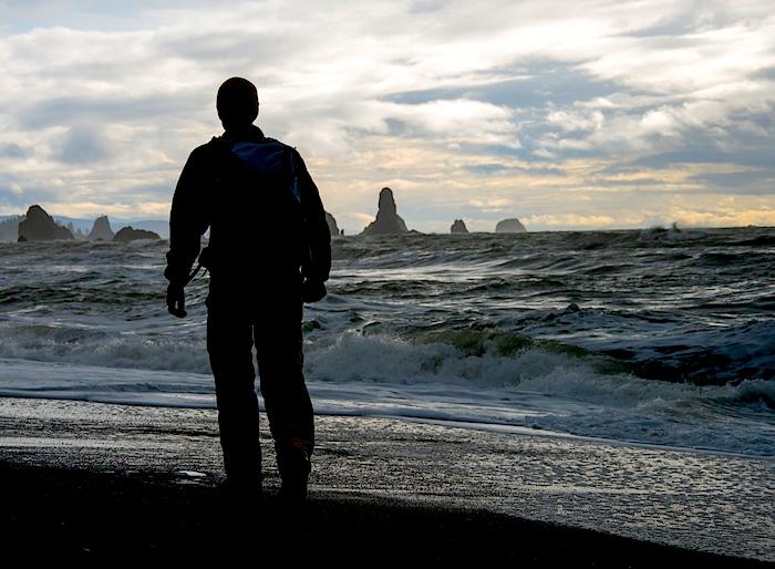
Hikers either start, or finish, on the Pacific coastline of Olympic National Park/USFW


Comments
Time to spend a winter planning!
Professional cartographer Ted Hitzroth thru-hiked the Trail in 1983 and has annually updated his maps ever since. His current version is available at the link below for free download if you wish to print his excellent maps yourself.
http://www.ronstrickland.com/rs/Pacific_Northwest_Trail.html