
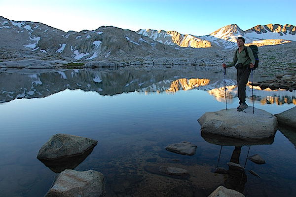
We awoke before dawn, crawling out of the sleeping bags we’d laid out the night before on our air mattresses atop flat, granite slabs near the shore of Evolution Lake, at nearly 11,000 feet deep in the backcountry of Kings Canyon National Park. Eating and packing up quickly, we started hiking by headlamps shortly before first light, eager to take advantage of the cool temperatures of mornings on our thru-hike of one of the world’s great footpaths, the John Muir Trail.
As dawn ignited the granite cliffs on an arc of 13,000-foot peaks surrounding us, we hiked up through the Evolution Basin, jaws gaping at the scenery—which is saying a lot, given that we had already been on the JMT for days, beginning many miles to the north, in legendary Yosemite National Park. The windless morning turned Sapphire Lake and Wanda Lake into flawless mirrors reflecting mountains bathed in morning sunlight. At Muir Pass, just shy of 12,000 feet above sea level—one of numerous passes ranging from 11,000 to over 13,000 feet along the JMT—we sat for a snack and looked around in awe, feeling awestruck and very fortunate.
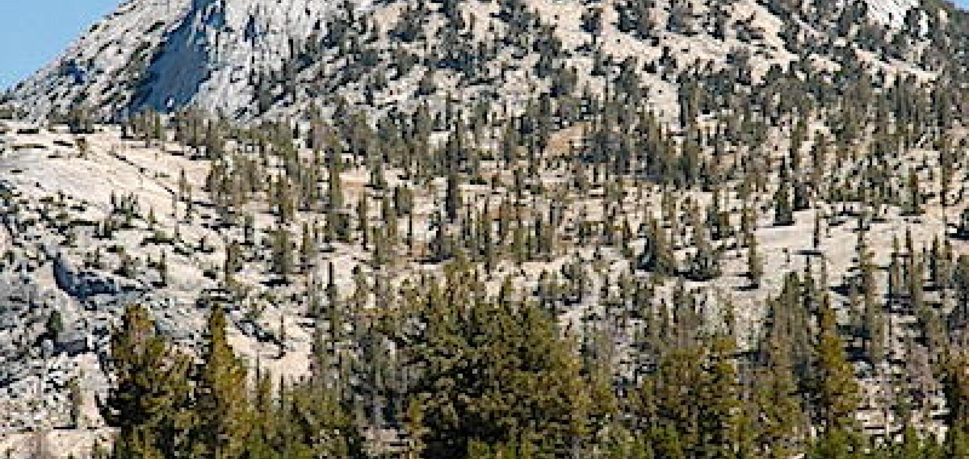
The John Muir Trail scenically justifies its enduring nickname: “America’s most beautiful trail.” Not only do its bookends lie in national parks that hold historic import because of their scenery—Yosemite and Sequoia—but it also passes through Kings Canyon National Park and a pair of the country’s premier wilderness areas, the Ansel Adams and John Muir. Every day is spent hiking through quiet, forested valleys and canyons nearly a mile deep, or past several of a constellation of alpine lakes in the shadow of 13,000- and 14,000-foot peaks. You see more waterfalls than anyone has taken the time to name.
As with many long trails, thru-hiking the JMT gives you the kind of extended, self-powered wilderness journey that distills life down to an uncomplicated and powerfully satisfying simplicity: wake up, eat, pack up camp, hike all day, set up camp, eat, sleep, repeat. You stop worrying about all the responsibilities and anxieties that we manage to worry about in civilization—in fact, you begin to wonder why they worried you at all. You forget what day it is. You start to feel like your body is doing what evolution designed it to do: walk far through the wilderness.
The JMT, though, differs from America’s major National Scenic Trails—including the big three, the Appalachian, Pacific Crest (which the JMT mostly coincides with), and Continental Divide trails—in that it's 212 miles (221 including the necessary descent off Mount Whitney, where the JMT officially ends) can be thru-hiked in a few weeks or less. You don’t have to drop out of life for five months; you just need a summer vacation.
Plus, the High Sierra’s often reliably sunny, dry summer weather makes a JMT trek eminently easier and more enjoyable.
I’ve backpacked many of America’s and the world’s most famous and glorious trails, from numerous Western national parks like Glacier and Grand Canyon to New Zealand and Patagonia. The John Muir Trail remains high on my short list of past adventures I yearn to repeat— probably the next time with my family—because it’s just that magical and lovely.
Trip Planner
Backpackers take anywhere from a week to 10 days (for uber hikers) to three weeks or more to thru-hike the 221 miles from Yosemite Valley to Whitney Portal. Hiking north to south gives you more time to strengthen your legs and acclimate to the higher elevations of the southern Sierra. The JMT thru-hiking season, like the hiking and backpacking season in the High Sierra, runs from July through September. But from mid-August to mid-September, the mosquitoes have abated and rain is rare (allowing you to use a tarp instead of a tent, cutting pack weight), the high passes are generally snow-free, and mornings are cool and afternoons not as stifling as mid-summer.
Maps
John Muir Trail map pack, $21.95 (3 oz. for entire set), tomharrisonmaps.com. Guidebook John Muir Trail— The Essential Guide to Hiking America’s Most Famous Trail, by Elizabeth Wenk, $18.95, wildernesspress.com.
Michael Lanza writes about his outdoor adventures, many with his family, at his blog and website, The Big Outside, and is the author of the National Outdoor Book Award-winning Before They’re Gone—A Family’s Year-Long Quest to Explore America’s Most Endangered National Parks. See his story about thru-hiking the John Muir Trail in a week and his tips on ultralight backpacking.
Stories about:
Story Categories:
A copy of National Parks Traveler's financial statements may be obtained by sending a stamped, self-addressed envelope to: National Parks Traveler, P.O. Box 980452, Park City, Utah 84098. National Parks Traveler was formed in the state of Utah for the purpose of informing and educating about national parks and protected areas.
Residents of the following states may obtain a copy of our financial and additional information as stated below:
- Florida: A COPY OF THE OFFICIAL REGISTRATION AND FINANCIAL INFORMATION FOR NATIONAL PARKS TRAVELER, (REGISTRATION NO. CH 51659), MAY BE OBTAINED FROM THE DIVISION OF CONSUMER SERVICES BY CALLING 800-435-7352 OR VISITING THEIR WEBSITE. REGISTRATION DOES NOT IMPLY ENDORSEMENT, APPROVAL, OR RECOMMENDATION BY THE STATE.
- Georgia: A full and fair description of the programs and financial statement summary of National Parks Traveler is available upon request at the office and phone number indicated above.
- Maryland: Documents and information submitted under the Maryland Solicitations Act are also available, for the cost of postage and copies, from the Secretary of State, State House, Annapolis, MD 21401 (410-974-5534).
- North Carolina: Financial information about this organization and a copy of its license are available from the State Solicitation Licensing Branch at 888-830-4989 or 919-807-2214. The license is not an endorsement by the State.
- Pennsylvania: The official registration and financial information of National Parks Traveler may be obtained from the Pennsylvania Department of State by calling 800-732-0999. Registration does not imply endorsement.
- Virginia: Financial statements are available from the Virginia Department of Agriculture and Consumer Services, 102 Governor Street, Richmond, Virginia 23219.
- Washington: National Parks Traveler is registered with Washington State’s Charities Program as required by law and additional information is available by calling 800-332-4483 or visiting www.sos.wa.gov/charities, or on file at Charities Division, Office of the Secretary of State, State of Washington, Olympia, WA 98504.
