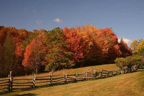
Fall is a wonderful season to visit the Blue Ridge Parkway, and the park has good news for travelers on the North Carolina portion of the scenic drive. Work on the Goshen Creek Bridge has been completed and the section of the Parkway between mileposts 285 and 288 has reopened to traffic.
The work, which has been underway since April of last year, required a detour off the Parkway of approximately eight miles. This section of the Parkway is located about five miles north of U.S. Route 321, and is north of the communities of Boone and Blowing Rock, North Carolina. If you aren't familiar with the local geography, you can download a map of the Parkway here.
What work was accomplished? According to the park, work on the bridge and nearby sections of roadway included
deck replacement, painting of superstructure steel, guardrail installation, drain repairs, asphalt paving and other related work.
The much needed rehabilitation restored the integrity of the historic structure while retaining most of the original design elements. Stonework was left undisturbed but did undergo cleaning and repointing. Picket bridge rail replacement was the most significant deviation from the previous design, as the Federal Highway Administration regulations required railing that met more stringent crash standards.
The affected section of road reopened on Thursday, September 17, just in time for the upcoming fall color season—arguably one of the most scenic times of the year on a trip that's a visual treat in any season.
If you're planning a trip on the North Carolina section of the Parkway, be aware of one other detour due to work between milepost 269.8 - 280.9, just a few miles north of the now reopened Goshen Creek Bridge, and about 12 miles of Blowing Rock. A marked detour is in use; you'll find more details on the park website. That project is due to be completed in November 2009.
If you haven't experienced the Blue Ridge Parkway, here's a little information from the park to help you understand the lay of the land…and whet your wanderlust.
The Parkway connects Shenandoah National Park near Waynesboro, VA (Milepost 0) with Great Smoky Mountains National Park near Cherokee, NC (Milepost 469). There are entrances and exits at all major federal and state highways and part of a Parkway experience is getting into the towns and communities of the region.
Asheville and Boone, NC and Roanoke, VA are the largest cities along the way. In Virginia, Interstates 64, 81, and 77 all have directions for accessing the Parkway. The same is true for Interstates 40 and 26 in North Carolina.
From Milepost 0 at Rockfish Gap, VA to Milepost 355 near Mount Mitchell State Park, NC, the Parkway lives up to its name by following the crest of the Blue Ridge Mountains, averaging about 3,000 feet in elevation, and occasionally dipping down into the coves and hollows or crossing low-elevation water gaps.
Near Mount Mitchell [the highest point east of the Mississippi], the Parkway veers westward through the Black Mountains, then into the Craggies before descending toward Asheville. From there, the road climbs to elevations over 6,000 feet in the Balsam Mountains before entering the Great Smoky Mountains National Park near Cherokee.
A common question for newcomers to the area this time of year is where—and when—to see the best fall color. The answer obviously varies a bit from year to year, so the park offers some general tips:
Typically, the Blue Ridge Parkway experiences the much anticipated change in fall foliage around the middle of October. Many factors, however, contribute to variations in when and where colors will peak. The Parkway stretches almost five hundred miles north to south, meanders from the east to west facing slopes, and, most importantly, varies in elevation from just under 650 feet at James River in Virginia, to over 6,000 feet south of Mt. Pisgah in North Carolina.
Many visitors have been frustrated trying to go to one spot on one day in October, hoping to find the leaves in full color. A far better plan is to drive some distance on the Parkway, changing elevations and north-south orientation. Any one who does this around mid to late October will catch at least some of the pretty color that we’re famous for.
You'll find additional information to help plan a trip on the park website, including a link for up-to-date information on any other closures and detours.


Add comment