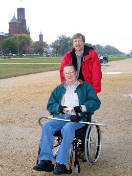
The other day I read a story about efforts at Cape Lookout National Seashore to install an ADA accessible ramp. And that got me to wondering about how accessible the National Park System is.
Part of the problem at Cape Lookout is that park managers directed that rocks be hauled in and lined along some sections of shore to prevent erosion. Those rocks, of course, make it hard for elderly and handicapped visitors to make their way down to the shores for fishing, or strolling, or simply enjoying the views. So now there are talks under way to build a ramp so those folks can reach the shore without clambering over and around the rocks.
But what's going on elsewhere in the National Park System to accommodate those who use wheelchairs, canes, or crutches to get around? I was surprised to find out just how much has been done. True, not all 17,000 miles of trails in the parks are ADA accessible. But there have been strides to improve access.
Attached below is a 40-page document (or you can visit this site for the same information) that points out the accessible trails across the park system. The document also explains how to obtain a free "Access Pass" to the parks for permanently disabled individuals. This pass not only gains the holder entrance to national parks, but also provides some discounts on "amenity fees" charged in parks, such as for camping or interpretive programs.
Now, in many cases the document simply refers you to an individual park's web site for information on accessible trails in that particular park. But it does provide some detailed information. For instance:
Denali National Park and Preserve
All of Denali’s ADA trails have a compacted gravel surface, 3 to 10 feet wide. No matter how close to the road visitors are, they may encounter wildlife on any trail, from songbirds and ground squirrels to bear and moose. Be alert and leave no trace.
The Denali Bike Trail serves as the main pedestrian artery connecting the park entrance with the Denali Visitor Center. It parallels the Park Road for 1.6 miles, providing access to the Riley Creek Campground and Mercantile, the Wilderness Access Center, the Bus & Train Depots, and the Visitor Center Campus. 5%
maximum grade, 10 feet wide.The Jonesville Trail is a 0.4-mile, forested shortcut between the Riley Creek Mercantile and the paved Canyon bike trail west of the Parks Highway. 8% maximum grade, 3 feet wide.
A 1.5-mile, scenic hike through diverse taiga forest, the McKinley Station Trail connects the Riley Creek Campground with the visitor center. The trail affords great views of cultural sites, Hines Creek, the railroad trestle, and the Alaska Range. 8-10% maximum grade, 6 feet wide.
Originating from behind the Denali Visitor Center, the 0.2-mile Spruce Forest Trail is a great option for a short, flat jaunt through taiga forest. Visitors can follow the McKinley Station Trail 0.2 mile from the visitor center to reach the 0.2-mile Morino Loop Trail, which includes interpretive historical sites. 2-3% maximum grade, 6 feet wide.
The Taiga Trail from the visitor center to the Healy Overlook Junction is 0.5 mile long and passes through mixed taiga forest with views of the surrounding mountains. 8% maximum grade, 3 feet wide.
And:
The Rim Trail extends from the village area to Hermits Rest. Users can begin from any viewpoint in the village or along Hermit Road. Rim trails offer excellent walking and quiet views of the inner canyon for visitors who desire an easy hike. By using the shuttle buses, visitors can customize their hikes to meet their needs. Part of the trail is paved and accessible.
And:
Tallgrass Prairie National Preserve
The Bottomland Nature Trail is wheelchair accessible. It is in a prairie restoration area with interpretive waysides, an information kiosk, benches, and a comfort station. It is on the southern edge of the preserve, not far from the historic ranch headquarters on K-177. The trail includes two loops. One is .75 mile, and the second is .5 mile. Visitors may see deer, wild turkey, insects, and many other animals common to the preserve. All areas, including the picnic area, are wheelchair accessible.
And:
Shenandoah National Park
The Limberlost Trail is an accessible trail, a gently sloping, 1.3-mile loop with a 5 foot-wide greenstone surface. The trail circles through forest and mountain laurel and includes a 65-foot bridge and a 150-foot boardwalk.
Now, those are just some of the examples. And, true enough, the offerings are limited. But, as the matter at Cape Lookout indicates, park officials are aware of the needs for accessible trails and, money-allowing, are willing to create them.


Comments
Thanks for the ideas.
I've hiked a few of these, including Arches, Kolob Canyon and part of the Needles District of Canyonlands, which I found rough going. Previous warnings kept me away from the Great Gallery, but now I'm reconsidering. Your suggestions also got me interested in Mt. Rainier, which I will be visiting in a few months.
Anyway, I keep track of these excurstions on my essay page at www.myhandicapparking.com, and I look forward to venturing into as many of these as possible.
I saw a good article about wheelchair access at the north rim of the Grand Canyon at http://AccessingArizona.com/